ملخّص سريع: تقع مدينة تيوس الأثرية على شبه جزيرة صغيرة على بُعد نحو 1 كم جنوب سيغاجيك و5 كم من سفريحصار، على ساحل بحر إيجة غرب تركيا. كانت في العصور القديمة إحدى المدن البحرية في أيونيا، تقع على الساحل الجنوبي لشبه جزيرة أورلا–تشيشمه، بمرافئ طبيعية تنفتح على جزر إيجة وطرق التجارة المتوسطية الأوسع.
جدول المحتويات
- نظرة عامة
- الخلفية التاريخية
- علم الآثار والتخطيط العمراني
- تجربة الزائر
- قصّة قصيرة من الماضي
- ملاحظات عملية للسفر
- الأسئلة الشائعة
- المصادر
نظرة عامة
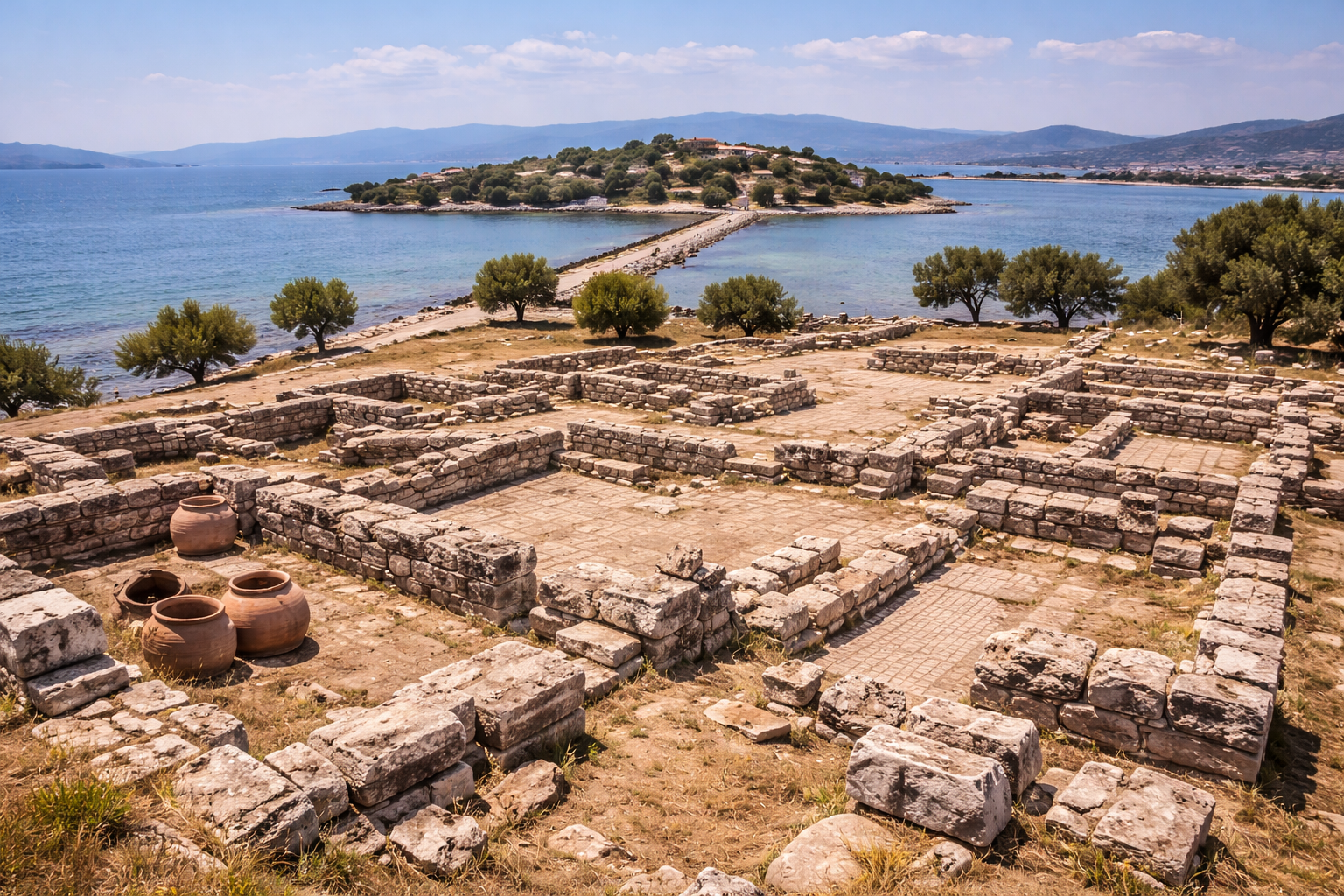
تقع مدينة تيوس الأثرية على شبه جزيرة صغيرة على بُعد نحو 1 كم جنوب سيغاجيك و5 كم من سفريحصار، على ساحل بحر إيجة غرب تركيا. كانت في العصور القديمة إحدى المدن البحرية في أيونيا، تقع على الساحل الجنوبي لشبه جزيرة أورلا–تشيشمه، بمرافئ طبيعية تنفتح على جزر إيجة وطرق التجارة المتوسطية الأوسع.
صُمّمت هذه الصفحة للزوّار الحقيقيين: لا تكتفي بشرح ماهية هذا المكان، بل لماذا يهمّ وكيف يمكن اختباره بشكل ذي معنى.
الخلفية التاريخية
تقع مدينة تيوس الأثرية على شبه جزيرة صغيرة على بُعد نحو 1 كم جنوب سيغاجيك و5 كم من سفريحصار، على ساحل بحر إيجة غرب تركيا. كانت في العصور القديمة إحدى المدن البحرية في أيونيا، تقع على الساحل الجنوبي لشبه جزيرة أورلا–تشيشمه، بمرافئ طبيعية تنفتح على جزر إيجة وطرق التجارة المتوسطية الأوسع.
(المصدر: مديرية الثقافة والسياحة لولاية إزمير – تيوس (سفريحصار) – ملخّص بالإنجليزية
المتاحف التركية – موقع تيوس الأثري في إزمير)
تُظهر الأدلّة الأثرية أنّ أوّل استيطان في تيوس يعود إلى القرنين الحادي عشر والعاشر ق.م (الفترة البروتو-هندسية). تقدّم التقاليد القديمة أثاماس بن ديونيسوس بصفته مؤسّس المدينة، ممّا يفسّر ارتباط تيوس الطويل بـعبادة ديونيسوس. وبحسب هيرودوت، كانت تيوس واحدة من المدن الاثنتي عشرة في التحالف الأيوني، وبفضل مرفأيها الطبيعيَّين أصبحت مركزًا مهمًا للتجارة البحرية بين برّ الأناضول وجزر إيجة.
(المصدر: ويكيبيديا – تيوس
مديرية الثقافة والسياحة لولاية إزمير – تيوس (سفريحصار))
على مدى القرون، خضعت تيوس للحكم الليدي ثمّ الفارسي. وخلال الثورة الأيونية والحروب الإغريقية-الفارسية، هاجرت مجموعات من التيويين إلى مستعمرات جديدة مثل أبديرا في تراقيا وفاناغوريا على البحر الأسود. وفي الفترتين الهلنستية والرومانية، ازدهرت تيوس بوصفها منتجة لـالنبيذ وزيت الزيتون والخزف، كما اشتهرت بأنّها مدينة الفنّانين والشعراء، إذ ارتبطت مثلًا بالشاعر الغنائي أناكريون.
(المصدر: ويكيبيديا – تيوس)
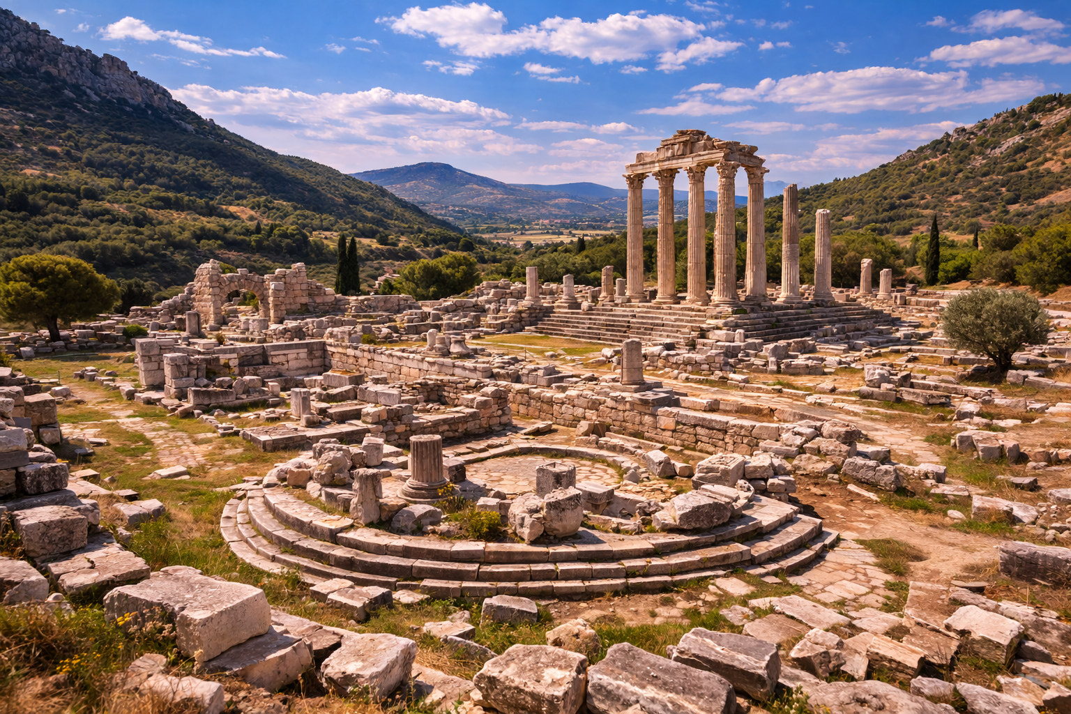
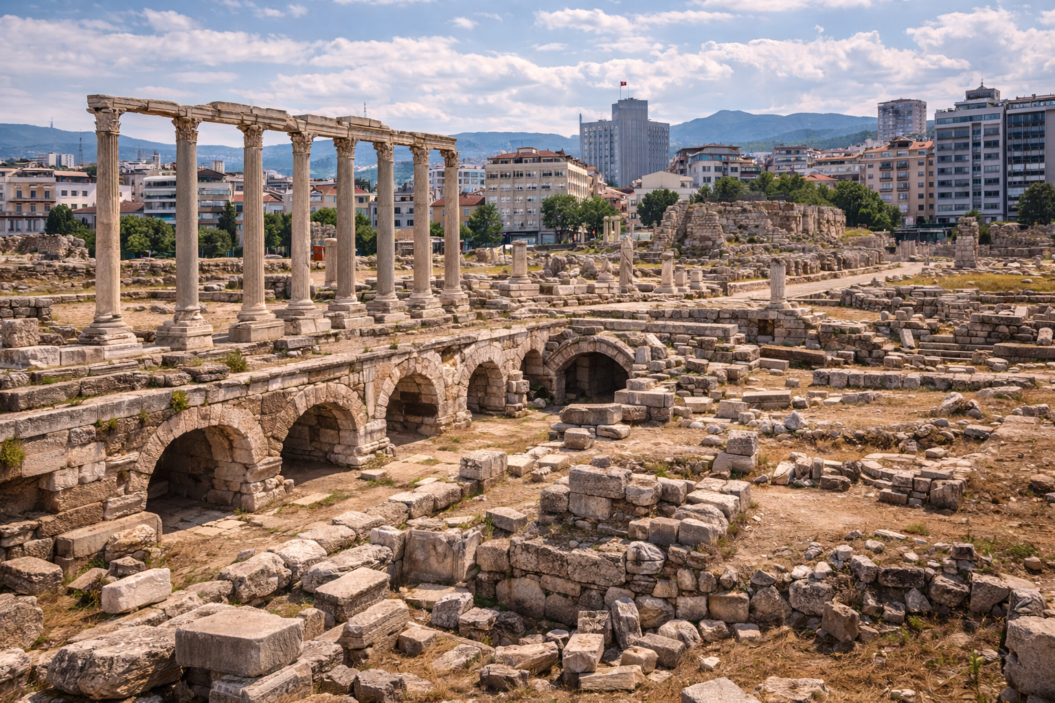
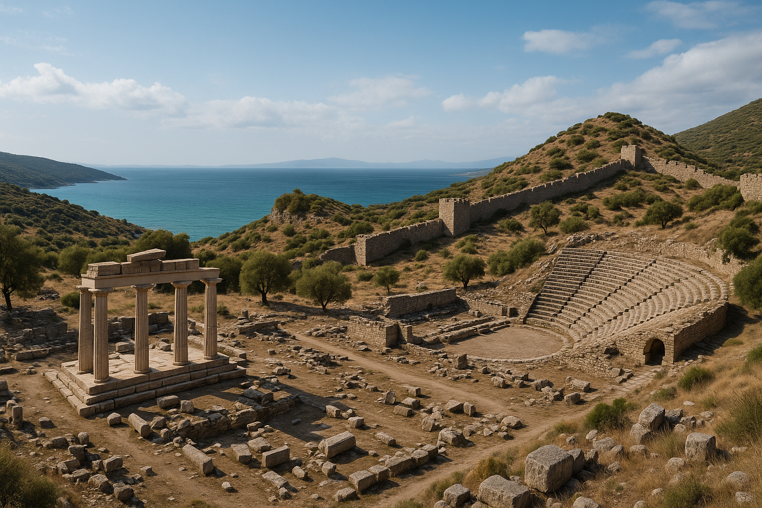
أبرز معالم تيوس هو معبد ديونيسوس، الذي صمّمه في أوائل القرن الثاني ق.م المعماري الهلنستي الشهير هرموغينيس البريني. بُني على الطراز الأيوني، ويُعدّ من أكبر المعابد المكرّسة لديونيسوس في آسيا الصغرى. وعلى الرغم من تضرّره الشديد بفعل الزلازل، فإنّ المخطّط والكثير من الكتل المعمارية لا تزال مرئيّة. وحول المعبد تمتدّ بقايا الأغورا والمسرح والأوديون والبولوتيريون (دار المجلس) والجمنازيوم والصهاريج وأسوار المدينة ومنشآت المرفأ.
(المصدر: بوّابة الثقافة – [مدينة تيوس الأثرية – إزمير](https://www.kulturportali.gov.tr/turkiye/izmir/gezilecekyer/teos-antik-k...
وبعيدًا عن الأطلال الظاهرة، تنبع القيمة التاريخية للموقع من الاستمرارية: تغيّر القوى، وتغيّر الوظائف الحضرية، وتغيّر الطرق التي استخدم بها الناس الفضاء العامّ عبر القرون.
علم الآثار والتخطيط العمراني
عند قراءة هذا الموقع في المكان، ركّز على ثلاث طبقات:
- طبقة الحركة: الشوارع والبوّابات والمدرّجات وصلات المرفأ أو المنحدر
- الطبقة العامة: المسارح والأغورات والحمّامات والمعابد والفضاءات الإدارية
- طبقة البنية التحتية: أنظمة المياه والأسوار ومناطق التخزين والعمارة الخدمية
تساعد هذه المنهجية الزوّار والباحثين على فهم المدينة بوصفها نظامًا حيًا، لا معالم منعزلة.
تجربة الزائر
تشمل الزيارة عالية الجودة عادةً:
- نقطة توجيه أولى (مرصد، حافة أكروبوليس، أو محور مركزي)
- مرورًا عبر البناء المميّز للموقع
- مسيرة أبطأ عبر فضاءات الحياة اليومية
- توقّفًا أخيرًا يربط الأطلال بالمشهد الطبيعي
يخلق هذا التسلسل سردًا تاريخيًا أقوى من الحركة السريعة "بهدف التصوير فحسب".
قصّة قصيرة من الماضي
تخيّل وصولك إلى هنا في العصور القديمة عند شروق الشمس: العمّال يستعدّون لليوم، والمسافرون يدخلون عبر الطرق أو مسارات المرفأ، والتجّار يفتحون أماكن التخزين، والعمارة العامة تشكّل الحركة والطقوس بالفعل. الحجارة التي تراها اليوم ليست أشياء صامتة؛ بل هي شظايا تلك الإيقاعات اليومية المتكرّرة.
ملاحظات عملية للسفر
- يُفضَّل الربيع والخريف للراحة.
- في الصيف، تجنّب ذروة حرارة منتصف النهار قدر الإمكان.
- ارتدِ أحذية مشي ثابتة لتضاريس غير مستوية.
- خصّص وقتًا كافيًا (1.5–3 ساعات على الأقلّ) لمسار ذي معنى.
- تحقّق من شروط الوصول والتذاكر الحالية قبل المغادرة.
الأسئلة الشائعة
لماذا تُعدّ مدينة تيوس الأثرية – سفريحصار، إزمير مهمّة؟
لأنّها تحفظ طبقات تاريخية متعدّدة وتساعد على تفسير الاستمرارية الثقافية الإقليمية في تركيا.
كم من الوقت ينبغي أن أقضي هنا؟
يقضي معظم الزوّار 1.5–3 ساعات؛ وقد تستغرق الزيارات المعمّقة نصف يوم.
هل هذا مناسب للمسافرين الذين يخوضون تجربة الآثار للمرّة الأولى؟
نعم. مع تخطيط أساسي، يكون هذا الموقع مناسبًا للزوّار المبتدئين وذوي الخبرة على حدّ سواء.
القياسات المعمارية: معبد ديونيسوس
يُعدّ معبد ديونيسوس في تيوس، الذي صمّمه المعماري هرموغينيس البريني، أهمّ معلَم باقٍ وأحد المباني الرئيسية في تاريخ العمارة الهلنستية.
| المعلمة | التفصيل |
|---|---|
| المعماري | هرموغينيس البريني |
| الطراز المعماري | أيوني |
| نوع المخطّط | محاط بالأعمدة من جميع الجوانب (Peripteral) |
| ترتيب الأعمدة | 6 × 11 عمودًا |
| أبعاد الستيلوبات | 18.50 × 35.00 م |
| فترة البناء | بدأ نحو 220 ق.م؛ اكتمل نحو 190 ق.م (حوالي 30 سنة) |
| مبدأ التصميم | Eustylos ("الأسلوب الجميل") -- ابتكار هرموغينيس في التباعد بين الأعمدة |
| نسبة التباعد بين الأعمدة | 2.25 من قطر العمود بين مراكز الأعمدة |
| نسبة ارتفاع العمود | 9.5 أضعاف قطر العمود السفلي |
| المكانة | أكبر معبد مكرّس لديونيسوس في آسيا الصغرى |
| الأعمدة القائمة حاليًا | 10 من أصل 26 عمودًا يُعاد تجميعها في إطار ترميم مستمرّ |
أصبح مبدأ eustyle عند هرموغينيس -- بضبط التباعد بين الأعمدة على ربعَين وعمود من سُمك العمود -- معيارًا كانونيًا لتصميم المعابد الأيونية. وقد قنّن فيتروفيوس لاحقًا هذا المبدأ في De Architectura، مستشهدًا تحديدًا بعمل هرموغينيس في تيوس بوصفه النموذج.
البولوتيريون: تنقيبات حديثة واكتشافات الفسيفساء (2022--2025)
كان البولوتيريون (مبنى المجلس) محور حملات تنقيب رئيسية بقيادة مشتركة من مشروع تيوس الأثري لجامعة أنقرة (بإدارة الأستاذ موسى كاديوغلو) وجامعة بنسلفانيا (بقيادة الأستاذة مانثا زارماكوبي).
أبعاد البولوتيريون ومراحله
| المعلمة | التفصيل |
|---|---|
| المخطّط | أساس مستطيل مع جلوس داخلي نصف دائري (كافيا) |
| صفوف الجلوس | 16 طبقة |
| تقسيمات الجلوس | الكافيا مقسّمة إلى 4 أقسام بـ5 سلالم |
| الوظيفة الأصلية | قاعة جمعية مدنية لمجلس المدينة (أواخر القرن الثالث ق.م، الفترة الهلنستية) |
| التعديل الروماني | إضافة رواق (ترايبورتيكوس) وبناء خشبة، ممّا حوّل الفضاء للعروض المسرحية |
| الموقع | جنوب شرق المسرح؛ شرق معبد ديونيسوس |
فسيفساء الكيوبيدات المتقاتلة (2024--2025)
كشف المنقّبون عن فسيفسائيتين أرضيتين هلنستيتين مبكّرتين (القرن الثالث ق.م) في غرفتين مرتبطتين بمجمع البولوتيريون:
| الفسيفساء | الموضوع | التاريخ | الأهمّية |
|---|---|---|---|
| الفسيفساء 1 | كيوبيدان مجنّحان (إيروتس) منخرطان في قتال | القرن 3 ق.م | مرتبطة بإيروس، الذي يظهر في الميثولوجيا الإغريقية باستمرار إلى جانب ديونيسوس -- المعبود الراعي لتيوس |
| الفسيفساء 2 | زخارف هندسية ونباتية | القرن 3 ق.م | تكمّل اللوحة التصويرية في الغرفة المجاورة |
اكتُشف نقش ضخم بارتفاع 30 سم على جدار البولوتيريون، مُحي جزئيًا -- ربّما لأسباب سياسية أو اجتماعية. ويشير الفكّ الجزئي للنقش إلى أنّ المبنى قد كُرّس على الأرجح من قِبل مجموعة من فنّاني ديونيسوس (Technitai of Dionysos)، النقابة المهنية للممثّلين والموسيقيين والفنّانين التي كانت تحظى بمكانة متميّزة في تيوس.
تسلسل التنقيب الزمني
| السنة / الفترة | المدير / الفريق | المحور |
|---|---|---|
| 1764--1765 | ريتشارد تشاندلر، نيكولاس ريفيت، ويليام بارس (جمعية الديليتانتي) | أوّل مسح حديث؛ رسومات معمارية لمعبد ديونيسوس |
| 1862 | ريتشارد بوبلويل بولان (معماري) | أوّل تنقيب منهجي؛ تركّز على معبد ديونيسوس |
| 1962--1967 | كلية اللغة والتاريخ والجغرافيا، جامعة أنقرة | تنقيبات في الأغورا والسور الهلنستي والأكروبوليس والمنطقة غرب المعبد وقرب المسرح والبولوتيريون |
| 2010--حتى الآن | الأستاذ موسى كاديوغلو (جامعة أنقرة) / مشروع تيوس الأثري | تنقيب وترميم مستمرّان؛ إعادة نصب أعمدة المعبد؛ تنقيب البولوتيريون |
| 2022--حتى الآن | الأستاذة مانثا زارماكوبي (جامعة بنسلفانيا) | حملة مشتركة على البولوتيريون والترايبورتيكوس؛ اكتشافات الفسيفساء والنقوش |
يمثّل التعاون بين جامعة أنقرة وجامعة بنسلفانيا واحدة من أنشط الشراكات الأثرية الدولية في غرب تركيا، حيث يجمع بين المعرفة المؤسّسية التركية والموارد البحثية الأمريكية.
الأدلّة النقدية وفنّاني ديونيسوس
ضربت تيوس النقود منذ القرن السادس ق.م فصاعدًا. وأبرز ما يميّز نقود تيوس هو الغريفون -- الكائن الميثولوجي المرتبط بديونيسوس -- الذي شكّل الشعار المدني للمدينة عبر جميع الفترات تقريبًا.
| الفترة | نوع العملة | الوجه | الظهر |
|---|---|---|---|
| القرنان 6--5 ق.م | ستاتر فضي | غريفون جالس | تجويف مربّع |
| القرن 4 ق.م | درخمة فضية | غريفون جالس | قيثارة أو كانثاروس (كأس نبيذ) |
| الهلنستية | برونز | غريفون | ديونيسوس مع الثيرسوس |
| الإمبراطورية الرومانية | برونز إقليمي | صورة الإمبراطور | غريفون؛ أو ديونيسوس على عرشه |
كان Technitai of Dionysos (فنّانو ديونيسوس) نقابة قوية للفنّانين المؤدّين أسّست مقرّها في تيوس في القرن الثاني ق.م. وقد جعل وجود النقابة من تيوس العاصمة الفعلية للثقافة المسرحية والموسيقية في شرق إيجة. وكان أعضاؤها يتمتّعون بـحصانة دبلوماسية وإعفاءات ضريبية ممنوحة من الملوك الهلنستيين، وكانوا يتنقّلون في جميع أنحاء العالم الإغريقي للأداء في المهرجانات الكبرى. وقد يقدّم نقش البولوتيريون المكتشف في 2024--2025 أوّل دليل معماري مباشر يربط النقابة بمبنى مدني محدّد في تيوس.
المصادر
- https://izmir.ktb.gov.tr/TR-210599/teos-seferihisar.html
- https://www.turkishmuseums.com/museum/detail/2100-izmir-teos-orenyeri/2100/1
- https://en.wikipedia.org/wiki/Teos
- https://www.kulturportali.gov.tr/turkiye/izmir/gezilecekyer/teos-antik-kenti-
- https://teos.ankara.edu.tr/miras/tapinak-ve-kutsal-alanlar/dionysos-kutsal-alani/
- https://www.visitizmir.org/en/destination/10263
- https://commons.wikimedia.org/w/index.php?search=Teos+Ancient+City+–+Seferihisar,+İzmir&title=Special:MediaSearch&type=image
- https://en.wikipedia.org/wiki/Teos_Ancient_City_–_Seferihisar,_İzmir
التحليل التاريخي المتقدّم
التطبّق السياسي
ينبغي تفسير مدينة تيوس الأثرية – سفريحصار، إزمير من خلال تحوّلات السلطة السياسية، لأنّ كلّ نظام غيّر الأولويات الإدارية والاستثمار العمراني والعمارة الرمزية. وهذا يعني أنّ البقايا المرئية ليست حجارة محايدة: بل تعكس قرارات تاريخية حول السيطرة والشرعية والاستراتيجية الإقليمية طويلة الأمد.
التكيّف الحضري
تطوّرت المدن وفق الطبوغرافيا والموارد وقيود التنقّل. في مواقع مثل مدينة تيوس الأثرية – سفريحصار، إزمير، يمكن تتبّع التكيّف في طرق الحركة وأنظمة الأسوار وإدارة المياه وإعادة توزيع الفضاءات العامّة عبر الزمن.
الاستمرارية المادية وإعادة الاستخدام
حقيقة أثرية جوهرية هي إعادة الاستخدام: غالبًا ما انتقلت الكتل والنقوش والعناصر المعمارية عبر الفترات. وإعادة الاستخدام ليست مجرّد أمر عملي -- بل هي أيضًا رسالة ثقافية، حيث حافظت المجتمعات اللاحقة بشكل انتقائي على هيبة سابقة أو حوّلتها أو أعادت تفسيرها.
الطقوس والذاكرة العامة
كثيرًا ما تتداخل الفضاءات المقدّسة والمدنية في المدن الطويلة العمر. ويمكن أن تستمرّ المشاهد الطقسية حتى عندما تتغيّر الأنظمة السياسية، ممّا يجعلها بالغة الأهمية لدراسة الاستمرارية في الذاكرة الجماعية.
إطار التفسير المطوّل للزائر
استخدم هذا الإطار المؤلّف من 8 خطوات في الموقع:
- أرسِ التوجيه بالطبوغرافيا وسياق المسار.
- حدّد النظام البنيوي الأفضل حفظًا (الأسوار، المرفأ، المسرح، المعبد، إلخ).
- ميّز المرحلة الأولية عن التدخّلات اللاحقة.
- قارن القطاعات المعمارية الضخمة بقطاعات الحياة اليومية.
- اقرأ البنية التحتية للمياه واللوجستيات بوصفها أنظمة بقاء.
- قيّم المحور الرمزي/الطقسي وسياسات الرؤية.
- تتبّع أدلّة إعادة الاستخدام والإصلاح.
- اختم بعلاقة المدينة بالمشهد الطبيعي عند مرصد أخير.
تُحسّن هذه المنهجية جودة التفسير لكلٍّ من الزوّار العاديين والقرّاء المتقدّمين.
التخطيط العملي للباحثين والمسافرين
- خصّص دورة تفسير كاملة واحدة على الأقلّ (2–4 ساعات).
- إذا أمكن، اقرن زيارة الموقع بسياق المتحف المحلّي.
- دوّن الملاحظات حسب المرحلة، لا حسب ترتيب الملاحظة العشوائي.
- افصل بين ما هو مرئي مباشرة وما هو مستنتج.
- استخدم الخرائط والارتفاع للتحقّق من افتراضات الحركة.
أسئلة وأجوبة موسّعة للزائر
هل هذا الموقع مخصّص فقط لمختصّي الآثار؟
لا. يجعل التخطيط المنظّم للمسار والتأطير التاريخي الأساسي الموقع مفهومًا لغير المختصّين.
لماذا تتداخل فترات مختلفة في مكان واحد؟
لأنّ المدن أنظمة حيّة. يُعاد بناؤها وإعادة استخدامها وإعادة تأطيرها سياسيًا، بدلًا من أن تُنشأ مرّة واحدة.
ما الطريقة الأكثر موثوقية لتجنّب التفسير السطحي؟
اتّبع التسلسل الزمني، وقارن الطبقات، وأدرج البنية التحتية والمشهد الطبيعي في قراءتك.
هل ينبغي تجنّب الزيارات الشتوية؟
ليس بالضرورة. يمكن أن يقدّم الشتاء كثافة زوّار أقلّ ووتيرة تفسيرية أفضل إذا كانت ظروف الطقس قابلة للتحمّل.
ما الذي يميّز هذا الموقع عن المدن الأثرية الأخرى؟
مزيجه المحدّد من الجغرافيا والتاريخ السياسي والعمارة والاستمرارية عبر تحوّلات تاريخية متعدّدة.