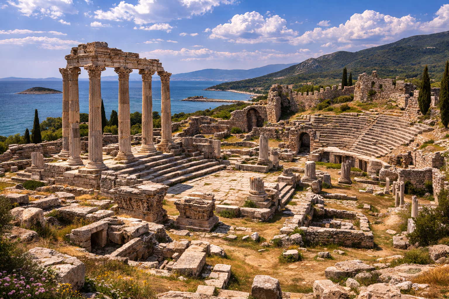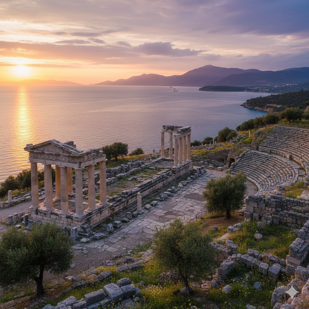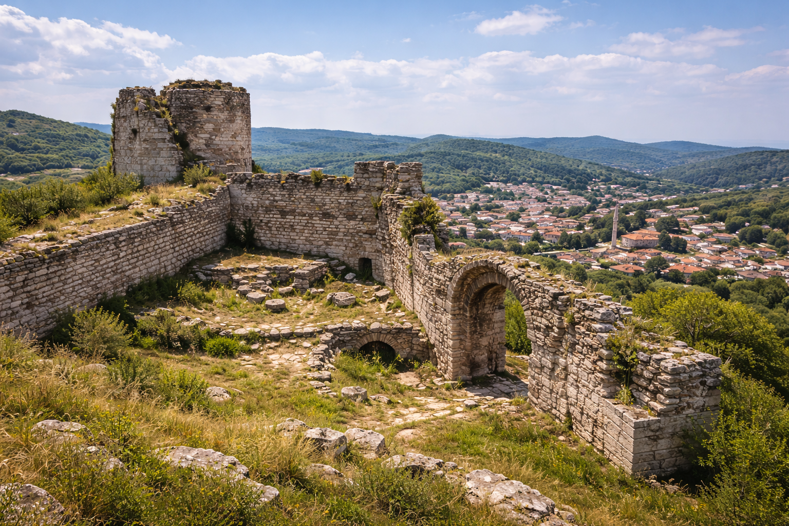
Quick Summary: Vize (ancient Bizye) in Kırklareli Province served as the capital of the Thracian Asti tribe and later a significant Byzantine fortress town. Its massive castle — first built between 72 and 76 BC and restored by Justinian I — still crowns the hilltop, surrounded by over 40 Thracian tumuli, a recently excavated Roman theatre, and important Byzantine churches. Vize is one of Turkey's designated Cittaslow (Slow City) centres.
- Why Vize Matters
- Geography and Setting
- Thracian Period
- Roman Period
- Byzantine Period
- Ottoman Period and Later
- The Castle (Vize Kalesi)
- Thracian Tumuli
- The Roman Theatre
- Byzantine Churches and Monuments
- Archaeological Excavations
- Cultural Heritage and Cittaslow Status
- Visitor Information
- Frequently Asked Questions
- Sources and Further Reading
Why Vize Matters
Vize is one of the rare Thracian sites in Turkey where continuous habitation from the Iron Age through the Ottoman period can be traced in a single compact settlement. As the capital of the Asti, the most powerful Thracian tribe in eastern Thrace, Bizye controlled the routes between the Danube frontier and the Sea of Marmara. The more than 40 tumuli surrounding the town constitute one of the densest concentrations of Thracian royal burial mounds in all of Turkey.
The town's castle preserves construction phases spanning at least five centuries — from its initial erection in the 1st century BC through Roman, Justinianic Byzantine, and Palaeologan restorations. Together with its recently excavated Roman theatre, Vize demonstrates that even smaller towns in Roman Thrace possessed the full apparatus of urban civilisation.
For visitors, Vize offers an unusual combination: genuine Thracian heritage (tumuli and fortress), Byzantine ecclesiastical architecture, and the laid-back atmosphere of a designated Cittaslow town — all within two hours of Istanbul.
Geography and Setting
Vize lies in the rolling hills of eastern Thrace (European Turkey), approximately 60 km north of the Marmara coast and 200 km north-west of Istanbul. The town sits at an elevation of roughly 250 metres on a defensible hill overlooking the surrounding agricultural plain.
The landscape is characterised by gently undulating farmland interspersed with oak and beech forests, a terrain that supported the pastoral and agricultural economy of the ancient Thracians. The Ergene River basin lies to the south, while the İstranca (Yıldız) Mountains rise to the north, forming a natural boundary with Bulgaria.
The strategic position of Vize controlled the land route from the Danube frontier to Constantinople via the Thracian interior. This made it a military and administrative centre throughout antiquity — any army marching from the Balkans toward the Byzantine capital had to pass through or near Vize.
Thracian Period
Capital of the Asti
Under its ancient name Bizye (Βιζύη in Greek), the settlement served as the capital city of the Asti (or Astae), a Thracian tribal confederation that dominated the eastern part of Thrace. The Asti were among the most important Thracian groups, mentioned by Strabo and other ancient geographers.
The Thracian kings established their seat on the fortified hilltop that would later become the castle's acropolis. The surrounding territory was rich in pastureland, and the Thracians of this region were renowned horsemen — a tradition reflected in the equestrian motifs found on funerary stelae and metalwork from the tumuli.
Thracian Royal Tumuli
More than 40 tumuli (burial mounds) have been identified in the countryside around Vize, representing one of the largest concentrations of Thracian elite burials in Turkey. These artificial mounds — some reaching 10–15 metres in height — contained stone-built or wood-lined burial chambers with gold and silver grave goods, bronze vessels, weapons, and horse equipment.
The tumuli date primarily from the 5th to 3rd centuries BC, the period of greatest Thracian political organisation. They are comparable in form and contents to the famous Thracian tombs of Kazanlak and Sveshtari in Bulgaria.
Several tumuli have been partially excavated, yielding:
- Gold and silver jewellery
- Bronze helmets and weapons
- Decorated pottery (both local Thracian and imported Greek)
- Horse fittings and chariot components
- Stone-lined burial chambers with corbelled or flat stone ceilings
Roman Period
Rome absorbed eastern Thrace into the province of Thracia in 46 AD under Emperor Claudius. Bizye became a civitas (administrative town) within the province and later rose to greater prominence.
Urban Development
The Romans developed Bizye with standard urban infrastructure:
- A theatre (seating capacity estimated at 3,000–5,000) built into the eastern slope of the acropolis hill
- Paved streets and water supply systems
- Public baths and market areas
A Latin inscription found on the castle, dated to the 2nd century AD, records a restoration of the fortification walls. This inscription — commemorating repairs during the Imperial period — provides the earliest epigraphic dating of the fortress to 72–76 BC, making Vize Castle one of the oldest dated fortifications in Thrace.
Provincial Capital
By the late Roman period, Bizye had been elevated to the capital of the province of Rhodope (or at times the province of Europa). This administrative role brought further investment in public buildings and infrastructure.
Byzantine Period
Bizye became an important Byzantine military stronghold due to its position on the land routes from the Balkans to Constantinople.
Justinian I Restorations
Emperor Justinian I (r. 527–565) carried out a major restoration of the castle as part of his empire-wide fortification programme documented by Procopius in De Aedificiis. The Justinianic phase added new curtain walls, towers, and gates, substantially enlarging the defensive perimeter.
Bishopric
Vize became the seat of a Christian bishopric by the 4th century at the latest, and eventually an archbishopric under the Patriarchate of Constantinople. Several churches were built within and around the fortress, including:
- The Hagia Sophia of Vize (Gazi Süleyman Paşa Mosque) — originally a Byzantine cathedral, converted to a mosque after the Ottoman conquest
- The Küçük Ayasofya (Small Hagia Sophia) — a smaller Byzantine church
- Various chapel foundations discovered during excavations
Palaeologan Period
The castle underwent another significant restoration during the Palaeologan dynasty (13th–15th centuries), the last ruling house of Byzantium. The Palaeologan-era masonry is identifiable by its distinctive brickwork patterns, including decorative brick arches and alternating courses of stone and brick.
Bulgarian Conflicts
Bizye was repeatedly contested between the Byzantine Empire and the Bulgarian Empire. The Bulgarian Tsar Kaloyan besieged and captured the town in 1206 during the aftermath of the Fourth Crusade. The fortress changed hands several times before being definitively recovered by the Byzantines.
Ottoman Period and Later
The Ottomans captured Vize in the mid-14th century during the initial Thracian campaigns of Murad I. The town retained administrative importance as a sanjak centre during the early Ottoman period.
Key Ottoman-era structures include:
- Gazi Süleyman Paşa Mosque — the converted Byzantine cathedral within the castle
- Hamam (bath) ruins from the early Ottoman period
- Traditional Ottoman-era houses in the town's narrow streets
The town gradually declined from its medieval importance as the main routes shifted, but it preserved its compact historic character — a quality recognised when Vize was designated a Cittaslow member.
The Castle
Vize Castle (Vize Kalesi) crowns the highest point of the town, providing commanding views of the surrounding countryside. The castle's construction history spans multiple periods:
Original Construction (1st century BC)
Based on the commemorative inscription, the first fortification was built between 72 and 76 BC, most likely as the acropolis walls of the Thracian tribal capital, possibly with Roman engineering assistance during the late Republican period.
Roman Restorations (2nd century AD)
The inscription from the 2nd century AD records a restoration, indicating that the walls were maintained as a functioning defensive system during the Imperial period.
Justinianic Phase (6th century AD)
The most substantial surviving stretches of wall belong to the Justinian I restoration (mid-6th century). These walls feature:
- Regularly coursed stone and brick masonry
- Projecting rectangular and semicircular towers
- Arched gates with dressed stone voussoirs
- Internal cisterns for water storage during siege
Palaeologan Phase (13th–15th centuries)
Late Byzantine repairs added distinctive decorative brickwork — zigzag patterns, herringbone courses, and blind arches — characteristic of the Palaeologan architectural style.
Current State
The castle walls survive to significant heights in several sections, particularly the main gate on the eastern side. The interior contains the converted Byzantine cathedral (Gazi Süleyman Paşa Mosque), cistern remains, and scattered architectural fragments. The hilltop platform offers panoramic views and is freely accessible.
Thracian Tumuli
The 40+ tumuli surrounding Vize constitute a Thracian royal necropolis of the first importance. Key characteristics include:
- Distribution: Tumuli are scattered across the agricultural landscape in groups and individual mounds, typically occupying hilltops or ridgelines visible from the town
- Size: Mounds range from modest (3–5 m high) to imposing (10–15 m high, 40–60 m in diameter)
- Construction: Internal chambers are typically stone-built, with either corbelled (pseudo-domed) or flat stone ceilings
- Date Range: Primarily 5th–3rd centuries BC, the era of organised Thracian kingdoms
- Finds: Gold and silver grave goods, bronze vessels, Attic Greek pottery imports, weapons, horse equipment
The Vize tumuli are often compared to those at Bolu/Safranbolu in Turkey and the famous tumuli of the Kazanlak and Mogila cemeteries in Bulgaria. They provide crucial evidence for Thracian social hierarchy, trade networks (particularly the import of Greek luxury goods), and burial rituals.
Some tumuli remain unexcavated and are visible as grass-covered mounds in the fields around the town. Local guides can point out the most prominent ones.
The Roman Theatre
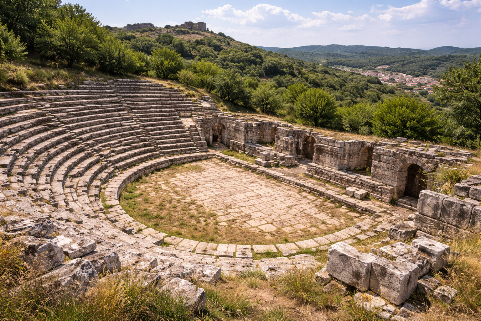
Remains of a 2nd-century AD Roman theatre were discovered on the eastern slope of the acropolis hill in the 1990s and excavated beginning in 1998. The theatre provides important evidence that Bizye possessed a full range of Roman civic buildings.
Key features:
- Estimated seating capacity: 3,000–5,000
- Built into the natural slope of the hill (a common Roman practice)
- Stone seating rows (cavea) partially preserved
- Orchestra and possible stage building (scaenae frons) foundations identified
- Roman construction technique with mortared rubble core and stone facing
The theatre is one of the few Roman theatres excavated in Turkish Thrace, making it an important comparative example for understanding urbanism in the region. Excavations have also yielded inscriptions and architectural fragments that illuminate the cultural life of Roman Bizye.
Byzantine Churches and Monuments
Hagia Sophia of Vize (Gazi Süleyman Paşa Mosque)
The most important Byzantine monument in Vize is the former cathedral church, now the Gazi Süleyman Paşa Mosque. Originally built as a Byzantine basilica, the church was converted to a mosque after the Ottoman conquest. It preserves:
- Byzantine masonry and structural elements in the walls
- A plan typical of middle-Byzantine basilicas
- Carved stone architectural fragments reused in the mosque
Küçük Ayasofya
A smaller Byzantine church known locally as the Küçük Ayasofya (Small Hagia Sophia) stands near the castle. Its architectural details suggest a date in the middle or late Byzantine period.
Other Byzantine Remains
Scattered throughout the town and its environs are:
- Rock-cut chambers and cisterns from the Byzantine period
- Architectural fragments (capitals, column shafts, screen panels) reused in later buildings
- Traces of the Byzantine-era city wall extending beyond the castle perimeter
Archaeological Excavations
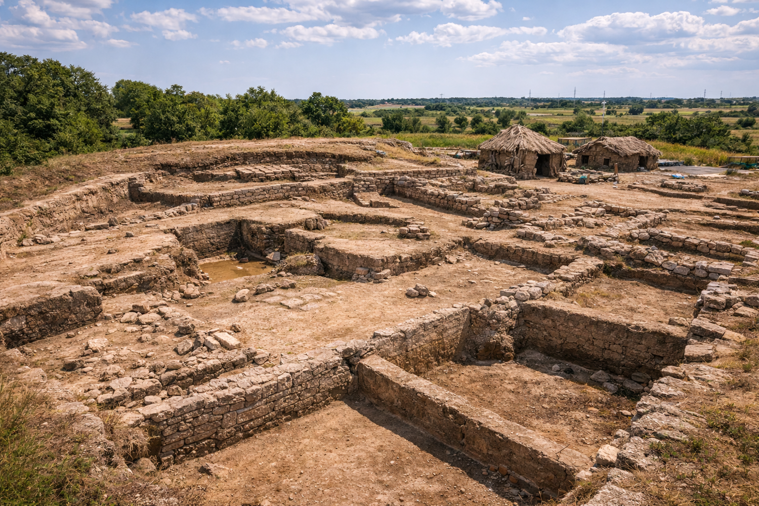
Systematic archaeological work at Vize has been conducted since the 1960s, with significant campaigns including:
- 1960s–1970s: Initial surveys of the tumuli and castle walls by Turkish archaeologists
- 1990s: Discovery and initial excavation of the Roman theatre on the eastern slope
- 1998–present: Continued excavation of the theatre and surrounding Roman-era structures
- Ongoing: Survey and mapping of the tumuli landscape using modern geophysical methods
Finds from Vize are housed primarily in the Kırklareli Museum and the Istanbul Archaeological Museums.
Cultural Heritage and Cittaslow Status
Vize was admitted to the international Cittaslow (Slow City) network, which recognises towns that prioritise quality of life, local food culture, environmental sustainability, and the preservation of historic character. This designation has brought attention to Vize's:
- Traditional stone houses in the historic core
- Local cuisine based on Thracian agricultural traditions
- Rural landscape with vineyards, sunflower fields, and forest
- Craft traditions including leatherwork and textile production
The Cittaslow status has helped preserve Vize's character against the pressures of modernisation, making it a genuinely atmospheric destination for visitors seeking an alternative to mass tourism.
Visitor Information
Location: Vize, Kırklareli Province. Approximately 200 km north-west of Istanbul, 60 km from the Marmara coast.
Getting There: By car via the E87/D020 highway from Istanbul (approximately 2.5–3 hours). Regular bus services run from Istanbul's Esenler terminal to Kırklareli, with onward minibuses to Vize.
Key Sites:
- Vize Castle — freely accessible, hilltop above town
- Gazi Süleyman Paşa Mosque (former Byzantine cathedral) — within the castle
- Roman Theatre excavation area — eastern slope of the castle hill
- Thracian Tumuli — scattered in countryside around town (ask locally for directions)
- Kırklareli Museum — houses finds from Vize excavations
Duration: A half-day allows you to see the castle, mosque, theatre, and nearest tumuli. A full day permits exploration of more distant tumuli and the surrounding countryside.
Tips:
- Vize is an excellent day trip from Istanbul or a stopover on the way to Edirne
- Visit during the annual Vize Festival (summer) for traditional music and local food
- The town's restaurants serve authentic Thracian cuisine — look for local cheese, meatballs, and sunflower honey
- Combine with visits to other Thracian sites: Edirne (1 hour west), Kırklareli (30 minutes), and the İstranca Mountains (north)
- Wear comfortable shoes for walking the uneven castle ruins and tumuli hills
Frequently Asked Questions
What was Vize called in ancient times? The ancient name was Bizye (Greek: Βιζύη), from the Thracian language. It has no connection to nearby Byzantion (Istanbul) despite the similar sound.
How old is Vize Castle? An inscription records the original construction between 72 and 76 BC, with major restorations by Justinian I (6th century AD) and the Palaeologan dynasty (13th–15th centuries).
Can I visit the Thracian tumuli? Yes, several tumuli are visible from the road and accessible on foot across farmland. The nearest are within 2–3 km of the town centre. Excavated tumuli are not currently open as formal sites.
Is there an entrance fee? The castle and town are freely accessible. The Kırklareli Museum charges a modest entrance fee.
What is Cittaslow? An international network of small towns (under 50,000 population) committed to quality of life, local food, cultural heritage, and sustainability. Vize's designation reflects its well-preserved historic character.
How does Vize compare to other Thracian sites in Turkey? Vize has the densest concentration of tumuli and the best-preserved Thracian-era castle in Turkish Thrace. For Greek and Roman remains, Ainos (Enez) and Perinthos (Marmaraereğlisi) offer complementary perspectives.
Vize in Regional Context
Vize's significance extends beyond its own walls when considered within the network of Thracian and Roman sites in Turkish Thrace:
- Eastern Thrace Route: Vize sits on the ancient route connecting the Danube frontier to the Propontis (Sea of Marmara) and Constantinople. This corridor was one of the most important military and commercial arteries in the Roman and Byzantine worlds.
- Thracian Heritage Network: Together with Edirne (Hadrianopolis), Kırklareli, and the İstranca Mountains, Vize forms part of an emerging cultural tourism route focusing on Thracian heritage in European Turkey.
- Wine and Food Trail: The region's viticultural tradition dates back to Thracian times — modern Thrace remains Turkey's premier wine-producing region. Vize's local food culture, recognised by its Cittaslow status, connects ancient agricultural traditions to contemporary gastronomy.
Excavation Chronology and Quantitative Site Data
Systematic Archaeological Campaigns at Vize
The following table documents the principal archaeological campaigns conducted at Vize from the early Republic period to the present, with key discoveries associated with each phase.
| Period | Lead Institution / Excavator | Focus Area | Key Discoveries |
|---|---|---|---|
| 1930s | Istanbul Archaeological Museum | Tumuli south of town | Unrobbed barrel-vaulted tomb (Tumulus A); gold, silver, bronze grave goods |
| 1960s--1970s | Turkish archaeologists (survey) | Castle walls, tumulus mapping | Identification of 40+ tumuli; wall phase documentation |
| 1990s | Construction monitoring | Eastern slope of acropolis | Initial exposure of Roman theater cavea |
| 1998--2003 | Kirklareli Museum / systematic excavation | Roman theater | Marble seating rows, stage reliefs, sculptural fragments |
| 2003--present | Ongoing conservation | Theater and fortifications | Stabilisation of marble elements; architectural survey of walls |
| 2010s--present | Geophysical survey teams | Tumulus landscape | Magnetometry and ground-penetrating radar mapping of unexcavated tumuli |
Tumulus Landscape: Distribution and Morphology
The more than 40 tumuli surrounding Vize represent a Thracian royal and elite necropolis of exceptional density. Modern geophysical survey and aerial photography have enabled systematic mapping of the tumulus field.
| Tumulus Group | Location Relative to Town | Number of Mounds | Approximate Date Range | Excavation Status |
|---|---|---|---|---|
| Southern river group | 4 km south, along riverbank | 9 mounds | 4th--2nd c. BC | Partially excavated (1930s) |
| Western hilltop group | 2--3 km west | ~12 mounds | 5th--3rd c. BC | Unexcavated; surveyed |
| Northern ridge group | 3--5 km north | ~10 mounds | 5th--3rd c. BC | Unexcavated; mapped |
| Eastern scattered group | 1--4 km east | ~12 mounds | 4th--2nd c. BC | Unexcavated; partially surveyed |
Tumulus heights range from 3 metres (smaller elite burials) to 15 metres (probable royal mounds), with basal diameters of 20 to 60 metres. The larger mounds are comparable in scale to the famous Thracian royal tumuli at Kazanlak and Sveshtari in Bulgaria.
Fortification Measurements and Comparative Data
Detailed architectural survey of the castle walls has documented the following structural parameters.
| Wall Section | Surviving Height | Wall Thickness | Length | Construction Phase |
|---|---|---|---|---|
| Southern curtain wall | 4.5--5.0 m | 2.5 m | ~120 m | Phase I (Thracian) / Phase III (Justinianic) |
| Western curtain wall | 3.0--4.5 m | 2.0--2.5 m | ~150 m | Phase II (Roman) / Phase IV (Palaeologan) |
| Eastern main gate | 6.0 m (max.) | 3.0 m | ~15 m (gate passage) | Phase III (Justinianic) with Phase IV repairs |
| Northwest tower | 5.5 m | 2.5 m | 8 x 8 m (plan) | Phase III (Justinianic) |
| Southeast tower | 4.0 m | 2.0 m | 7 x 7 m (plan) | Phase IV (Palaeologan) |
The castle occupies the broad summit of the town hill, extending approximately 250 metres from southeast to northwest and 120 metres at its widest point. The total perimeter of the surviving wall circuit measures approximately 700 metres. The inner castle (citadel) occupies the highest point, while the outer castle extends along the southern and western slopes.
Hagia Sophia of Vize: Architectural Dimensions
The 9th-century Byzantine church (now Gazi Suleyman Pasa Mosque) has been measured in architectural surveys.
| Architectural Element | Measurement | Notes |
|---|---|---|
| External length | ~22 m | Including narthex |
| External width | ~15 m | At transept |
| Central dome diameter | ~6 m | Supported on four piers |
| Dome height (interior) | ~12 m | Above floor level |
| Narthex depth | ~4 m | Western entrance vestibule |
| Wall thickness | ~1.2 m | Brick and rubble core construction |
| Plan type | Cross-in-square | Four piers supporting central dome |
The church's cross-in-square plan, characteristic of middle-Byzantine architecture in the 9th--11th centuries, places it in the same architectural tradition as the Church of the Dormition at Iznik (Nicaea) and the Kalenderhane Mosque in Istanbul (originally a Byzantine church). The proportional relationship between dome diameter and overall plan width at Vize (approximately 1:2.5) is consistent with standard middle-Byzantine design ratios.
Historical Sieges and Military Events at Bizye
Bizye's strategic position on the route from the Balkans to Constantinople made it a frequent target of military action.
| Date | Event | Aggressor | Outcome |
|---|---|---|---|
| 559 AD | Kutrigur Bulgar raid | Kutrigur Bulgars | Bypassed; nearby areas devastated |
| 812 AD | Bulgarian campaign | Khan Krum | Bizye besieged; outcome uncertain |
| 1206 AD | Fourth Crusade aftermath | Tsar Kaloyan of Bulgaria | Town captured; Latin garrison expelled |
| 1265 AD | Byzantine-Bulgarian conflict | Michael VIII Palaiologos | Recovered for Byzantium |
| 1307 AD | Catalan Company raids | Catalan mercenaries | Surrounding territory pillaged |
| c. 1368--1369 | Ottoman conquest | Murad I | Permanent Ottoman control established |
The repeated targeting of Bizye during the medieval period underscores its continuing strategic value as a fortified position controlling the approaches to Constantinople from the north.
Sources and Further Reading
- Strabo, Geographica, Book VII — on the tribes of Thrace
- Procopius, De Aedificiis, Book IV — Justinian's Thracian fortifications
- M. Taşlıklıoğlu, Trakya'da Epigrafi Araştırmaları (Istanbul, 1971)
- Castles.nl — Vize Castle (detailed architectural description)
- The Byzantine Legacy Project — Bizye (photographic documentation)
- Kırklareli İl Kültür ve Turizm Müdürlüğü — official tourism information
- Cittaslow International — Vize entry
- Daily Sabah, "Slow Cities of Turkey: Vize" (December 2019)