Asagi Pinar is a prehistoric settlement mound (hoyuk) located approximately 3 km south of Kirklareli city center, along the road to Asilbeyli village, in a transitional zone between the Istranca (Strandzha) Mountains and the Ergene Basin. First identified by Prof. Mehmet Ozdogan in 1980 and systematically excavated since 1993, the site has revealed nine cultural layers spanning roughly 6200 to 5000 BC, covering the transition from the Early Neolithic to the Late Neolithic. Asagi Pinar is the only habitation site in Eastern Thrace that reveals the entire sequence of the Neolithic period in the Balkans, making it one of the most important prehistoric sites in southeastern Europe for understanding how farming, animal husbandry, and settled village life spread from Anatolia into Europe.
- Why Asagi Pinar Matters
- Geography and Setting
- Historical Timeline
- Major Discoveries and Features
- Archaeological Work
- The Open-Air Museum
- Visitor Information
- Frequently Asked Questions
- Sources and Further Reading
Why Asagi Pinar Matters
-
The complete Neolithic sequence of Eastern Thrace. Asagi Pinar is the only site in Turkish Thrace that provides an unbroken archaeological record of the entire Neolithic period (c. 6200-5000 BC). No other site in the region offers this depth of continuous prehistoric occupation, making it the benchmark for all Neolithic chronologies in southeastern Europe.
-
Gateway of the Neolithic Revolution into Europe. The site documents the process by which the first farming communities -- originating in the Near East and passing through Anatolia -- arrived in Thrace and adapted to a new environment. This transition fundamentally changed the course of European history, replacing hunter-gatherer societies with agricultural villages. Asagi Pinar provides the most detailed evidence for how this transformation unfolded in the critical transition zone between Asia and Europe.
-
Innovation in wooden architecture. The early farming communities at Asagi Pinar, who arrived with knowledge of mud-brick and stone construction from Anatolia, developed wooden architecture (wattle-and-daub with timber framing) as an adaptation to the forested Thracian environment. This architectural innovation later spread across the European continent and became the dominant building tradition of prehistoric Europe for millennia.
-
Rich material culture. The excavations have yielded an exceptionally rich assemblage of Neolithic figurines, ceramics, stone tools, bone implements, and ritual objects. These provide detailed insight into the daily life, belief systems, and craft technologies of Europe's earliest farming communities. The figurine assemblage alone, studied by Eylem Ozdogan, constitutes one of the most important collections from Early Neolithic southeastern Europe.
-
Open-air museum and public archaeology model. Asagi Pinar hosts one of Turkey's few Neolithic open-air museums, with reconstructed buildings, informational displays, and replica artifacts. It serves as an important model for making prehistory accessible to the general public and has been published as a case study in the academic literature on open-air museum design.
-
Bridging Anatolian and Balkan Neolithic traditions. The ceramic typology, lithic industries, and architectural practices at Asagi Pinar show clear connections to both Anatolian Neolithic traditions and emerging Balkan cultural complexes such as Karanovo and Vinca. This dual character makes the site essential for tracing cultural transmission routes.
-
Ditch-digging practices and settlement boundaries. Recent research on ditch-digging practices in the Eastern Balkans, including evidence from Asagi Pinar, has illuminated how early Neolithic communities defined and defended their settlement boundaries. These ditch systems represent some of the earliest examples of planned community infrastructure in southeastern Europe.
Geography and Setting
Asagi Pinar occupies a low, flat mound that blends into the surrounding topography, characteristic of prehistoric settlement mounds in the Thracian lowlands. The site lies in a transitional landscape between the Istranca (Strandzha) Mountain foothills to the north and the broad Ergene River basin to the south.
The mound is situated near the Haydardere stream, which provided the reliable freshwater supply essential for a permanent farming settlement. The surrounding terrain offered a mosaic of ecological zones: forested hills for timber and wild resources, flat alluvial land for crop cultivation, and stream valleys for water and pasture.
This environmental diversity was critical for Neolithic settlers. They practiced mixed farming -- growing wheat, barley, and legumes while raising sheep, goats, cattle, and pigs. The proximity of forest, arable land, and water within a small radius made the Asagi Pinar location optimal for the balanced subsistence economy of early farming communities.
The flat, low profile of the mound itself is significant. Unlike the dramatic tells of Mesopotamia and central Anatolia, which accumulated thick layers of mud-brick debris over millennia, Asagi Pinar's mound is shallow -- reflecting the lighter construction materials (wood, wattle, and daub) used by its inhabitants. This difference in mound morphology is itself an indicator of the fundamental architectural shift that occurred when farming communities crossed from Anatolia into Thrace.
The transitional location between mountain and plain environments is also reflected in the faunal assemblage recovered from the excavation. Wild animal species from forested uplands and open grassland species both appear in the record, indicating that the inhabitants exploited the full range of environmental zones available to them.
Coordinates: Approximately 41.72 N, 27.22 E
Elevation: Approximately 200-220 meters above sea level.
Climate: Continental-transitional; cold, snowy winters and warm summers with moderate rainfall. The Neolithic climate (c. 6200-5000 BC) was somewhat warmer and moister than today, supporting denser forest cover with oak, elm, linden, and hazel as dominant species. Pollen analysis from the region suggests that the Early Neolithic landscape was more heavily forested than the modern agricultural terrain.
Modern context: The site lies along the Kirklareli-Asilbeyli road, easily accessible from Kirklareli city center. The open-air museum is signposted from the main road. The surrounding landscape remains agricultural, offering visitors a sense of the environmental setting that attracted Neolithic farmers over eight millennia ago.
Historical Timeline
Pre-Settlement Landscape (before c. 6200 BC)
Before the arrival of farming communities, the Thracian landscape was inhabited by Mesolithic hunter-gatherer groups whose archaeological traces are sparse in Eastern Thrace. The forests were dense, dominated by oak, elm, and other deciduous species, with abundant game and wild plant resources. Evidence from pollen cores in the region suggests a landscape of mixed deciduous forest interspersed with open meadows and wetlands near stream courses.
The transition from this foraging world to settled agriculture is one of the most profound transformations in human history. Asagi Pinar documents precisely this moment of change in Eastern Thrace, where incoming farmers encountered and gradually replaced or absorbed existing hunter-gatherer populations. The mechanisms of this transition -- whether through population replacement, cultural diffusion, or a combination of both -- remain one of the most actively debated topics in European prehistory.
Phase 1: Early Neolithic Arrival (c. 6200 -- 6000 BC)
The earliest occupation at Asagi Pinar represents the first farming communities to settle in this part of Thrace. These people arrived with a complete "Neolithic package" from Anatolia: domesticated crops (wheat, barley, lentils), domesticated animals (sheep, goat, cattle, pig), ceramic technology, ground stone tools, and knowledge of permanent settlement construction.
The architecture of this earliest phase shows a critical adaptation: while the settlers came with experience of mud-brick and stone construction common in Anatolian Neolithic sites (such as Catalhoyuk), they quickly adopted wooden architecture -- wattle-and-daub walls on timber post frames -- as a response to the abundant forest resources and different soil conditions of Thrace.
This architectural shift is one of the most significant cultural innovations documented at Asagi Pinar. Wooden building traditions developed here and in neighboring sites would become the dominant construction method across Neolithic and Chalcolithic Europe, persisting for thousands of years. The innovation represents a fundamental rethinking of building technology driven by environmental adaptation.
The earliest ceramics are simple, thick-walled vessels with minimal decoration, showing clear typological links to Anatolian Neolithic pottery traditions. Chipped stone tools include blades and scrapers made from locally available flint. The overall material culture points to a community that was culturally Anatolian but rapidly adapting to its new Thracian environment.
Phase 2-3: Consolidation and Growth (c. 6000 -- 5800 BC)
The settlement expanded and formalized. Houses became more standardized with rectangular multi-room plans, typically measuring 6 to 8 meters in length. Storage facilities (pits, vessels, raised granaries) indicate growing agricultural surplus and the emergence of organized food management systems. The community established regular patterns of domestic space organization, with hearths, ovens, and activity areas following consistent layouts.
Ceramic production became more sophisticated, with a wider range of vessel forms and decorative techniques, including incised and painted motifs. Chipped stone tools made from locally available flint, alongside obsidian imported from distant sources (likely central Anatolia or the Aegean islands), demonstrate both self-sufficiency and participation in long-distance exchange networks spanning hundreds of kilometers. The presence of obsidian at this inland Thracian settlement demonstrates that trade routes were already well established during the Early Neolithic.
Evidence for craft specialization begins to emerge during this phase, with certain households showing concentrations of specific production activities -- suggesting the beginnings of a division of labor within the community.
Phase 4-5: Mature Neolithic Community (c. 5800 -- 5500 BC)
The middle phases represent the peak of Neolithic settlement at Asagi Pinar. The village was a well-organized community with:
- Multi-room rectangular houses with internal division of living, storage, and work spaces
- Communal features including ditches (possibly defensive or drainage), shared work areas, and open spaces for group activities
- Specialized craft production including fine ceramics, polished stone tools, and bone implements of increasing sophistication
- Ritual practices evidenced by figurines, structured deposits, and foundation rituals beneath buildings
The figurines from this period are particularly important. Asagi Pinar has yielded Early Neolithic figurines that provide evidence for symbolic and ritual life in the first farming communities of Thrace. These small clay and stone objects, often depicting human forms (frequently female), are among the earliest known from the region and have been the subject of detailed typological studies.
The ditch systems reached their most developed form during this phase, with well-planned linear features that suggest centralized community planning and organized labor. These ditches served multiple functions and represent some of the earliest evidence for planned settlement infrastructure in southeastern Europe.
Phase 6-7: Late Neolithic Transformation (c. 5500 -- 5200 BC)
The later Neolithic phases show changes in material culture and settlement organization that reflect broader regional developments. Ceramic styles evolved, with new forms and decorative patterns showing connections to wider Balkan Neolithic traditions (such as the Vinca and Karanovo cultural complexes).
Settlement density may have fluctuated, with periods of more or less intensive occupation. Environmental changes (slight shifts in precipitation and temperature) may have influenced agricultural productivity and settlement decisions. Trade networks appear to have expanded, with a greater variety of imported materials appearing in the archaeological record.
The architectural traditions also evolved, with some modifications to house plans and construction techniques that suggest adaptation to changing social structures or community organization. The transition from the Middle to Late Neolithic at Asagi Pinar mirrors patterns seen across the wider Balkans, suggesting that the site was fully integrated into regional cultural networks by this period.
Phase 8-9: Terminal Neolithic / Chalcolithic Transition (c. 5200 -- 5000/4800 BC)
The final occupation phases at Asagi Pinar correspond to the transition from the Neolithic to the Early Chalcolithic (Copper Age). This period saw the introduction of rudimentary copper metallurgy, changes in ceramic technology including new firing techniques, and shifts in settlement patterns across Thrace.
After approximately 1,200-1,400 years of continuous occupation, the settlement at Asagi Pinar was eventually abandoned. The reasons are not entirely clear but may involve environmental changes, shifts in regional exchange networks, or population movements toward newly emerging centers. The nearby site of Kanligecit, which shows later occupation including an impressive Early Bronze Age fortified settlement, may represent a relocation of the community or its successor population.
Major Discoveries and Features
Wattle-and-Daub Architecture
The most significant architectural discovery at Asagi Pinar is the transition from Anatolian-style mud-brick/stone construction to wattle-and-daub (cit-cayir) buildings with timber post framing. This represents a fundamental technological adaptation:
- Wall construction: Wooden posts set into the ground provided structural framing; walls were filled with woven branches (wattle) plastered with clay (daub)
- Floor plans: Rectangular houses with multiple rooms, typically 6-8 meters in length, with standardized internal organization
- Internal features: Clay ovens, hearths, grinding installations (querns and mortars), and storage bins arranged in consistent spatial patterns
- Roofing: Likely flat or gently pitched, using timber beams and thatch or clay
- Flooring: Packed earth floors, sometimes plastered with clay and periodically renewed
- Post-hole patterns: The carefully planned arrangement of post-holes reveals the structural engineering understanding of these early builders
This building tradition, developed at sites like Asagi Pinar as an adaptation to the Thracian forest environment, became the dominant construction method across Neolithic and Chalcolithic Europe, persisting in many regions well into the historical period. The innovation at Asagi Pinar thus had continent-wide implications for the history of architecture.
Neolithic Figurines
Asagi Pinar has produced an important collection of clay and stone figurines, primarily from the Early and Middle Neolithic phases. The figurines include:
- Anthropomorphic figures: Often depicting women, sometimes with emphasized features (breasts, hips). These are interpreted as related to fertility symbolism, ancestor veneration, or ritual practices. Some examples show seated or standing poses with detailed facial features.
- Schematic figures: More abstract representations of the human form, reduced to essential geometric shapes
- Animal figures: Representations of domesticated and wild animals, providing evidence for the symbolic importance of particular species
- Miniature vessels: Small ceramic containers that may have been used in ritual contexts or as children's toys
The Asagi Pinar figurines are among the earliest known from the Balkans and provide crucial evidence for the ritual and symbolic world of the first European farming communities. They have been studied and published in detail by Eylem Ozdogan, with comparisons drawn to figurine traditions from Anatolia, the Aegean, and the central Balkans. The stylistic evolution of figurines across the nine cultural phases provides a unique record of changing symbolic expression over more than a millennium.
Ceramics and Pottery Technology
The ceramic assemblage from Asagi Pinar spans the full Neolithic sequence and shows progressive development:
- Earliest phase: Simple, thick-walled vessels with limited decoration, hand-built using coil or slab techniques
- Middle phases: Finer fabrics, wider range of forms (bowls, jars, storage vessels), and painted or incised decoration with increasingly complex geometric patterns
- Late phases: Connections to wider Balkan ceramic traditions visible in form and decoration, including dark-burnished wares and specific decorative motifs shared with Karanovo and Vinca cultural horizons
- Firing technology: Progressive improvement in kiln technology and firing control throughout the sequence, from low-temperature open firing to more controlled conditions
The pottery provides the primary chronological framework for dating the site's phases and connecting them to regional sequences across southeastern Europe. Cross-dating with other sites through ceramic typology has been essential for building the relative chronology of the Eastern Thracian Neolithic.
Stone Tools and Exchange Networks
Chipped stone tools (blades, scrapers, arrowheads) made from locally available flint constitute the bulk of the lithic assemblage. However, small quantities of obsidian -- a volcanic glass not available in Thrace -- demonstrate that Asagi Pinar participated in long-distance exchange networks reaching into central Anatolia (possibly Cappadocian sources) or the Aegean islands (Melos).
Ground stone tools (axes, adzes, querns, mortars) were essential for both forest clearance/woodworking and food processing (grinding grain). The polished stone axes found at Asagi Pinar are technologically refined and would have been indispensable for the timber-based construction economy of the settlement. The wear patterns on these tools have been studied to understand how they were used and how long they lasted.
Subsistence Evidence
Archaeobotanical and archaeozoological analysis has documented the full range of Neolithic subsistence practices:
- Crops: Emmer wheat, einkorn wheat, barley, lentils, and various wild plants gathered as supplements
- Domesticated animals: Sheep, goat, cattle, and pig, with evidence for age-based slaughter patterns indicating managed herd strategies
- Wild resources: Deer, wild boar, fish, freshwater mussels, and gathered plant foods supplemented the domesticated food supply
- Storage: Pits, ceramic vessels, and possible raised storage structures for grain surplus, suggesting seasonal planning and surplus management
- Evidence for food processing: Grinding stones, cooking installations, and charred food remains reveal the daily practices of food preparation
This mixed economy -- combining cereal agriculture, animal husbandry, and continued exploitation of wild resources -- is characteristic of early Neolithic communities adapting to new environments and represents a transitional stage between pure farming and the earlier foraging lifeway. The continued reliance on wild resources suggests that the transition to fully agricultural economy was gradual rather than sudden.
Ditches and Settlement Organization
Excavations have revealed ditch systems surrounding or dividing the settlement. These may have served multiple purposes:
- Drainage: Managing water flow in the flat terrain, critical during spring snowmelt and autumn rains
- Defense: Providing a barrier against animal or human intrusion
- Spatial organization: Defining community boundaries or separating functional zones such as residential areas from livestock enclosures
- Symbolic boundaries: Marking the conceptual boundary between the settled, domesticated world and the wild landscape beyond
- Waste management: Channeling refuse and wastewater away from the living areas
Recent research published on ditch-digging practices in the Eastern Balkans has highlighted the importance of these features at Asagi Pinar and contemporary sites, demonstrating that they were integral to early Neolithic community planning.
Archaeological Work
Discovery (1980)
Asagi Pinar was first identified by Prof. Dr. Mehmet Ozdogan in 1980 during an archaeological survey of the Kirklareli region. The mound's low profile and its proximity to fresh water marked it as a probable prehistoric settlement, but it was not initially excavated.
Mehmet Ozdogan is one of Turkey's most distinguished prehistorians, known for his work on Neolithic Anatolia and the spread of farming into Europe. His identification of Asagi Pinar was part of a broader research program investigating the routes and mechanisms of Neolithic diffusion from Anatolia into the Balkans -- a question that remains one of the most debated topics in European prehistory. His systematic survey of Eastern Thrace identified numerous prehistoric sites, but Asagi Pinar proved to be the most important for understanding the Neolithic sequence.
Systematic Excavation (1993 -- present)
Full-scale archaeological excavations began in 1993 under the direction of Mehmet Ozdogan and have continued in various formats since then. The excavations have been conducted as a joint project involving Istanbul University and later partners, with support from the German Archaeological Institute (DAI) and the Turkish Ministry of Culture and Tourism.
Key methodological features:
- Stratigraphic excavation with meticulous recording of all nine cultural layers and their sub-phases
- Flotation and sieving for recovery of small finds, seeds, and animal bones that would otherwise be missed
- Radiocarbon dating (C14) providing absolute chronological anchors for the cultural sequence and allowing correlation with regional chronological frameworks
- Archaeobotanical and archaeozoological analysis documenting subsistence practices and environmental conditions
- Spatial analysis of settlement organization, building plans, and activity areas to reconstruct patterns of daily life
- Comparative ceramic analysis connecting the Asagi Pinar sequence to regional Balkan chronologies and tracing exchange networks
- Micromorphological soil analysis examining floor surfaces and construction materials at microscopic level
- Geomagnetic survey mapping subsurface features without excavation, revealing the full extent of the settlement
The excavation results have been published extensively in Turkish and international journals, conference proceedings, and monographs. Key publications include chapters in The Neolithic in Turkey: New Excavations and New Research (edited by Ozdogan, Basgelen, and Kuniholm) and numerous articles in journals such as the Journal of Archaeological Science and Anatolica.
Research Team and Contributors
Beyond Mehmet Ozdogan, important contributions have come from:
- Eylem Ozdogan: Specialist on settlement architecture, figurines, and household archaeology at Asagi Pinar; her work on contextualizing the Neolithic house has provided new frameworks for understanding domestic life and the figurine assemblage
- German Archaeological Institute (DAI): Provided logistical support, specialist scientific analyses, and radiocarbon dating facilities
- Various international collaborators working on archaeobotany, archaeozoology, lithic analysis, ceramic studies, and geoarchaeology
- Istanbul University Department of Archaeology: Institutional home of the project and training ground for graduate students who have contributed theses and dissertations on Asagi Pinar materials
- Kirklareli Museum Directorate: Local institutional partner providing logistical support and finds storage
The Open-Air Museum
Asagi Pinar hosts one of Turkey's few Neolithic open-air museums, designed to make the site and its significance accessible to the general public. The museum, developed under the guidance of the excavation team, currently consists of three exhibition units:
-
Informational posters and panels: Explaining the Neolithic period, the site's history, excavation methodology, and key discoveries. Written in Turkish (and sometimes English), these panels provide context for non-specialist visitors and place Asagi Pinar within the broader narrative of the Neolithic Revolution. The panels include maps, chronological charts, and photographs of excavation findings.
-
Replica buildings: Full-scale reconstructions of Neolithic wattle-and-daub houses based on architectural evidence from the excavations. Visitors can enter these structures and experience the spatial dimensions and construction techniques of 8,000-year-old buildings. The reconstructions include interior features such as hearths, storage areas, and sleeping platforms. Each reconstruction is based on a specific house plan documented during excavation.
-
Artifact replicas and models: Reproductions of pottery, stone tools, figurines, and other objects that illustrate daily life, craftsmanship, and technology in Neolithic Asagi Pinar. These replicas allow hands-on engagement without risking original finds, and are particularly valuable for educational programming. Scale models of the settlement at different phases help visitors understand how the community evolved over time.
The open-air museum is particularly valuable for school groups and families, providing a tangible, experiential introduction to prehistory. It has also been documented as a case study in the academic literature on public archaeology and open-air museum design (see publications by the Ozdogan team on "Open-Air Museum Applications at Prehistoric Settlements: Asagi Pinar and Kanligecit"). The challenges of maintaining outdoor reconstructions in Thrace's continental climate, including winter freeze-thaw cycles and summer heat, have been documented as lessons for future projects.
The museum concept at Asagi Pinar represents a pioneering effort in Turkey to bridge the gap between academic archaeological research and public engagement. Its model has influenced subsequent open-air museum projects at other Turkish prehistoric sites.
Visitor Information
Getting There
- From Kirklareli city center: Approximately 3 km south on the road to Asilbeyli village. The site is signposted from the main road.
- By car: Easily accessible from Kirklareli; park along the road near the site entrance.
- By foot/bicycle: A pleasant walk or ride from Kirklareli center through agricultural landscape.
- From Istanbul: Kirklareli is approximately 3 hours by car via the O-3 motorway and D020. Public bus services also connect Istanbul to Kirklareli.
- From Edirne: Approximately 1.5 hours by car via the E-87 highway.
What to See
- The open-air museum with reconstructed Neolithic houses and informational panels
- The excavation area (may be partially covered or fenced depending on season; visible from the perimeter)
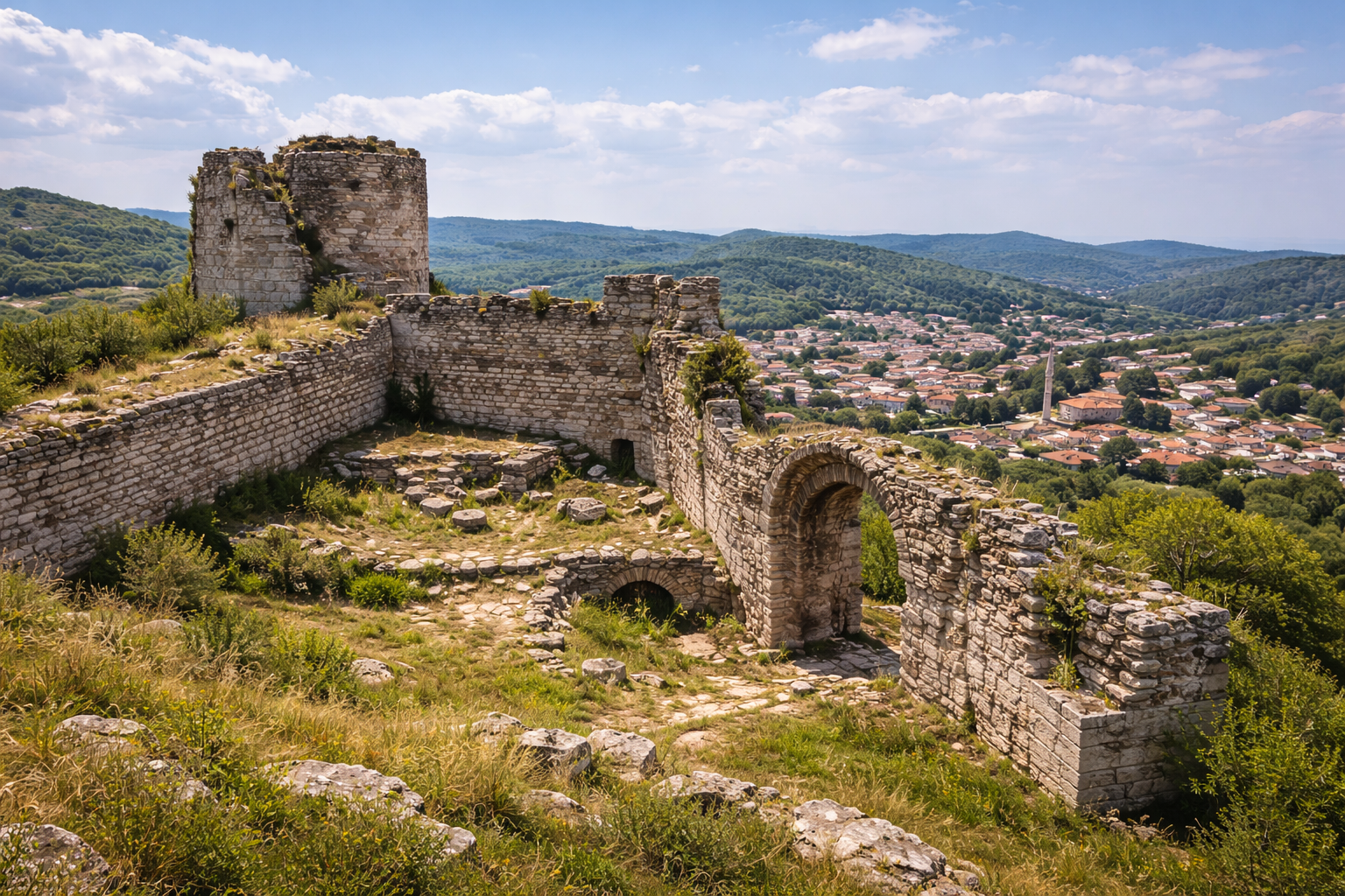
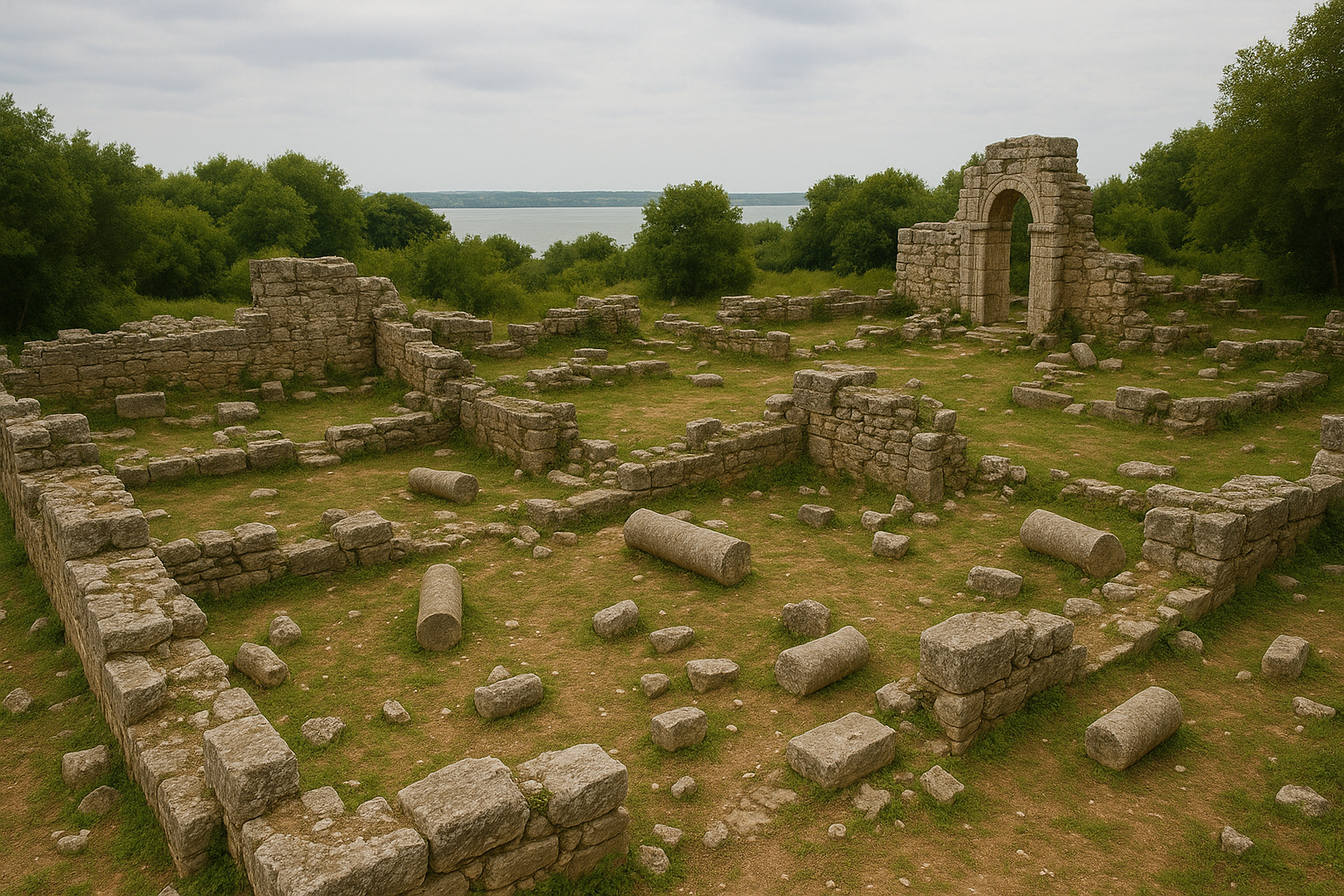
- The mound itself -- its low, flat profile is characteristic of prehistoric settlement mounds in Thrace and offers a contrast to the dramatic tells of central Anatolia
- The surrounding landscape -- the view toward the Istranca foothills and the flat Ergene basin illustrates why Neolithic settlers chose this location: diverse ecological zones within easy reach
- The Haydardere stream -- the water source that made permanent settlement possible at this location
Best Time to Visit
- Spring (April -- June): Warm weather, green fields, wildflowers. Ideal for photography and outdoor exploration.
- Autumn (September -- November): Pleasant temperatures, harvest season. Good visibility and comfortable walking conditions.
- Summer: Hot but feasible; bring sun protection and water. Early morning visits recommended.
- Winter: Cold and potentially muddy; the open-air museum structures may be less comfortable to visit, but the site is still accessible.
Estimated Visit Duration
Allow 1 to 2 hours for the open-air museum and a walk around the mound. Add time for the Kirklareli city center and regional museum if combining visits.
Combining with Other Sites
- Kirklareli Provincial Museum: Houses some original finds from the excavation and provides broader regional context from Paleolithic to Ottoman periods
- Kanligecit: A nearby prehistoric and Early Bronze Age site, also excavated by the Ozdogan team, with its own open-air museum component. The fortified Early Bronze Age settlement here provides a chronological continuation of the Asagi Pinar story.
- Vize (Bizye): The Roman theater and Byzantine fortifications (approximately 45 minutes south)
- Istranca Mountains: Hiking and nature tourism in the mountains north of Kirklareli, including the Longoz forests (floodplain forests of international ecological importance)
- Dupnisa Cave: A notable karst cave with archaeological and geological significance, approximately 40 km northeast
- Demirkoy and Igneada: Further Istranca Mountain destinations offering Ottoman-era ironworks history and unique coastal Longoz forests
Practical Tips
- The site is outdoors; wear comfortable shoes and weather-appropriate clothing
- Bring water and snacks; there are no on-site facilities
- Photography is generally permitted in the open-air museum area
- For the latest opening hours and access conditions, check with the Kirklareli Museum Directorate or local tourism office
- The site is family-friendly and suitable for children; the reconstructed houses are particularly engaging for young visitors
- Consider combining with a visit to the Kirklareli Museum for a complete picture of the region's archaeological heritage
- Guided visits may be available during excavation season; inquire locally
Frequently Asked Questions
What is a "hoyuk" (mound)?
A hoyuk (also spelled hoyuk or tell) is an artificial mound formed by the accumulated remains of successive settlements. As communities built, lived in, and demolished or abandoned structures over centuries or millennia, the debris gradually raised the ground level. Asagi Pinar's mound is relatively flat and low compared to the dramatic tells of Mesopotamia or central Anatolia, reflecting the use of lighter wooden construction materials rather than the thick mud-brick walls that create taller mounds elsewhere.
How old is Asagi Pinar?
The oldest occupation dates to approximately 6200 BC, and the site was occupied continuously until around 5000-4800 BC. This means the settlement lasted approximately 1,200-1,400 years -- longer than the entire history of the Roman Empire from Augustus to the fall of the Western Empire.
What is the "Neolithic Revolution"?
The Neolithic Revolution refers to the transition from hunting and gathering to farming and settled village life. This transformation originated in the Fertile Crescent (modern Turkey, Syria, Iraq) around 10,000 BC and spread gradually westward over several thousand years. Asagi Pinar documents one of the key stages in this process: the arrival of farming communities in Thrace, from where they would continue into the Balkans and ultimately across all of Europe.
Why did they switch from mud-brick to wood?
The first settlers at Asagi Pinar came from Anatolia, where mud-brick and stone construction was standard. However, Thrace's abundant forests and different soil conditions made timber a more practical and available building material. The shift to wattle-and-daub construction was an intelligent adaptation to local resources that would become the dominant building method across prehistoric Europe -- one of the most consequential architectural innovations in human history.
Can I see original artifacts from Asagi Pinar?
Original artifacts are primarily housed in the Kirklareli Provincial Museum and Istanbul Archaeological Museums. The open-air museum at the site displays replica artifacts. Some finds have also been featured in international exhibitions and academic publications.
Is Asagi Pinar connected to Catalhoyuk?
Not directly, but both sites are part of the broader narrative of the Neolithic spread from Anatolia into Europe. Catalhoyuk (c. 7500-5700 BC in central Anatolia) represents an earlier, more densely settled Neolithic community. The farming knowledge and cultural practices developed at sites like Catalhoyuk were eventually carried westward by migrating communities, some of whom founded settlements like Asagi Pinar in Thrace after a journey spanning generations and hundreds of kilometers.
How does Asagi Pinar compare to other Neolithic sites in Turkey?
While sites like Catalhoyuk and Gobekli Tepe attract global attention for their monumental features, Asagi Pinar's significance lies in its strategic geographic position and its complete cultural sequence. It is the critical "relay station" documenting how Neolithic lifeways were transmitted from Anatolia into Europe. In this sense, it addresses one of the most important questions in prehistoric archaeology: how did farming spread to Europe?
What role did Asagi Pinar play in European prehistory?
Asagi Pinar and the surrounding Eastern Thracian sites represent the critical transmission zone through which the Neolithic Revolution passed on its way from Anatolia into Europe. The innovations developed here -- particularly wooden architecture -- became foundational elements of European prehistoric culture that persisted for millennia.
Quantitative Archaeological Data
Stratigraphic Sequence and Radiocarbon Chronology
The following table summarises the nine cultural layers documented at Asagi Pinar, with approximate absolute dates derived from radiocarbon (C14) samples processed through the German Archaeological Institute (DAI) laboratory facilities.
| Cultural Layer | Approximate Date (cal. BC) | Cultural Affiliation | Primary Architectural Character |
|---|---|---|---|
| Layer 1 (earliest) | c. 6400--6200 | Early Neolithic I | Post-built wattle-and-daub; earliest Anatolian-derived forms |
| Layer 2 | c. 6200--6050 | Early Neolithic II | Rectangular timber-frame houses, 6--8 m long |
| Layer 3 | c. 6050--5800 | Early Neolithic III | Standardised multi-room plans; storage pits |
| Layer 4 | c. 5800--5650 | Middle Neolithic I | Ditched settlement boundary; communal features |
| Layer 5 | c. 5650--5500 | Middle Neolithic II | Peak occupation density; refined ceramics |
| Layer 6 | c. 5500--5300 | Late Neolithic I | Karanovo I parallels; white-on-red painted pottery |
| Layer 7 | c. 5300--5100 | Late Neolithic II | Karanovo I--II horizon connections |
| Layer 8 | c. 5100--4900 | Terminal Neolithic | Transitional Chalcolithic traits appear |
| Layer 9 (latest) | c. 4900--4300 | Early Chalcolithic | Final occupation; rudimentary copper objects |
The continuous sequence from c. 6400 to c. 4300 BC spans approximately 2,100 years of unbroken habitation -- substantially longer than the previously cited 1,200--1,400 year range, which covered only the core Neolithic phases. This extended chronology was established through flotation-derived seed samples and charcoal specimens subjected to AMS radiocarbon dating.
Figurine Assemblage: Quantitative Summary
Excavations at Asagi Pinar have recovered approximately 500 figurine fragments, studied in detail by Eylem Ozdogan. This constitutes one of the largest Early Neolithic figurine corpora from southeastern Europe.
| Figurine Category | Approximate Count | Material | Chronological Range |
|---|---|---|---|
| Anthropomorphic (female) | ~210 fragments | Fired clay | Layers 1--5 (Early--Middle Neolithic) |
| Anthropomorphic (schematic) | ~130 fragments | Clay and stone | Layers 2--7 |
| Zoomorphic (domesticated animals) | ~85 fragments | Fired clay | Layers 3--6 |
| Zoomorphic (wild animals) | ~40 fragments | Fired clay | Layers 2--5 |
| Miniature vessels / indeterminate | ~35 fragments | Fired clay | Layers 1--7 |
The stylistic uniformity of the figurines across multiple layers suggests a continuous tradition of symbolic expression that served to maintain community identity among successive generations of settlers. The predominance of female anthropomorphic figures in the earliest layers parallels figurine traditions documented at Anatolian Neolithic sites such as Catalhoyuk and Hacilar.
Ceramic Typology and Balkan Correlations
The pottery assemblage provides the primary chronological framework for correlating Asagi Pinar with regional sequences across the Balkans.
| Ceramic Phase | Diagnostic Wares | Regional Parallels |
|---|---|---|
| Layers 1--3 | Thick-walled, coarse; minimal decoration | Earliest Neolithic assemblages of NW Anatolia |
| Layers 4--5 | Red-slipped wares; incised geometric motifs | Pre-Karanovo horizons of southern Bulgaria |
| Layer 6--7 | White-on-red painted pottery; dark-burnished wares | Karanovo I culture of the Thracian Plain, Bulgaria |
| Layers 8--9 | Graphite-painted sherds; channelled decoration | Karanovo II--III and early Vinca cultural complex |
The appearance of white-on-red painted pottery in Layer 6 is a significant marker. This distinctive ware, characteristic of the Karanovo I culture, demonstrates that by c. 5500 BC the Asagi Pinar community was fully integrated into the broader Balkan cultural network rather than maintaining purely Anatolian traditions.
Excavation Area and Methodology
The total excavated area at Asagi Pinar covers approximately 2,500 square metres of the estimated 4--5 hectare settlement mound. The mound itself rises only 2--3 metres above the surrounding terrain -- a characteristically low profile reflecting the use of lightweight timber construction materials rather than the thick mud-brick debris that creates the tall tells of central Anatolia and Mesopotamia.
Key methodological innovations employed at the site include:
- Wet-sieving and flotation of all excavated sediment for seed and micro-fauna recovery
- Geomagnetic prospection surveys (conducted with DAI support) that mapped subsurface features across the entire mound, revealing unexcavated house foundations, ditches, and pit clusters
- Micromorphological thin-section analysis of floor deposits, providing evidence for floor renewal frequency, fuel types, and activity patterns at the household level
- Use-wear analysis of chipped stone tools, identifying specific functions (sickle blades for grain harvesting, scrapers for hide working)
Obsidian Sourcing and Exchange Networks
Chemical analysis (X-ray fluorescence spectrometry) of obsidian artefacts recovered from Asagi Pinar has identified source origins in the central Anatolian obsidian fields, most likely Cappadocian sources (Gollu Dag or Nenezi Dag). The presence of obsidian at a site approximately 700 km from its geological source confirms participation in long-distance exchange networks that were operational from the earliest Neolithic phases.
| Material | Source Region | Distance from Asagi Pinar | Layers Present |
|---|---|---|---|
| Obsidian | Central Anatolia (Cappadocia) | ~700 km | Layers 2--7 |
| High-quality flint | Local Thracian sources | 10--50 km | All layers |
| Spondylus shell | Aegean coast | ~200 km | Layers 4--6 |
| Polished green stone (axes) | Istranca Mountains | 20--40 km | All layers |
The obsidian quantities are small (less than 2% of the total chipped stone assemblage), indicating that these imports were valued items rather than everyday tools. This pattern is consistent with other Early Neolithic Balkan sites, where obsidian served as a prestige material exchanged along established inter-community networks.
Sources and Further Reading
- Green Corridors Project, "The Excavation Area of Asagi Pinar." Link
- Ozdogan, M. & Ozdogan, E., "Settlement Organization and Architecture in Asagi Pinar (2011)." Link
- Vici.org, "Asagi Pinar - Kirklareli Hoyuk." Link
- Ozdogan, E., "Early Neolithic Figurines in Asagi Pinar, Turkish Thrace." Link
- Ozdogan, E., "Contextualising the Neolithic House: A View from Asagi Pinar in Eastern Thrace." Link
- Ozdogan, M., Basgelen, N. & Kuniholm, P. (eds.), The Neolithic in Turkey: New Excavations and New Research, Northwestern Turkey and Istanbul. Istanbul: Archaeology and Art Publications.
- DergiPark, "Asagi Pinar Acik Hava Muzesi: Yaklasim, Uygulama Sureci ve Karsilasilan Sorunlar." Link
- Kirklareli Projesi, "Asagi Pinar." Link
- TAY Project, "Asagi Pinar." Link
- Cambridge University Press, "Continuity and Discontinuity in Eastern Thrace during the Neolithic Period." Link
- Turkish Archaeological News, "Archaeology in Turkey - 2024 in Review." Link
- De Gruyter, "Setting the Boundaries of Early Neolithic Settlement Sites: Ditch-Digging Practices in the Eastern Balkans." Link