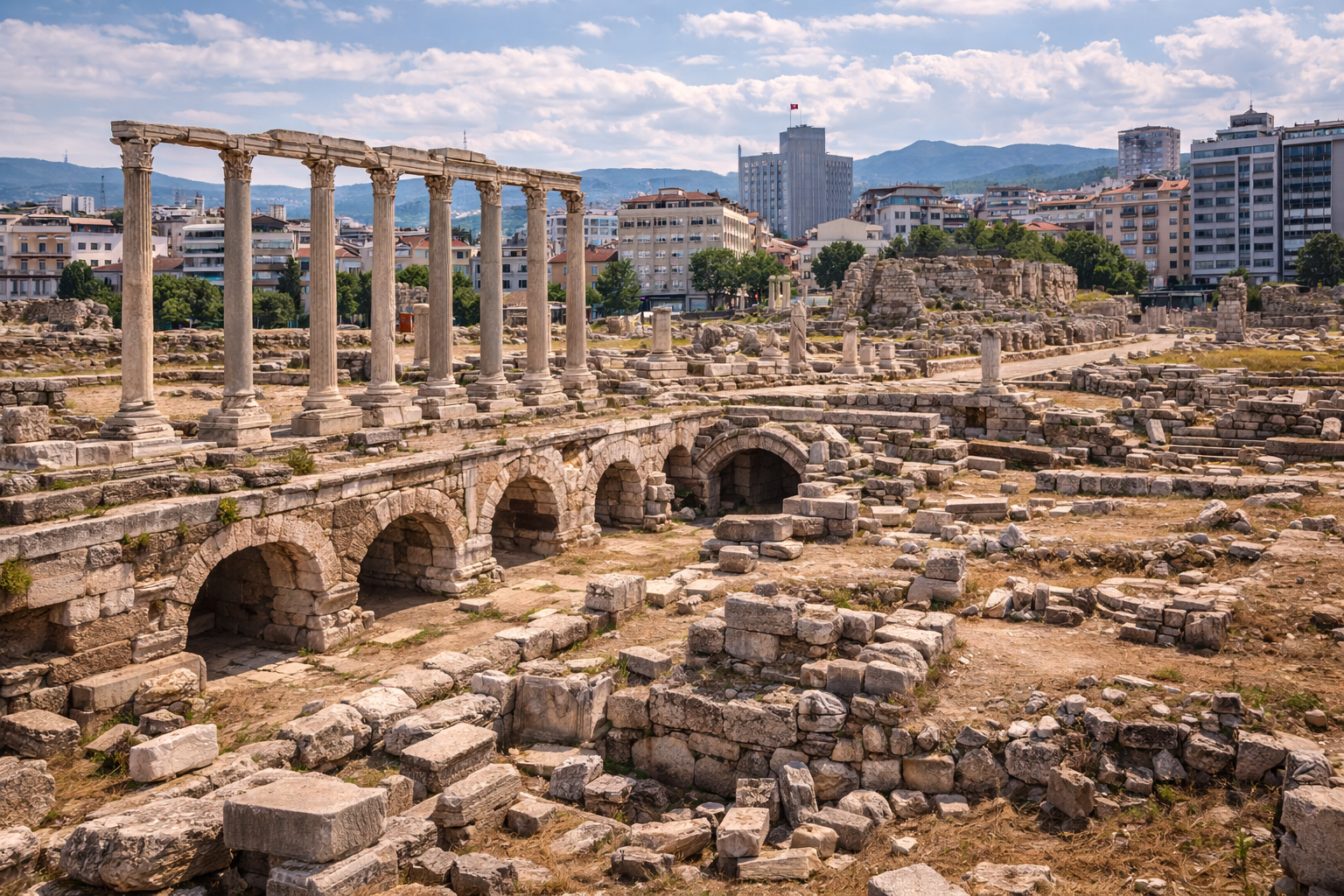
El Tepe de Bayraklı, también conocido como Tepekule o Antigua Esmirna, es el yacimiento de asentamiento original de la antigua Esmirna -- una de las ciudades habitadas de forma continuada más antiguas del mundo mediterráneo. Con capas de ocupación que se remontan al III milenio a. C., este modesto montículo urbano del distrito de Bayraklı de Izmir entregó algunos de los descubrimientos más revolucionarios de la arqueología egea: el templo griego de Atenea más antiguo conocido (c. 725-700 a. C.), uno de los primeros trazados urbanos en retícula del mundo antiguo, formidables murallas de fortificación en adobe y casas de tipo megaron que iluminan cómo vivían los griegos comunes durante la vida de Homero. La tradición antigua nombra a la Antigua Esmirna como cuna del propio Homero, convirtiendo a este modesto altozano en uno de los yacimientos arqueológicos culturalmente más significativos de Turquía.
Tabla de contenidos
- Por qué importa la Antigua Esmirna
- Geografía y emplazamiento
- Cronología histórica
- Principales monumentos
- Trabajos arqueológicos
- Información para el visitante
- Preguntas frecuentes
- Fuentes y lecturas complementarias
Por qué importa la Antigua Esmirna
La Antigua Esmirna ocupa una posición de una importancia singular en la arqueología mediterránea por las siguientes razones:
- Tradición de la cuna de Homero: Múltiples fuentes antiguas -- entre ellas Estrabón, Heródoto y Pausanias -- identifican a Esmirna como la cuna más probable de Homero, el poeta tras la Ilíada y la Odisea. Si esta tradición es correcta, las calles de la Antigua Esmirna son por las que caminó el mayor poeta de la civilización occidental.
- El templo griego de piedra más antiguo: El Templo de Atenea descubierto en Bayraklı, datado aproximadamente en 725-700 a. C., es el templo griego más antiguo conocido construido en piedra en el Egeo oriental. Revolucionó la comprensión académica de cuándo los griegos comenzaron a construir arquitectura religiosa monumental.
- Pionero del urbanismo: La Antigua Esmirna es uno de los primeros yacimientos en mostrar evidencia de trazado de calles en retícula, anticipándose en más de un siglo al «plan hipodámico» tradicionalmente acreditado. Las manzanas organizadas de casas demuestran un pensamiento urbano sofisticado en el período arcaico.
- 5.000 años de ocupación continua: El montículo contiene capas de asentamiento desde la Edad del Bronce Antiguo (c. 3000 a. C.) hasta el período clásico (siglo V a. C.), conformando un registro ininterrumpido de la interacción cultural anatolio-egea.
- Narrativas espectaculares de destrucción: La ciudad fue violentamente destruida por el rey lidio Aliates hacia el 600 a. C. y posteriormente devastada por fuerzas persas en el 545 a. C., proporcionando capas de destrucción datables arqueológicamente que ayudan a calibrar la cronología en todo el Egeo antiguo.
Geografía y emplazamiento
El Tepe de Bayraklı se asienta en el distrito de Bayraklı de la moderna Izmir, aproximadamente a 700 metros tierra adentro de la línea costera actual, en el barrio llamado Tepekule. En la Antigüedad, el montículo era una pequeña península o isla que se proyectaba en el Golfo de Esmirna (la actual bahía de Izmir), lo que le otorgaba acceso natural a un puerto y ventajas defensivas.
| Rasgo | Detalle |
|---|---|
| Coordenadas | 38,46 N, 27,17 E |
| Dimensiones del montículo | Aproximadamente 130 m x 100 m |
| Elevación | Aproximadamente 10-15 m sobre la llanura circundante |
| Distrito moderno | Bayraklı, área metropolitana de Izmir |
| Punto de referencia más cercano | Estación de tren de Bayraklı (1 km) |
| Línea costera antigua | El montículo era originalmente costero; los depósitos aluviales han empujado desde entonces la costa hacia el norte |
El contexto geológico y topográfico es crítico para comprender la Antigua Esmirna. El montículo se asienta sobre una elevación natural de roca madre que formaba un promontorio defendible cuando los niveles del mar y los patrones de sedimentación diferían de los actuales. Los ríos que drenaban la llanura de Bornova depositaron aluviones que gradualmente colmataron el antiguo puerto, lo que explica por qué el yacimiento aparece ahora aislado del mar.
El clima local es mediterráneo con veranos cálidos y secos (35+ grados C en julio-agosto) e inviernos suaves y lluviosos. El montículo está hoy rodeado por bloques de apartamentos modernos e infraestructura urbana, en marcado contraste con su entorno antiguo.
Cronología histórica
Bronce Antiguo (c. 3000-2000 a. C.)
La ocupación más antigua del Tepe de Bayraklı se remonta al III milenio a. C., contemporánea de las grandes civilizaciones de la Edad del Bronce de Troya, las Cícladas y la Creta minoica. Estos pobladores más antiguos fueron probablemente pueblos anatolios indígenas dedicados a la pesca, la agricultura y el comercio costero. La evidencia cerámica de estas capas muestra conexiones tanto con las tradiciones del interior anatolio como con las de las islas egeas.
Bronce Medio y Tardío (c. 2000-1200 a. C.)
La ocupación continuó a lo largo del II milenio a. C. Algunos estudiosos han explorado posibles conexiones con las migraciones eolio-griegas tradicionalmente datadas a finales de la Edad del Bronce. El yacimiento muestra signos de transición cultural durante este período.
Períodos protogeométrico y geométrico (c. 1050-700 a. C.)
Tras el colapso de la Edad del Bronce, Esmirna resurgió como un asentamiento con un fuerte carácter eolio-griego. Las capas protogeométrica (c. 1050-900 a. C.) y geométrica (c. 900-700 a. C.) están entre las más ricas del yacimiento:
- Se construyeron casas de tipo megaron con hogares centrales en filas organizadas.
- El primer Templo de Atenea se construyó hacia 725-700 a. C. -- una pequeña estructura de piedra que es el templo griego más antiguo conocido en el Egeo oriental.
- La población se estima en 500-600 casas que sostenían aproximadamente 3.000 habitantes en el apogeo de la ciudad.
- Los hallazgos cerámicos incluyen cerámica geométrica fina con decoración pintada.
La tradición antigua del nacimiento de Homero en Esmirna lo sitúa en este período (Homero se data habitualmente en el siglo VIII a. C.). Si Homero compuso realmente la Ilíada y la Odisea aquí, las casas-megaron de la Antigua Esmirna proporcionan el contexto doméstico para parte de la mayor literatura jamás escrita.
Período arcaico (c. 700-546 a. C.)
El siglo VII a. C. fue la edad de oro de la Antigua Esmirna. La ciudad:
- Amplió su Templo de Atenea con un edificio de piedra más elaborado (c. 640-580 a. C.), uno de los templos monumentales más antiguos del mundo griego.
- Construyó formidables murallas de fortificación de adobe sobre cimientos de piedra, con baluartes torreados y una puerta monumental.
- Desarrolló un trazado de calles en retícula con manzanas residenciales normalizadas.
- Construyó una fuente monumental para abastecer de agua fresca a la población urbana.
- Se involucró en el comercio de larga distancia, como evidencia la cerámica importada de Corinto, Grecia oriental y el Levante.
Esta prosperidad terminó en catástrofe. Hacia el 610-600 a. C., el rey lidio Aliates (padre del legendario Creso) asedió y destruyó la Antigua Esmirna. La evidencia arqueológica de esta destrucción es vívida: muros colapsados, escombros de fuego y puntas de flecha incrustadas en torres de fortificación. El geógrafo Estrabón registra que tras el asalto de Aliates, la población quedó dispersa en aldeas durante aproximadamente 400 años.
Destrucción persa (545 a. C.)
Cualquier recuperación tras el ataque lidio fue interrumpida por la conquista persa de Lidia en el 546 a. C. La Antigua Esmirna fue de nuevo devastada, esta vez por las fuerzas de Ciro el Grande. El yacimiento nunca recuperó su carácter urbano anterior.
Refundación helenística -- Nueva Esmirna (c. 300 a. C.)
Según la leyenda, Alejandro Magno soñó con refundar Esmirna en una nueva ubicación. Sus sucesores, en particular Antígono y luego Lisímaco, llevaron a cabo esta visión hacia el 300 a. C., estableciendo la Nueva Esmirna en el actual Kadifekale de Izmir (monte Pagos), aproximadamente a 5 km al sur. El antiguo montículo de Bayraklı quedó en gran medida abandonado como centro urbano, aunque pudo continuar alguna ocupación modesta.
Principales monumentos
Templo de Atenea
El Templo de Atenea en Bayraklı es el descubrimiento arqueológico individual más importante del montículo. Se han identificado dos fases principales:
- Fase I (c. 725-700 a. C.): Un pequeño templo de piedra -- el templo griego más antiguo conocido en el Egeo oriental. Este descubrimiento por Ekrem Akurgal en la década de 1960 retrocedió la cronología de la arquitectura monumental griega en décadas.
- Fase II (c. 640-580 a. C.): Una reconstrucción mayor y más elaborada con sillería de piedra refinada. Esta versión incluía un pronaos (pórtico de entrada) y una cella (cámara interior) y está entre los ejemplos más tempranos del plan de templo griego en desarrollo.
El templo confirma que la diosa Atenea era la deidad patrona de la Antigua Esmirna, en consonancia con la identidad de la ciudad como centro de aprendizaje y cultura griegas.
Murallas de fortificación y puerta de la ciudad
La Antigua Esmirna poseía un notable sistema defensivo consistente en:
- Murallas de adobe sobre cimientos de piedra, con una altura estimada de 5-6 metros.
- Baluartes torreados a intervalos regulares a lo largo del circuito.
- Una puerta monumental de la ciudad que proporcionaba la entrada principal.
- Un glacis exterior (superficie defensiva en pendiente) para impedir que las máquinas de asedio alcanzaran las murallas.
Estas fortificaciones se datan principalmente en el siglo VII a. C. y están entre los sistemas defensivos griegos arcaicos mejor documentados. El asedio lidio dejó una espectacular evidencia arqueológica: puntas de flecha alojadas en las superficies de los muros, adobe enrojecido por el fuego y secciones de torres colapsadas.
Casas-megaron
La arquitectura residencial de la Antigua Esmirna consiste principalmente en casas de tipo megaron -- estructuras rectangulares con un hogar central, un pórtico de entrada y una sala principal. Estas casas se:
- Construyeron en filas organizadas a lo largo de calles planificadas.
- Edificaron en adobe sobre cimientos de piedra.
- Dimensionaron en aproximadamente 4 x 8 metros internamente.
- Caldearon mediante hogares de fuego centrales.
El plan de megaron es la misma tradición arquitectónica que influyó en el diseño de los propios templos griegos, proporcionando una rara ventana a la vida doméstica de los griegos de los siglos VIII-VII a. C.
Fuente monumental
Se construyó una estructura de fuente pública para abastecer de agua fresca a los residentes de la ciudad. Alimentada por un canal desde una fuente natural, esta estructura demuestra la infraestructura cívica de la Esmirna arcaica y su capacidad para obras públicas organizadas.
Cuadrícula de calles residenciales
El trazado organizado de calles de la Antigua Esmirna, con casas dispuestas en filas aproximadamente paralelas separadas por callejones, es uno de los primeros ejemplos de planificación protorreticular del mundo griego. Si bien no tan rígido como la posterior retícula hipodámica, demuestra que los conceptos de urbanismo se estaban desarrollando ya en el Egeo oriental mucho antes del siglo V a. C.
Trabajos arqueológicos
La exploración arqueológica del Tepe de Bayraklı tiene una distinguida historia:
- 1930-1931: Las primeras excavaciones fueron realizadas por el arqueólogo austriaco Franz Miltner, que identificó el yacimiento como la antigua Esmirna.
- 1948-1951: Una importante excavación conjunta británico-turca fue dirigida por John Manuel Cook (British School at Athens) y Ekrem Akurgal (Universidad de Ankara). Esta campaña estableció el marco cronológico del yacimiento y sacó a la luz el sistema de fortificación.
- 1966-1992: Ekrem Akurgal continuó las excavaciones centrándose en la ocupación de los períodos geométrico y arcaico. Descubrió el Templo de Atenea y las áreas residenciales organizadas, transformando la comprensión del urbanismo griego temprano. Su monografía Alt-Smyrna I: Wohnschichten und Athenatempel (1983) sigue siendo la publicación definitiva.
- 2007-actualidad: Las excavaciones renovadas, ahora bajo el proyecto «Patrimonio para el Futuro» del Ministerio de Cultura y Turismo de Turquía, se han concentrado en el área en torno al Templo de Atenea, investigando tanto las secciones septentrional como la meridional. Estas campañas continúan refinando la estratigrafía y la cronología del yacimiento.
Las contribuciones académicas clave incluyen:
| Erudito | Período | Contribución |
|---|---|---|
| Franz Miltner | 1930-1931 | Primera identificación y excavación |
| John M. Cook | 1948-1951 | Marco estratigráfico, análisis de la fortificación |
| Ekrem Akurgal | 1948-1992 | Templo de Atenea, casas-megaron, gran publicación |
| Equipos turcos actuales | 2007-actualidad | Refinamiento en curso en torno al recinto del Templo de Atenea |
Información para el visitante
Ubicación y acceso
| Detalle | Información |
|---|---|
| Ubicación | Barrio de Tepekule, distrito de Bayraklı, Izmir |
| Distancia desde el centro de Izmir (Konak) | Aproximadamente 8 km al norte |
| Transporte más cercano | Estación de tren de cercanías IZBAN de Bayraklı (caminata de 1 km) |
| En coche | Accesible desde la circunvalación de Izmir (Otoyol); señales hacia Bayraklı/Tepekule |
| Aparcamiento | Aparcamiento en la calle limitado cerca del montículo |
Opciones de transporte
- En IZBAN (tren de cercanías): Tome la línea IZBAN hasta la estación de Bayraklı, luego camine aproximadamente 1 km al este hasta el barrio de Tepekule. Esta es la opción más conveniente de transporte público.
- En metro/autobús: El metro y las rutas de autobús de Izmir conectan con el área de Bayraklı; pregunte localmente por la dirección a Tepekule.
- En coche/taxi: Desde el centro de Izmir (Konak), conduzca al norte por la carretera de la bahía hacia Bayraklı. El montículo está situado en el área residencial de Tepekule.
- Caminando: Si se hospeda en los distritos de Bayraklı o Bornova, el yacimiento es accesible a pie.
Duración de la visita
- Visita rápida: 30-45 minutos para caminar por el montículo y ver las principales áreas de excavación
- Visita estándar: 1-1,5 horas con un examen cuidadoso del área del templo, las murallas y los letreros interpretativos
- Combinada con los museos de Izmir: Añada 2-3 horas para el Museo Arqueológico de Izmir (Konak) y el Museo Ágora al Aire Libre
Mejor momento para visitar
- Primavera (marzo-mayo): Temperaturas suaves, agradables para caminar al aire libre
- Otoño (septiembre-noviembre): Tiempo confortable, menos humedad
- Verano: Puede ser muy cálido; visite por la mañana temprano o al final de la tarde
- Invierno: Suave pero lluvioso; todavía accesible
Visitas combinadas
- Museo Arqueológico de Izmir (Konak): Alberga muchos artefactos de las excavaciones de la Antigua Esmirna, incluida cerámica y fragmentos arquitectónicos. Complemento esencial de la visita al yacimiento.
- Ágora de Esmirna (Konak): El ágora de época romana de la «Nueva Esmirna» en Kadifekale, aproximadamente 8 km al sur, proporciona el capítulo posterior de la historia de Esmirna.
- Kadifekale (monte Pagos): La ciudadela helenístico-romana donde la Nueva Esmirna fue refundada por Lisímaco.
- Éfeso: 80 km al sur, la ciudad antigua más famosa del oeste de Turquía, para comparación de escala y conservación.
Consejos prácticos
- El yacimiento está situado dentro de un barrio residencial; sea respetuoso con los residentes locales.
- Lleve calzado cómodo para caminar; el montículo tiene superficies irregulares.
- Lleve agua y protección solar en verano.
- Verifique localmente los horarios de acceso actuales, ya que el yacimiento puede tener horarios de visita limitados durante las temporadas activas de excavación.
- En general se permite la fotografía.
- No hay cafetería ni tienda de regalos en el yacimiento; los servicios están disponibles en el barrio circundante de Bayraklı.
- El yacimiento es relativamente compacto y adecuado para visitantes de la mayoría de niveles de forma física.
- Considere visitar el Museo Arqueológico de Izmir antes que el yacimiento, ya que el museo proporciona un contexto que enriquece la interpretación in situ.
Preguntas frecuentes
¿Nació realmente Homero en la Antigua Esmirna?
Siete ciudades del mundo antiguo se proclamaban cuna de Homero, pero Esmirna tenía una de las tradiciones más fuertes. Autores antiguos entre los que se incluyen Estrabón y un texto llamado Vida de Homero pseudoheródotea sitúan aquí su nacimiento. Aunque una prueba absoluta es imposible, la evidencia arqueológica muestra que la Antigua Esmirna era una próspera y culturalmente sofisticada ciudad griega en el siglo VIII a. C. -- exactamente el período en que se piensa que Homero compuso sus epopeyas. Las casas-megaron, el templo y el activo comercio portuario revelados por la excavación proporcionan un contexto plausible para un poeta de la talla de Homero.
¿Por qué es tan importante el Templo de Atenea?
El templo de la Fase I (c. 725-700 a. C.) en Bayraklı es el templo griego de piedra más antiguo conocido en el Egeo oriental. Antes de este descubrimiento, los estudiosos creían que la arquitectura templaria monumental griega comenzó más tarde, principalmente en la Grecia continental. El templo de Bayraklı retrasó la cronología y demostró que las ciudades griegas orientales eran innovadoras arquitectónicas. El templo de la Fase II (c. 640-580 a. C.) demuestra además la rápida evolución de la arquitectura sagrada griega durante el período arcaico.
¿Por qué destruyeron los lidios Esmirna?
El rey lidio Aliates (r. c. 610-560 a. C.), padre del famoso Creso, llevó a cabo una política expansionista a lo largo de la costa egea. La Antigua Esmirna, como una ciudad griega rica e independiente, era un objetivo. El asedio y la destrucción en torno al 600 a. C. dispersaron a la población y pusieron fin a la existencia urbana de la ciudad. Estrabón registra que los habitantes vivieron en aldeas durante aproximadamente 400 años hasta que los sucesores de Alejandro Magno refundaron la ciudad en una nueva ubicación.
¿Adónde fue la Nueva Esmirna?
Hacia el 300 a. C., los sucesores de Alejandro Magno -- en particular Antígono y Lisímaco -- refundaron Esmirna en el monte Pagos (Kadifekale), aproximadamente 5 km al sur del antiguo montículo. Esta «Nueva Esmirna» creció hasta convertirse en una de las ciudades más grandes y prósperas del Oriente romano, con una población de más de 100.000 habitantes. Sus ruinas, incluida el Ágora romana, son visibles en el centro de Izmir hoy.
¿Está bien conservado el yacimiento?
El montículo ha sufrido la invasión urbana, ya que la moderna Bayraklı creció alrededor y sobre partes del yacimiento antiguo. Sin embargo, las áreas excavadas están protegidas y mantenidas. Las cimentaciones del templo, los trazados de las murallas y las secciones estratigráficas son visibles. La extensión completa de la ciudad antigua yace bajo edificios modernos, y solo se ha excavado una parte.
¿Puedo ver artefactos de la Antigua Esmirna?
Sí. El Museo Arqueológico de Izmir en el distrito de Konak alberga cerámica, figurillas, fragmentos arquitectónicos y otros hallazgos de las excavaciones de Bayraklı. Visitar el museo antes o después del yacimiento enriquece enormemente la experiencia.
Repertorio cerámico y fases estratigráficas
El registro cerámico del Tepe de Bayraklı proporciona una de las secuencias cerámicas más completas del Egeo, abarcando desde la Edad del Bronce Antiguo hasta el período clásico. Las recientes excavaciones dirigidas por la Dra. Aylin Ümit Erdem de la Universidad del Egeo (Ege Üniversitesi) han revelado nuevos datos significativos de los estratos más profundos.
Tipología cerámica de la Edad del Bronce
| Tipo cerámico | Período | Paralelos | Significado |
|---|---|---|---|
| Jarras con pico picudo | III milenio a. C. (BA temprano) | Troya I-II | Evidencia de la ocupación más antigua; vínculos comerciales anatolios |
| Cuencos acanalados | III milenio a. C. (BA temprano) | Tradición cicládica | Conexiones marítimas egeas |
| Vasos de cerámica roja | II milenio a. C. (BM-BT) | Larisa (valle del Hermos) | Esfera cultural anatolia del interior |
| Vasos de cerámica gris | II milenio a. C. (BM-BT) | Tipos del noroeste de Anatolia | Zona de influencia troadica |
| Jarras de almacenamiento (pithoi) | III-II milenio a. C. | Formas anatolias regionales | Excedente agrícola y economía de almacenamiento |
| Cerámica de influencia micénica | Bronce Tardío (c. 1400-1200 a. C.) | Miceno IIIA-B | Evidencia de contactos comerciales palaciales egeos |
Durante las campañas de excavación de 2007-actualidad se identificaron cinco capas arquitectónicas distintas del Bronce Medio y Tardío. Entre los hallazgos se incluyeron talleres, un horno cerámico de cocción, restos de múltiples hornos de pan y una colección de vasos de bronce -- indicando un asentamiento con una producción artesanal diversificada y capacidades de procesamiento de alimentos.
Secuencia cerámica protogeométrica y geométrica
La transición de la Edad del Bronce a la Edad del Hierro en Bayraklı está documentada a través de una secuencia cerámica continua:
- Fase protogeométrica (c. 1050-900 a. C.): Vasos hechos a mano y primeros vasos a torno con decoración lineal simple. Estas cerámicas muestran fuertes características eolio-griegas, en consonancia con el asentamiento de colonos eolios.
- Geométrico antiguo (c. 900-800 a. C.): Introducción de motivos decorativos más complejos incluidos círculos concéntricos, entramado cruzado y patrones de meandro.
- Geométrico tardío (c. 800-700 a. C.): Cerámica pintada fina con escenas figuradas. La cerámica de esta fase es contemporánea del Templo de Atenea más antiguo y proporciona el contexto material para el período homérico.
Datos de ingeniería de las murallas de fortificación
La investigación reciente publicada en la revista Höyük (2023, número 11) ha refinado la comprensión de las murallas defensivas de la Antigua Esmirna. El sistema de fortificación representa la muralla de ciudad más antigua conocida del mundo griego, datada aproximadamente en el 850 a. C.
| Rasgo de la muralla | Medida / Detalle |
|---|---|
| Técnica de construcción | Superestructura de adobe sobre cimentación de zócalo de piedra |
| Revestimiento del zócalo de piedra | Piedra labrada exterior, núcleo de mampostería |
| Altura estimada de la muralla | 5-6 m (incluida la superestructura de adobe) |
| Extensión del circuito | Aproximadamente 400 m de perímetro alrededor del montículo |
| Baluartes torreados | Proyecciones semicirculares a intervalos de aprox. 15-20 m |
| Pendiente del glacis | Rampa de tierra apisonada en la base, ángulo de aprox. 35-45 grados |
| Rampa de asedio (Aliates) | Montículo de asedio de tierra construido contra la sección oriental de la muralla |
La fortificación representa una historia constructiva multifase. El circuito de muralla más temprano (c. 850 a. C.) fue ampliado y reforzado durante el siglo VII a. C. a medida que aumentaba la agresión lidia. La fase final corresponde al período inmediatamente anterior a la destrucción por Aliates (c. 600 a. C.).
Templo de Atenea: datos de reconstrucción arquitectónica
La publicación de Cook y Nicholls (Old Smyrna Excavations: The Temples of Athena, 1998) proporciona el análisis arquitectónico más detallado:
| Rasgo | Fase I (c. 725-700 a. C.) | Fase II (c. 640-580 a. C.) |
|---|---|---|
| Material de cimentación | Bloques de piedra de andesita | Caliza labrada |
| Fragmento del muro de la cella | Tramo conservado de 5,5 m de largo | Mayor huella, pronaos + cella |
| Orden de las columnas | Eólico (los capiteles eólicos más antiguos conocidos) | Transicional eólico a jónico |
| Disposición de columnas | Objeto de debate; posiblemente peristilo de 6 x 11 | Reconstruido como templo periptero |
| Rampa de acceso | Rampa de aprox. 3 m de ancho al área del altar | Camino formal de aproximación |
| Altar | Altar de piedra al este del templo | Altar reconstruido con depósitos de ceniza |
Los capiteles de columna eólicos del templo de la Fase I -- con su característico diseño de doble voluta -- están entre los ejemplos más antiguos de decoración monumental de columnas en el mundo griego. Estos capiteles vinculan la tradición arquitectónica de la Antigua Esmirna con la zona cultural eolia más amplia del noroeste de Anatolia y Lesbos.
Cronología de excavaciones: registro detallado
| Año(s) | Director / Institución | Actividades y descubrimientos clave |
|---|---|---|
| 1930-1931 | Franz Miltner (Instituto Arqueológico Austriaco) | Primera identificación del yacimiento como antigua Esmirna; prospección de superficie y catas de prueba |
| 1948-1951 | J.M. Cook (British School at Athens) + E. Akurgal (Universidad de Ankara) | Marco estratigráfico establecido; sistema de fortificación sacado a la luz; identificadas las capas de ocupación desde la Edad del Bronce hasta el arcaico |
| 1966-1992 | Ekrem Akurgal (Universidad de Ankara) | Descubrimiento del Templo de Atenea (Fase I y II); excavación de casas-megaron y retícula residencial; publicación de Alt-Smyrna I (1983) |
| 2007-2012 | Ministerio de Cultura de Turquía | Renovado enfoque en el recinto del Templo de Atenea; conservación de los restos arquitectónicos expuestos |
| 2013-actualidad | Colaboración del Ministerio Turco / Universidad del Egeo | Investigación de las capas de la Edad del Bronce y del Hierro; descubrimiento de cerámica de 5.000 años de antigüedad que revela tempranos vínculos comerciales; prospecciones geofísicas de áreas no excavadas |
Las campañas más recientes (2013-actualidad) han desplazado el enfoque hacia las capas pregriegas de la Edad del Bronce, revelando que el papel del yacimiento como nodo comercial que conectaba las redes interiores anatolias con las rutas marítimas egeas se extiende mucho más atrás en el tiempo de lo previamente comprendido. El repertorio cerámico de 5.000 años de antigüedad muestra paralelos directos con las formas de los períodos Troya I y Troya II, sugiriendo que Bayraklı formaba parte de la misma esfera cultural y comercial que los asentamientos del noroeste de Anatolia durante el III milenio a. C.
Fuentes y lecturas complementarias
- Akurgal, E. Alt-Smyrna I: Wohnschichten und Athenatempel. Ankara: Türk Tarih Kurumu, 1983.
- Cook, J.M. «Old Smyrna, 1948-1951». Annual of the British School at Athens 53/54, 1958-59.
- Cook, J.M. y Nicholls, R.V. «Old Smyrna Excavations: The Temples of Athena». Annual of the British School at Athens, Supplement, 1998.
- Akurgal, E. Ancient Civilizations and Ruins of Turkey. Estambul: Haset, 1985.
- Wikipedia -- Old Smyrna
- Wikipedia -- Smyrna
- Türkiye Today -- Archaeological excavations at 5,000-year-old Smyrna Mound
- Visit Izmir -- Old Smyrna - Bayrakli Hoyuk
- Luwian Studies -- Bayrakli/Alt-Smyrna
Homero y Esmirna: la tradición literaria
La cuestión de la cuna de Homero fue debatida a lo largo de la Antigüedad. Un famoso epigrama antiguo enumera siete ciudades candidatas:
Siete ciudades se disputaron a Homero muerto: Esmirna, Quíos, Colofón, Ítaca, Pilos, Argos y Atenas.
De estas, Esmirna y Quíos tenían las tradiciones más fuertes. La llamada Vida de Homero pseudoheródotea -- un texto biográfico probablemente escrito en el período helenístico -- proporciona el relato más detallado, situando el nacimiento de Homero en Esmirna y describiendo su vida temprana a orillas del río Meles (un arroyo que fluye por el área cercana a Bayraklı y la antigua Esmirna).
Por qué la tradición de Esmirna es plausible
La evidencia arqueológica de Bayraklı apoya la plausibilidad de la tradición Homero-Esmirna:
- Coincidencia cronológica: La Antigua Esmirna era una ciudad griega próspera y culturalmente activa en el siglo VIII a. C., precisamente cuando se cree que Homero vivió y compuso la Ilíada y la Odisea.
- Sofisticación cultural: Las casas-megaron, la cuadrícula organizada de calles, el Templo de Atenea y la cerámica importada demuestran una comunidad rica e internacionalmente conectada -- el tipo de entorno que podría producir un poeta de la ambición y el rango literario de Homero.
- Mezcla cultural eolio-jónica: La Antigua Esmirna fue originalmente un asentamiento eolio que pasó bajo influencia jonia. La lengua de Homero combina notoriamente los dialectos griegos eolio y jónico, lo que es coherente con un poeta criado en esta intersección cultural.
- Conocimiento marítimo: El detallado conocimiento de Homero sobre la navegación, los puertos y la geografía costera -- evidente a lo largo de la Odisea -- encaja con una infancia en una ciudad portuaria como Esmirna.
Aunque la prueba absoluta de la cuna de Homero es inalcanzable, la Antigua Esmirna sigue siendo el candidato arqueológico más fuerte.
La destrucción por Aliates: evidencia arqueológica
La destrucción lidia de la Antigua Esmirna hacia el 600 a. C. es uno de los acontecimientos militares mejor documentados de la arqueología griega arcaica. La evidencia incluye:
- Capa de incendio: Un grueso depósito de escombros carbonizados que cubre amplias áreas del montículo, indicando una conflagración generalizada.
- Puntas de flecha en las murallas: Se han hallado puntas de flecha de bronce incrustadas en las murallas de adobe, evidencia física del asalto del asedio.
- Fortificaciones colapsadas: Secciones de la muralla de la ciudad y de los baluartes torreados muestran un colapso violento coherente con la guerra de asedio.
- Trazas de montículo de asedio: Evidencia de una rampa de tierra construida contra las murallas, una técnica estándar de asedio lidia y del Próximo Oriente.
El rey lidio Aliates (r. c. 610-560 a. C.) fue uno de los líderes militares más agresivos del Egeo de los siglos VII-VI a. C. Expandió el territorio lidio hacia el oeste hasta la costa, sometiendo a las ciudades griegas. Su hijo Creso se convertiría más tarde en legendario por su riqueza antes de ser derrotado por el rey persa Ciro el Grande en el 546 a. C.
Estrabón registra las consecuencias: los habitantes de Esmirna «vivieron en aldeas» durante aproximadamente 400 años antes de que la ciudad fuera refundada. Esta declaración está confirmada en líneas generales por la arqueología -- el montículo muestra una ocupación urbana mínima entre la destrucción del siglo VI a. C. y los períodos posteriores.
De la Antigua Esmirna a la Nueva Esmirna: la leyenda de Alejandro
La refundación de Esmirna en una nueva ubicación es una de las historias más espectaculares de la historia de la ciudad. Según la tradición antigua preservada por Pausanias:
- Alejandro Magno, mientras cazaba en el monte Pagos (Kadifekale), se quedó dormido bajo un plátano cerca de un santuario de las Némesis (diosas de la retribución).
- En su sueño, las Némesis se le aparecieron y le dijeron que refundase la ciudad de Esmirna en las laderas del monte Pagos.
- Alejandro dio la orden, pero la construcción real fue llevada a cabo por sus sucesores Antígono y Lisímaco hacia el 300 a. C.
La Nueva Esmirna creció hasta convertirse en una de las ciudades más importantes del Oriente romano, con una población que superaba los 100.000 habitantes en su apogeo. Era reconocida por su belleza, sus escuelas de retórica y su pretensión de ser una «primera ciudad de Asia» junto con Éfeso y Pérgamo.
Las ruinas de la Nueva Esmirna son visibles en el centro de Izmir hoy, incluida el Ágora romana (reconstruida tras un terremoto del 178 d. C. bajo Marco Aurelio) y las murallas de la fortaleza de Kadifekale.
El significado del plan en retícula
El trazado protorreticular de calles en la Antigua Esmirna tiene implicaciones importantes para la historia del urbanismo:
- Antes de Hipodamo: La narrativa tradicional atribuye a Hipodamo de Mileto (siglo V a. C.) la condición de «padre del urbanismo» que inventó el sistema de calles en retícula. Sin embargo, la Antigua Esmirna demuestra que existían trazados organizados de calles en el Egeo oriental al menos dos siglos antes.
- Precedentes anatolios: La planificación organizada de poblaciones tenía raíces aún más profundas en Anatolia, con yacimientos de la Edad del Bronce como Hattusa (la capital hitita) que mostraban barrios planificados. La Antigua Esmirna puede representar una convergencia de tradiciones de planificación anatolias con la urbanización griega.
- Implicaciones sociales: Un plan reticular implica autoridad centralizada capaz de asignar tierras sistemáticamente, tamaños de propiedad normalizados que reflejan igualdad o regulación social, e inversión cívica colectiva en infraestructura pública.
La retícula de la Antigua Esmirna, aunque no tan rígida como los planes hipodámicos posteriores, demuestra que el concepto de una ciudad organizada y planificada estaba incrustado en la cultura griega oriental desde una fecha muy temprana.