Neandria (Neandreia) was an ancient Greek polis (city-state) perched on the summit and upper slopes of Cigri Dag (Mount Cigri), approximately 500 meters above sea level, in the Ezine district of Canakkale Province. Founded as an Aeolian colony in the Archaic period, Neandria is remarkable for its 3.2 km circuit of granite fortification walls -- among the best-preserved ancient defensive systems in the Troad -- and for housing what may be the oldest known Greek temple in Asia Minor, dating to the 7th or 6th century BC. The city was abandoned around 310 BC when its entire population was relocated to the newly founded coastal city of Alexandria Troas, making Neandria a rare example of a "frozen" ancient city whose urban plan was never overbuilt by later generations. Rock-cut inscriptions found near the city attest the existence of a sacred grove of Zeus and a temple of Dionysus, enriching our understanding of religious life in this remote Aeolian settlement.
- Why Neandria Matters
- Geography and Setting
- Historical Timeline
- Major Monuments
- Urban Planning and Grid Layout
- Religious Life and Sacred Landscapes
- Archaeological Work
- Visitor Information
- Frequently Asked Questions
- Sources and Further Reading
Why Neandria Matters
-
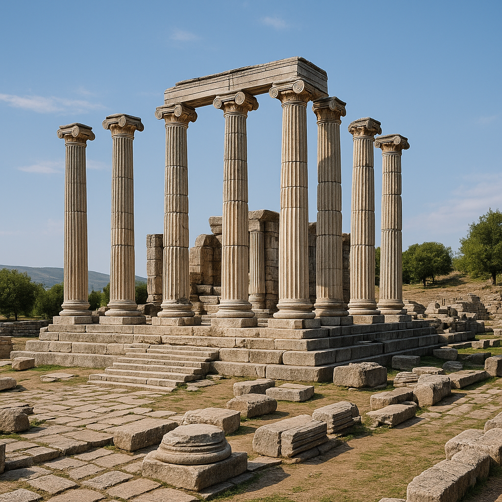
Oldest Greek temple in Asia Minor: The temple on the acropolis, probably dedicated to Apollo, dates to the 7th or 6th century BC and is considered by some scholars to be the earliest known example of a Greek temple in the territory of Asia Minor. This makes it a critical reference point for studying the development of Greek sacred architecture in the eastern Aegean and the process by which Greek colonists adapted their religious building traditions to Anatolian landscapes.
-
Exceptionally preserved fortification circuit: The 3.2 km wall circuit, built of local granite ashlar blocks approximately 3 meters thick, with at least 11 towers, survives remarkably well. Because the site was abandoned in the early Hellenistic period and never reoccupied, the walls were not robbed for building material to the degree typical of continuously inhabited cities. They stand as one of the most complete examples of Classical-era Greek military architecture in western Anatolia.
-
Frozen urban plan: Neandria's abrupt abandonment around 310 BC means its rectangular grid street plan -- with internal drainage systems, residential blocks, and public spaces -- was never modified by later construction. This provides archaeologists with an unusually clear view of a Classical-era Greek city layout in the Troad, uncontaminated by later building phases.
-
Synoecism case study: The forced relocation of Neandria's population to Alexandria Troas by Antigonus I Monophthalmus around 310 BC is one of the best-documented examples of synoecism (the merging of smaller communities into a new city) in the Hellenistic world. The earliest coins of Alexandria Troas adopted Neandria's grazing horse emblem, preserving the older city's identity in numismatic form -- a poignant symbol of cultural continuity despite political erasure.
-
Panoramic landscape archaeology: The mountaintop location offers extraordinary 360-degree views over the western Troad, the Scamander valley, and the Aegean coast. The site demonstrates how ancient communities chose defensible high-ground positions and how geography shaped urban strategy in the colonial Greek world.
-
Sacred landscape with multiple sanctuaries: Rock-cut inscriptions discovered approximately 1 km from the city's main gate, tentatively dated to the Classical period, attest a sacred grove of Zeus. Additional inscriptions near Cigri Dag indicate the existence of a temple of Dionysus in the city's territory. Combined with the Apollo temple on the acropolis, this evidence reveals a rich polytheistic sacred landscape rarely documented for smaller Troad cities.
Geography and Setting
Neandria occupies the summit and upper slopes of Cigri Dag, a granite mountain rising approximately 500 meters above the surrounding terrain. The site is located approximately 9 km east of Alexandria Troas and 15 km southwest of Ezine, near the villages of Yahyacavus and Kayacik.
Key geographic features:
- Elevation: At approximately 500 meters, Neandria commanded sweeping views over the Scamander (Karamenderes) valley to the north and east, the Aegean coast to the west, and the island of Lesbos (Midilli) on clear days. This height provided both defensive advantage and visual control of a vast territory -- from the peak, approaching enemies, merchant caravans, or naval fleets could be spotted hours before reaching the city.
- Granite geology: The mountain is composed of granite, which provided the primary building material for the city's fortification walls. The local stone's exceptional durability accounts for the excellent preservation of the walls after more than 2,300 years of exposure to the elements. Unlike softer limestone or tuff, granite resists weathering and does not crumble easily.
- Steep approaches: The mountain's sides are steep and difficult to climb on most sides, creating natural defenses supplemented by the constructed walls. Only the western slope offers a relatively gentle approach, which is where the main gate was positioned.
- Water supply: At this elevation, water supply was a significant challenge. Archaeological evidence of cisterns and possibly channeled rainwater collection systems has been noted. The presence of large cisterns cut into bedrock suggests organized communal water management -- essential for sustaining a population estimated at 2,500 people.
- Regional context: Neandria sits within the broader Troad region, surrounded by other ancient cities including Troy (to the north), Alexandria Troas (to the west), Assos (to the south), and the Apollo Smintheus temple at Gulpinar. This network of cities shared cultural, commercial, and political ties, and their relative proximity created both competition and collaboration.
- Vegetation: The mountain and its surroundings support Mediterranean scrubland (maquis), pine forests, and seasonal wildflowers. The terrain is particularly scenic in spring (April--May) when the hillsides are covered in wildflowers and the distant Aegean shimmers through clear air.
Historical Timeline
Archaic Period: Foundation and Early Growth (c. 700--480 BC)
Neandria was founded as an Aeolian Greek colony, probably around 700 BC or earlier. The name derives from the Greek root Neandros, meaning "young man's land" or "land of the brave" -- perhaps reflecting the pioneering spirit of the colonists who settled this demanding mountain terrain. Archaeological remains from the earliest phase include:
- Burials dating to the 7th century BC in the vicinity of the settlement, providing evidence of the founding generation
- The construction of the Temple of Apollo on the acropolis -- possibly the oldest Greek temple in Asia Minor, with a simple plan featuring stone foundations and mud-brick or stone upper walls
- Early fortification walls at the western end of the site, protecting the most vulnerable approach
- An agora and stoa complex in the civic center, demonstrating organized public life from an early date
Inscriptions from the 6th century BC confirm that the city spoke the Aeolic Greek dialect, consistent with literary sources (including the Periplus of Pseudo-Scylax, a 4th-century BC sailing manual) that describe Neandria as ethnically Aeolian. This linguistic identity connected Neandria culturally to the island of Lesbos and the Aeolian coastal cities, distinguishing it from the Ionian settlements further south.
Classical Period: Delian League and Persian Control (480--330 BC)
During the 5th century BC, Neandria was a member of the Delian League (the Athenian-led alliance against Persia) and appears in the Athenian tribute lists as part of the Hellespontine district, paying tribute of approximately 2,000 drachmas -- indicating it was a city of moderate size and resources, neither insignificant nor among the wealthiest.
In the late 5th and early 4th centuries BC, Neandria came under the control of Zenis and Mania of Dardanus, who served as administrators for the Persian satrap Pharnabazus. Mania, notably, was one of the few known women to hold administrative power in the Persian satrapal system, governing the Troad on behalf of the satrap until she was assassinated by her son-in-law. The city was subsequently liberated by the Spartan commander Dercylidas during his campaigns against Persian influence in the Troad around 399 BC.
During the 4th century BC, the major fortification walls were constructed or substantially rebuilt in their current form: a 3.2 km circuit of granite ashlar walls, approximately 3 meters thick, with at least 11 towers. The enclosed area was roughly 40 hectares, and the city's population is estimated at approximately 2,500 inhabitants -- a substantial community for a mountaintop settlement.
Hellenistic Period: Synoecism and Abandonment (c. 310 BC)
Around 310 BC, Antigonus I Monophthalmus -- one of Alexander the Great's successor generals -- founded a new coastal city called Antigonia Troas (later renamed Alexandria Troas by Lysimachus after the Battle of Ipsus in 301 BC). To populate this new city, Antigonus ordered the synoecism (forced consolidation) of several surrounding communities, including Neandria, Hamaxitus, Kebren, Larisa, and Kolonai.
The inhabitants of Neandria were relocated entirely to the new city on the coast. From this point, Neandria ceased to exist as an independent polis. The earliest coins of Alexandria Troas adopted Neandria's grazing horse coin type, symbolically preserving the older community's identity -- a numismatic echo of a city that no longer existed.
This abrupt abandonment meant the city was essentially "frozen" in its 4th-century BC state -- never rebuilt, never significantly quarried, never overbuilt. For archaeologists, this is an extraordinary circumstance: the equivalent of finding a time capsule of Classical Greek urban life.
Post-Abandonment (310 BC -- present)
After abandonment, Neandria's ruins were gradually covered by vegetation and soil. The granite walls, however, proved remarkably resistant to deterioration, and substantial stretches remain visible today, standing in some places to heights of 2--3 meters. The site was rediscovered by Western scholars in the 19th century and has remained largely undisturbed, though concerns about nearby mining operations in the Kaz Daglari (Mount Ida) region have raised preservation alarms.
Major Monuments
Temple of Apollo (Archaic Period)
Located on the acropolis at the highest point of the settlement:
- Date: 7th or 6th century BC -- among the earliest Greek temples known in Anatolia
- Significance: Potentially the oldest known Greek temple in Asia Minor. The temple was built in a simple plan with a stone foundation and mud-brick or stone upper walls, reflecting the earliest stages of Greek monumental religious architecture
- Dedication: Probably to Apollo, based on regional cult patterns and limited inscriptional evidence. Apollo was a major deity across the Aeolian world, and his cult at Neandria connects to the broader network of Apollo sanctuaries in the Troad, including the famous temple at Chryse and the Smintheum at Gulpinar
- Current state: Foundation walls and scattered architectural elements are visible on the acropolis summit. The foundations allow visitors to trace the temple's ground plan
- Archaeological significance: Robert Koldewey's excavation of this temple in 1889 contributed to early scholarly understanding of the development of Greek temple architecture, particularly the transition from wooden to stone construction
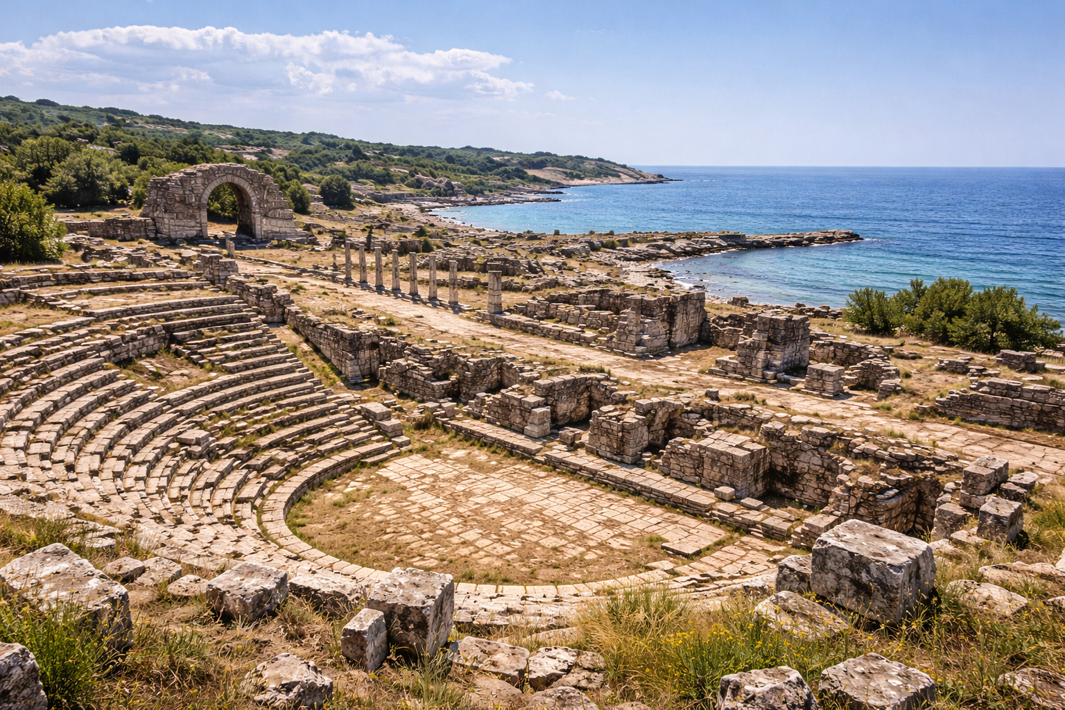
Fortification Walls
The most visually impressive feature of the site:
- Length: Approximately 3.2 km total circuit -- one of the most extensive wall circuits of any Classical-era city in the Troad
- Thickness: Approximately 3 meters, sufficient to withstand siege engines of the period
- Material: Local granite ashlar blocks -- large, carefully squared stones laid in regular courses. The blocks were quarried on-site from the mountain's native granite, reducing transportation costs
- Towers: At least 11 defensive towers at regular intervals along the wall circuit, providing flanking fire against attackers
- Gates: Multiple gates, including a principal entrance on the gentler western slope, designed with defensive chicanes to prevent direct assault
- Date: Primarily 4th century BC, possibly with earlier phases dating to the Archaic period
- Preservation: Among the best-preserved ancient fortification circuits in the Troad, thanks to the city's abandonment and the extraordinary durability of granite. Some wall sections stand 2--3 meters high after more than 2,300 years
Agora and Stoa
The civic center of the city, located on a relatively flat terrace:
- Includes the foundations of a stoa (columned portico) defining the public marketplace
- The agora served as the commercial, political, and social heart of the polis -- the space where citizens gathered for trade, debate, legal proceedings, and civic ritual
- The stoa's foundations suggest a substantial building, indicating that even this remote mountain city invested significantly in public architecture
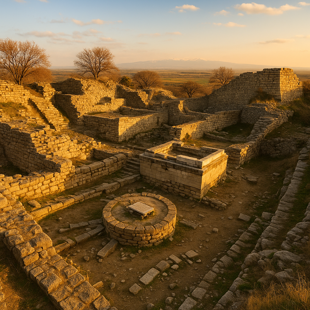
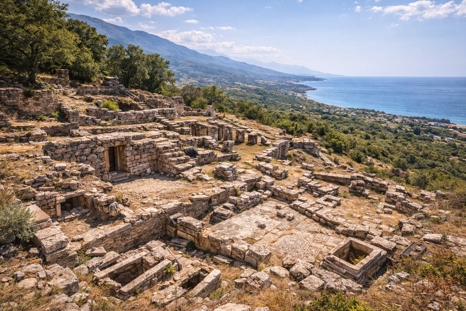
Residential Quarter and Grid Plan
The urban area within the walls was organized on a rectangular grid pattern:
- Streets intersected at approximately right angles, creating orderly residential blocks
- Residential blocks (insulae) were of relatively uniform size, suggesting planned development rather than organic growth
- An internal drainage system channeled rainwater through the street grid -- essential for a hilltop settlement with limited natural water supply
- A possible small theater or stepped assembly area has been identified, though its function remains debated
- The grid plan indicates sophisticated urban planning typical of Greek cities from the 5th--4th centuries BC, comparable to the Hippodamian tradition
Urban Planning and Grid Layout
Neandria's urban plan is one of its most important archaeological features. The rectangular grid layout -- sometimes called a Hippodamian plan after the famous Greek urban theorist Hippodamus of Miletus -- demonstrates that even mountain-top cities in the Troad adopted organized urban planning principles rather than allowing haphazard development.
Key features of the grid:
- Street width: Main streets were approximately 4--5 meters wide, sufficient for wheeled traffic and market activity
- Block dimensions: Residential blocks followed a regular module, with individual house plots of standardized size
- Orientation: The grid was adapted to the mountain's topography, with streets following the natural contours where necessary while maintaining overall geometric regularity
- Drainage: Stone-lined drainage channels ran along streets, collecting and directing rainwater to cisterns -- essential for a hilltop settlement with limited natural water supply and no access to river water
- Public-private division: The agora and temple were positioned on the best terrain, with residential areas filling the surrounding blocks in a clearly hierarchical spatial arrangement
- Defensive integration: The grid was designed to work with the fortification circuit, with streets providing efficient movement routes for defenders responding to threats at different sections of the wall
The preservation of this layout, unmodified by later construction, makes Neandria an invaluable case study for understanding Greek urban planning in the colonial context. It provides a snapshot of how a relatively small Greek community organized its physical space according to rational principles -- even in an extremely challenging topographic setting.
Religious Life and Sacred Landscapes
Beyond the Temple of Apollo on the acropolis, Neandria's religious landscape was richer than the city's small size might suggest:
Sacred Grove of Zeus
Rock-cut inscriptions discovered approximately 1 km from the city's main gate, tentatively dated to the Classical period, attest the existence of a sacred grove (temenos) dedicated to Zeus. Such groves were important features of Greek religious life, serving as open-air sanctuaries where rituals, prayers, and animal sacrifices were conducted under the canopy of sacred trees. The location of this grove outside the city walls but within the city's territory follows the common Greek practice of positioning Zeus sanctuaries on high ground or in natural settings of particular beauty or awe.
Temple of Dionysus
Additional inscriptions found near Cigri Dag indicate the existence of a temple of Dionysus within the city's territory. Dionysus, the god of wine, ecstasy, and theatrical performance, was widely worshipped throughout the Aegean world. His cult at Neandria connects the city to broader Aeolian and Anatolian religious networks. The temple's precise location has not been identified through excavation.
Apollo at the Acropolis
The acropolis temple, dedicated to Apollo, occupied the most prominent position in the city. Apollo was associated with light, prophecy, music, and the protection of colonists -- making him a natural patron for a Greek colonial settlement. His cult at Neandria connects to the dense network of Apollo sanctuaries across the Troad, including the Smintheum at Gulpinar and the temple at Chryse.
Together, these sanctuaries reveal a community that maintained a diverse religious life despite its remote mountain location, honoring Zeus, Apollo, and Dionysus in distinct sacred spaces distributed across the urban and peri-urban landscape.
Archaeological Work
Frank Calvert (1865)
The pioneering archaeologist Frank Calvert -- who also first identified Troy at Hisarlik -- was the first Western scholar to identify the ruins on Cigri Dag as Neandria in 1865. Calvert's identification was based on his knowledge of ancient literary sources and his extensive survey work across the Troad. His contribution to Troad archaeology extends far beyond Troy.
Joseph Thacher Clarke (1886)
American archaeologist Joseph Thacher Clarke further documented the site in 1886, recording surface remains and the fortification circuit in more detail than Calvert's initial identification. Clarke's notes provided valuable baseline documentation for later researchers.
Robert Koldewey (1889)
The German architect and archaeologist Robert Koldewey -- later famous for his excavation of Babylon in Mesopotamia -- conducted the first systematic excavation of Neandria in 1889. Koldewey's work was remarkably thorough for its era:
- Documented the complete wall circuit and tower positions with precise measurements
- Excavated the Temple of Apollo on the acropolis, revealing its Archaic-period foundations and establishing its potential significance as one of the earliest Greek temples in Anatolia
- Recorded the street grid and residential areas, providing the first evidence of organized urban planning at the site
- Published detailed architectural drawings that remain valuable references for scholars more than a century later
- Identified the agora and stoa complex
Koldewey's excavation of the Archaic temple was particularly significant, as it contributed to early scholarly understanding of the development of Greek temple architecture -- specifically the transition from timber construction to stone, and the evolution of the temple ground plan.
Later Research (20th--21st century)
Subsequent survey work and archaeological research have continued to refine understanding of the site's chronology and urban layout. The discovery of the rock-cut inscriptions attesting the sacred grove of Zeus and the temple of Dionysus has enriched understanding of Neandria's religious landscape. The Turkish government has designated the area as a protected archaeological zone. However, concerns have been raised about the potential impact of mining operations in the Kaz Daglari (Mount Ida) region near the site -- a controversy that has drawn attention from both environmentalists and cultural heritage advocates.
Visitor Information
Getting There
- From Ezine: Approximately 15 km southwest. Take the road toward Kayacik/Yahyacavus villages, then follow unpaved tracks up the mountain. A vehicle with good clearance is recommended for the final approach.
- From Alexandria Troas: Approximately 9 km east. The two sites can be combined in a day trip for a mountain-and-coast experience of the Troad.
- From Canakkale: Approximately 65 km, about 1.5 hours by car. Consider combining with visits to Troy (on the way) and Alexandria Troas.
Important: The final approach to the summit involves unpaved roads and potentially steep terrain. Check road conditions locally, especially after rain. In winter, snow may make the upper portions impassable.
Hours and Admission
- Neandria is an open-air archaeological site without formal gate hours or admission fees.
- There is no ticket office, visitor center, or on-site facilities of any kind.
- Visit during daylight hours. Allow time for the climb/drive to the summit and the walk around the site.
Time Required
- Minimum: 1.5--2 hours (main wall circuit and acropolis temple)
- Recommended: 3--4 hours (full exploration including residential areas, all accessible wall sections, and panoramic viewpoints)
- Combined visit: Pair with Alexandria Troas (9 km west) for a full-day Troad mountain-and-coast experience. Adding the Apollo Smintheus Temple at Gulpinar makes a comprehensive Troad day.
Best Seasons
- Spring (April--May): Ideal -- wildflowers carpet the hillsides, mild temperatures, clear views reaching to Lesbos. The mountain is at its most scenic and photogenic.
- Autumn (September--October): Excellent conditions, comfortable hiking weather, golden light
- Summer: Very hot and exposed at this elevation with minimal shade. Bring ample water and sun protection. Early morning visits strongly recommended to avoid peak heat.
- Winter: Can be cold, windy, and potentially foggy or snowy. However, clear winter days offer extraordinary views with snowcapped peaks in the distance. Check access roads before attempting the drive.
Practical Tips
- Footwear: Sturdy hiking boots are essential. The terrain is rocky, uneven, and involves climbing over ancient wall remains and navigating loose granite rubble.
- Water and food: Bring everything you need. There are no facilities on the mountain -- no water, no shade structures, no vendors.
- Navigation: GPS coordinates or a downloaded offline map is helpful, as the site is not well signposted from the main road. The ruins can be difficult to locate without prior research.
- Photography: The panoramic views from the summit are spectacular in all directions. Bring a wide-angle lens for landscapes and a telephoto for architectural details. The golden hour (early morning or late afternoon) provides the best light for photographing the granite walls against the sky.
- Physical fitness: The site is at 500 meters elevation with uneven, rocky terrain. A moderate level of fitness is helpful. The walk from where vehicles must be parked to the upper ruins can be demanding.
- Respect the site: Do not remove stones or artifacts. Stay on visible paths where possible. The granite walls have survived 2,300 years -- help them survive many more.
- Combine intelligently: Neandria pairs naturally with Alexandria Troas (accessible coastal plain below) and the Apollo Smintheus Temple at Gulpinar for a comprehensive Troad day that shows the range of Greek settlement strategies -- mountain fortress, coastal metropolis, and rural sanctuary.
Frequently Asked Questions
What does "Neandria" mean?
The name comes from the Greek Neandros, meaning "young man's land" or "land of the brave/youthful." It may reflect the city's identity as a settlement of vigorous, pioneering colonists who chose a challenging but defensible mountain location.
Why was the city built on a mountaintop?
Defensive strategy was the primary reason. The steep slopes of Cigri Dag provided natural protection on most sides, supplemented by the constructed walls on all approaches. The commanding views allowed early detection of approaching threats from any direction. High-ground settlements were common among Aeolian Greeks in the Troad, reflecting the security concerns of colonial communities in potentially hostile territory.
Why was Neandria abandoned?
Around 310 BC, the Hellenistic general Antigonus I Monophthalmus forcibly relocated Neandria's population to his new coastal city, Antigonia Troas (later Alexandria Troas). This process, called synoecism, was a common Hellenistic practice for consolidating power and creating larger, more viable urban centers. The move transferred the mountain population to a coastal city with superior harbor access and commercial potential, but it extinguished Neandria as an independent community.
Is the oldest Greek temple in Asia Minor really here?
The temple on Neandria's acropolis, dated to the 7th or 6th century BC, is considered by some scholars to be among the earliest known Greek temples in Anatolia. While dating is debated and other early temple sites exist (including Ephesus and Didyma), Neandria's temple is a critically important example because of its early date, its position in the Aeolian colonial world, and its excavation by Koldewey.
What happened to Neandria's population?
They were forcibly moved to Alexandria Troas around 310 BC. The new city preserved some of Neandria's identity through the adoption of its grazing horse coin type, but the mountain community's independent political existence ended permanently.
Can I drive to the top?
Partially. You can drive most of the way on unpaved roads, but the final portion may require walking depending on road conditions and your vehicle. A 4x4 or high-clearance vehicle is strongly recommended. After heavy rain, the upper tracks may become impassable even for off-road vehicles.
Is Neandria suitable for children?
The site requires significant physical effort (climbing, rocky terrain) and has no facilities whatsoever. It is best suited for older children (12+) and adults with hiking experience. The adventure and spectacular views, however, make it highly rewarding for those who are prepared. Bring extra water and snacks.
Is there any connection between Neandria and the Neanderthals?
No. The name "Neanderthal" derives from the Neander Valley (Neanderthal) in Germany, where the first Neanderthal fossils were found. The coincidence of "Neander" in both names is simply due to the common Greek root neo-aner (new man). There is no archaeological or historical connection between the two.
Architectural Measurements and Key Figures
| Feature | Measurement / Detail |
|---|---|
| Fortification wall circuit | 3.2 km total length |
| Wall thickness | 2.9 m (granite ashlar blocks) |
| Enclosed area | approximately 40 hectares |
| Defensive towers | at least 11 along the circuit |
| Wall construction date | Late 5th or early 4th century BC |
| Estimated population | approximately 2,500 inhabitants |
| Summit elevation | approximately 500 m above sea level |
| Temple altar foundations | 4.8 x 4.1 m |
| Main street width | 4--5 m |
| Distance to Alexandria Troas | approximately 9 km |
Numismatic Evidence
Neandria's coinage provides a compact but important record of the city's economic activity during its final century of independent existence (c. 430--310 BC). All known Neandria coins are struck in silver, with no bronze or gold issues recorded.
Coin Denominations and Weights
| Denomination | Period | Weight | Diameter | Obverse | Reverse |
|---|---|---|---|---|---|
| Hemidrachm (Triobol) | c. 400--310 BC | 1.85 g | 11.5 mm | Laureate head of Apollo right | Grazing horse right, within incuse square |
| Obol | 4th century BC | 0.50--0.53 g | 9 mm | Laureate head of Apollo right | Ram standing right |
| Hemiobol | c. 400--310 BC | 0.39 g | 8 mm | Head of Apollo | Ram or horse device |
The two principal reverse types -- the grazing horse and the standing ram -- divide neatly by denomination: the horse appears on the larger hemidrachm issues, while the ram is reserved for the smaller obols and hemiobols. This consistent pairing suggests a deliberate civic iconographic program in which the horse symbolized the city's identity at a higher economic level (trade and external commerce), while the ram may have reflected the pastoral economy of the mountain settlement.
The Grazing Horse as Civic Emblem
The grazing horse of Neandria became the city's most enduring legacy after its abandonment. When Antigonus I Monophthalmus founded Alexandria Troas around 310 BC and relocated Neandria's population, the earliest coins of the new city adopted the grazing horse motif directly from Neandria's coinage. This numismatic inheritance is one of the clearest documented examples of civic identity transfer through coinage in the Hellenistic world. The horse type persisted on Alexandria Troas coins for several generations, long after the memory of Neandria itself had faded.
The Temple of Apollo: Architectural Significance
Robert Koldewey's 1889 excavation of the acropolis temple was foundational for the study of early Greek sacred architecture in Asia Minor. Key architectural details from his findings include:
- Altar foundations: The stone altar base, measuring 4.8 x 4.1 meters, was positioned east of the temple proper, following standard Greek orientation practice
- Capitals: Koldewey recovered and reconstructed several capitals whose elements vary from example to example, suggesting experimental craftsmanship during this early phase of Greek monumental architecture. These capitals are now housed in the Istanbul Archaeological Museum
- Construction technique: The temple combined stone foundations with mud-brick or stone upper walls -- a transitional building method characteristic of the late 7th to early 6th century BC, before the full adoption of all-stone construction in Greek temple architecture
- Proto-Aeolic elements: The capital forms show connections to the broader Aeolic architectural tradition, linking Neandria to the stylistic world of Lesbos and the Aeolian coast
Koldewey published his findings in the 51st Winckelmannsprogramm of the Archaeological Society of Berlin (1891), a monograph titled simply Neandria. This publication, with its precise architectural drawings and measured plans, remains the primary scholarly reference for the temple and established Koldewey's reputation as a meticulous field documentarian years before his famous excavation of Babylon (1899--1917).
Delian League Membership and Tribute Assessment
Neandria's appearance in the Athenian Tribute Lists (ATL) places it within the Hellespontine district of the Delian League. The city's assessed tribute of approximately 2,000 drachmas (one-third of a talent) positioned it as a mid-ranking member -- significantly smaller than the neighboring Troad cities of Lampsacus (12 talents) or Abydos (4--6 talents), but comparable to other mountain or inland communities of the region.
For context, the tribute scale reveals the relative economic standing of Troad cities within the League:
| City | Approximate Annual Tribute |
|---|---|
| Lampsacus | 12 talents |
| Abydos | 4--6 talents |
| Kebren | 4 talents |
| Neandria | approximately 2,000 drachmas (0.33 talent) |
| Hamaxitus | unknown (small) |
This relatively modest assessment reflects the economic limitations of a mountaintop settlement with no direct harbor access, limited agricultural land, and a small population. Nevertheless, League membership brought Neandria into the Athenian political orbit and connected it to the broader network of allied Greek cities in the northeastern Aegean.
Sources and Further Reading
- Wikipedia -- Neandreia https://en.wikipedia.org/wiki/Neandreia
- Turkish Archaeological News -- Neandria https://turkisharchaeonews.net/site/neandria
- ToposText -- Neandria (Troad) https://topostext.org/place/397263UNea
- Greek Travel Pages -- Neandria https://www.gtp.gr/LocInfo.asp?InfoId=49&Code=ETRPTS00EZNEZN00061
- Cultural Inventory -- Neandria https://kulturenvanteri.com/en/yer/neandria/
- Archiqoo -- Neandreia https://archiqoo.com/locations/neandreia.php
- Vici.org -- Neandreia https://vici.org/vici/23573/
- CoinWeek -- Coins of Ancient Greek Troas Part 3 https://coinweek.com/ancient-coins/coins-of-ancient-greek-troas-troad-part-3/
- Pleiades Gazetteer -- Neandreia https://pleiades.stoa.org/places/550772