نظرة شاملة موسّعة: أينوس، إنيز الحديثة، هي إحدى أكثر البلدات الطبقية تاريخيًا في تراقيا التركية — مدينة قديمة تقع عند مصب نهر هيبروس (ميريتش / إيفروس) حيث يصب في بحر إيجة. تقع في محافظة أدرنة بالقرب من الحدود اليونانية، كانت أينوس ميناء تجاري مزدهر من الحقبة الكالكوليتية (الألفية 4-3 ق.م) حتى العصر العثماني. تحافظ المدينة على بقايا رائعة بما في ذلك أسوار التحصينات الهلنستية والرومانية، وقلعة بيزنطية قوية معززة من قبل الإمبراطور يوستينيان الأول، وبازيليكا مسيحية مبكرة، ومسجد عثماني، وآثار لما كان يومًا أحد أهم الموانئ على ساحل شمال بحر إيجة. بصفتها عاصمة المقاطعة الرومانية المتأخرة لـرودوب وأبرشية مسيحية مبكرة مهمة، لعبت أينوس دورًا مهمًا في التاريخ الديني والسياسي للإمبراطورية البيزنطية.
جدول المحتويات
- لماذا تُعدّ أينوس مهمة
- الجغرافيا والموقع
- الخط الزمني التاريخي
- الأصول الكالكوليتية والعصر البرونزي
- الاستعمار اليوناني
- أينوس الكلاسيكية والهلنستية
- أينوس الرومانية
- أسوار التحصينات
- القلعة البيزنطية
- تحصينات يوستينيان
- عاصمة مقاطعة رودوب
- الأبرشية والمسيحية المبكرة
- الميناء والتجارة البحرية
- اتصال فيا إغناتيا
- أينوس في الحملات الصليبية والحقبة اللاتينية
- إنيز العثمانية
- مسجد الفاتح والآثار العثمانية
- دلتا نهر ميريتش
- البحث الأثري
- كيفية زيارة إنيز
- الأسئلة الشائعة
- المصادر
لماذا تُعدّ أينوس مهمة
أينوس/إنيز مهمة لعدة أسباب:
- أكثر من 6000 عام من السكن: من المستوطنات الكالكوليتية (الألفية 4 ق.م) حتى الحقبة العثمانية — أحد أطول المواقع المأهولة باستمرار في تراقيا
- ميناء عند مصب النهر: جعل الموقع الاستراتيجي عند مصب نهر هيبروس — أحد أعظم أنهار البلقان — أينوس مركزًا تجاريًا حاسمًا بين العالم الإيجي والداخل التراقي
- قلعة يوستينيان: عزز الإمبراطور يوستينيان الأول (527-565) التحصينات، مما جعل أينوس أحد المواقع الدفاعية البيزنطية الرئيسية على شمال بحر إيجة
- عاصمة رودوب: في إعادة التنظيم الإداري الروماني المتأخر، أصبحت أينوس عاصمة مقاطعة رودوب — دور سياسي مهم
- أبرشية مسيحية مبكرة: مركز مهم للمسيحية المبكرة في تراقيا، مع بازيليكا متعددة وأبرشية مؤكدة من القرن الرابع
- الأراضي الرطبة لدلتا ميريتش: دلتا نهر ميريتش/إيفروس المحيطة بإنيز هي إحدى أهم النظم البيئية للأراضي الرطبة في تركيا وموطن رئيسي للطيور
- أجواء بلدة حدودية: بصفتها إحدى أكثر بلدات تركيا بُعدًا، بالقرب من الحدود اليونانية، تتمتع إنيز بأجواء فريدة من العزلة والعمق التاريخي
الجغرافيا والموقع
تحتل أينوس موقعًا قياديًا عند ملتقى النهر والبحر.
الموقع:
- بلدة إنيز، محافظة أدرنة، تراقيا التركية
- عند مصب نهر ميريتش (هيبروس القديم / إيفروس باليونانية)
- على ساحل شمال شرق بحر إيجة
- على بعد نحو 60 km جنوب أدرنة
- قريبة من الحدود التركية اليونانية (نهر ميريتش/إيفروس يشكل الحدود)
- في الطرف الغربي لخليج ساروس
المناظر الطبيعية:
- رأس صخري منخفض يطل على مصب النهر وبحر إيجة
- دلتا نهر ميريتش — أراضٍ رطبة شاسعة وبحيرات وكثبان رملية — تمتد حول البلدة
- الدلتا هي إحدى أهم النظم البيئية للأراضي الرطبة في جنوب شرق أوروبا
- سهول زراعية مسطحة تمتد إلى الداخل نحو أدرنة
- الجزيرة اليونانية ساموثراكي مرئية في الأيام الصافية من ساحل إنيز
- قليلة السكان — تتمتع إنيز بطابع بلدة حدودية نائية
المناخ:
- متأثر بالمتوسط مع عناصر قارية
- صيف حار وجاف، شتاء بارد، أحيانًا ثلجي
- رياح قوية من بحر إيجة، خاصة في الصيف (الرياح الإيتيسية)
- تخلق الأراضي الرطبة للدلتا مناخًا دقيقًا فريدًا
الخط الزمني التاريخي
| الحقبة | التاريخ | الأحداث الرئيسية |
|---|---|---|
| الكالكوليتي | نحو 4000-3000 ق.م | الاستيطان المبكر؛ أدلة على السكن في العصر النحاسي |
| العصر البرونزي | نحو 3000-1200 ق.م | الاستيطان التراقي؛ الروابط التجارية |
| الاستعمار اليوناني | القرن 7 ق.م | تأسيس مستعمرة يونانية إيوليانية (تقليديًا من قبل مستوطنين من ليسبوس/سايمي) |
| الكلاسيكية | القرن 5-4 ق.م | عضو في الرابطة الديلية؛ سك عملاتها الخاصة |
| الهلنستية | القرن 3-1 ق.م | تحت النفوذ المقدوني، ثم البطلمي، ثم الأتالي |
| الجمهورية الرومانية | القرن 2-1 ق.م | مدمجة في المقاطعة الرومانية لمقدونيا/تراقيا |
| الإمبراطورية الرومانية | القرن 1-4 م | ميناء مزدهر؛ عاصمة مقاطعة رودوب |
| يوستينيان الأول | 527-565 م | تعزيز التحصينات |
| البيزنطية | القرن 6-14 م | قلعة وأبرشية مهمة |
| الحملة الصليبية الرابعة | 1204 | استولى عليها الصليبيون اللاتينيون |
| الجنويون | القرن 13-14 م | مستعمرة تجارية جنوية |
| العثمانية | 1456 | غزاها محمد الثاني (الفاتح) |
| الحقبة العثمانية | القرن 15-20 م | إنيز — حامية وبلدة تجارية عثمانية |
| الجمهورية التركية | 1923-حتى الآن | بلدة حدودية في محافظة أدرنة |
الأصول الكالكوليتية والعصر البرونزي
تمتد أصول أينوس إلى ما قبل التاريخ.
الحقبة الكالكوليتية (نحو 4000-3000 ق.م):
- كشفت المسوحات الأثرية والحفريات المحدودة عن فخار كالكوليتي وبقايا استيطان بالقرب من إنيز
- كان الموقع عند مصب النهر جذابًا للاستيطان بالفعل — المياه العذبة والأسماك والتربة الخصبة للدلتا والوصول إلى الطرق البحرية
- ارتبطت مجتمعات العصر النحاسي في تراقيا بشبكات التبادل الأوسع في بحر إيجة والبلقان
العصر البرونزي (نحو 3000-1200 ق.م):
- استمر استيطان الموقع خلال العصر البرونزي
- سكن التراقيون المنطقة
- وفر نظام نهر هيبروس الوصول العميق إلى الداخل التراقي
- وصلت السلع التجارية من جزر بحر إيجة (بما في ذلك الأوبسيديان) إلى الموقع عبر الطرق البحرية
- تم التعرف على الموقع الاستراتيجي للميناء عند مصب النهر منذ أقدم الفترات
الاستعمار اليوناني
أسس المستعمرون اليونانيون أينوس كمدينة رسمية في القرن السابع ق.م.
التأسيس:
- تقليديًا أسسها المستعمرون اليونانيون الإيوليانيون من ليسبوس و/أو سايمي (في إيوليس، غرب الأناضول)
- يقال إن المؤسس الأسطوري كان أينوس (أو إينياس في بعض التقاليد)، يربط المدينة بدورة طروادة
- جذب المستعمرون موقع الميناء الاستراتيجي والإمكانات الزراعية الغنية للدلتا النهرية
التطور المبكر:
- تطورت المدينة اليونانية حول الميناء الطبيعي عند مصب النهر
- أُنشئت المؤسسات اليونانية — الجمعية والقضاة والمعابد
- سكّت المدينة عملاتها الخاصة منذ تاريخ مبكر — تتميز عملات أينوس برأس هرمس (إله التجارة) على الوجه الأمامي، مما يعكس الطابع التجاري للمدينة
- كان معبد هرمس من بين الأضرحة الرئيسية للمدينة
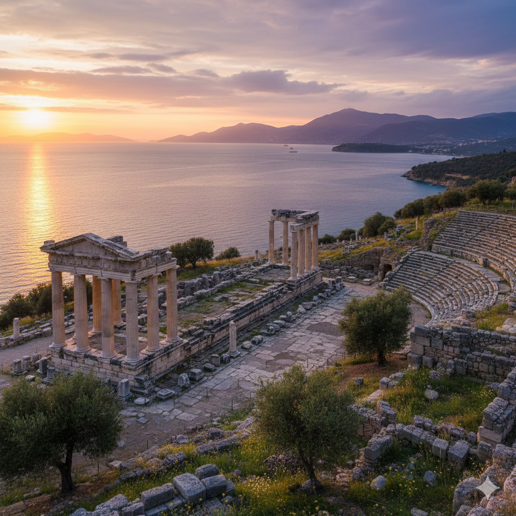
أينوس الكلاسيكية والهلنستية
في الحقبتين الكلاسيكية والهلنستية، كانت أينوس ميناءً مهمًا في شمال بحر إيجة.
الحقبة الكلاسيكية (القرن 5-4 ق.م):
- عضو في الرابطة الديلية — دفع الجزية لأثينا
- نشطة في تجارة الحبوب بين منطقة البحر الأسود وبحر إيجة
- ازدهرت المدينة من سيطرتها على مصب نهر هيبروس — مرت السلع من الداخل التراقي (الحبوب والمعادن والأخشاب والعبيد) عبر أينوس
- يذكر ثوكيديدس أينوس في سياق الحرب البيلوبونيزية
- حافظت المدينة على درجة من الاستقلال على الرغم من الضغط من الممالك التراقية وأثينا ومقدون
الحقبة الهلنستية (القرن 3-1 ق.م):
- بعد الإسكندر الأكبر، وقعت أينوس تحت نفوذ المملكة المقدونية
- كانت المدينة لفترة وجيزة تحت السيطرة البطلمية (احتفظ بطليموس الثاني بأجزاء من الساحل التراقي)
- لاحقًا، مارست المملكة الأتالية في بيرغامون النفوذ
- تم تعزيز جدران المدينة خلال هذه الفترة من القوى المتغيرة
- استمرت أينوس الهلنستية في الازدهار كميناء تجاري
أينوس الرومانية
تحت الحكم الروماني، وصلت أينوس إلى مستوى جديد من الازدهار والأهمية السياسية.
الدمج:
- أصبحت أينوس جزءًا من المقاطعة الرومانية تراقيا (تم تنظيمها رسميًا كمقاطعة عام 46 م)
- لاحقًا، في إعادة التنظيم الديوكليتياني (أواخر القرن 3-أوائل القرن 4)، أصبحت أينوس عاصمة المقاطعة المنشأة حديثًا رودوب
التطور في العصر الروماني:
- تم تحسين وتوسيع الميناء
- ربطت الطرق الرومانية أينوس بـفيا إغناتيا — الطريق السريع الشرق-غرب الكبير عبر البلقان
- شُيدت المباني العامة والحمامات والمعابد على الطراز الروماني
- نما سكان المدينة مع زيادة أهميتها التجارية
- تظهر النقوش اللاتينية إلى جانب اليونانية
الاقتصاد:
- تجارة الحبوب من الداخل التراقي
- الأسماك من النهر والدلتا (دلتا ميريتش لا تزال غنية بالأسماك اليوم)
- إنتاج النبيذ في المنطقة
- الأخشاب من الغابات التراقية
- التجارة العابرة بين بحر إيجة والبلقان
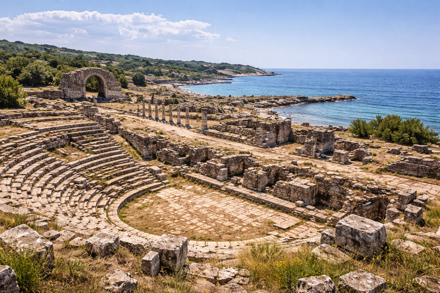
أسوار التحصينات
كانت أينوس محمية بـأسوار تحصينات كبيرة بُنيت وأُعيد بناؤها على مدى قرون عديدة.
الميزات:
- جدران تحيط بالرأس الصخري على الجانب البري
- وفر البحر والنهر دفاعًا طبيعيًا على الجوانب الأخرى
- مراحل بناء متعددة مرئية في البناء — من الحقب الهلنستية إلى البيزنطية
- الجدران الهلنستية: كتل حجرية منحوتة في مسارات منتظمة، مع أبراج على فترات
- الإصلاحات الرومانية: إضافات من الحطام والملاط تعزز الدائرة الهلنستية
- إعادة البناء البيزنطية: بما في ذلك برنامج إعادة بناء يوستينيان الرئيسي (القرن 6)
- لا تزال أقسام مثيرة للإعجاب من الجدران قائمة، خاصة على الجانبين الغربي والشمالي
الأهمية:
- تمثل أسوار التحصينات أحد أكثر الأنظمة الدفاعية اكتمالًا متعددة الفترات في تراقيا
- توضح الأهمية الاستراتيجية المستمرة للموقع على مدى ما يقرب من ألفي عام
- تشير جودة البناء، خاصة في المراحل الهلنستية واليوستينيانية، إلى الموارد المستثمرة في الدفاع عن هذا الميناء الحاسم
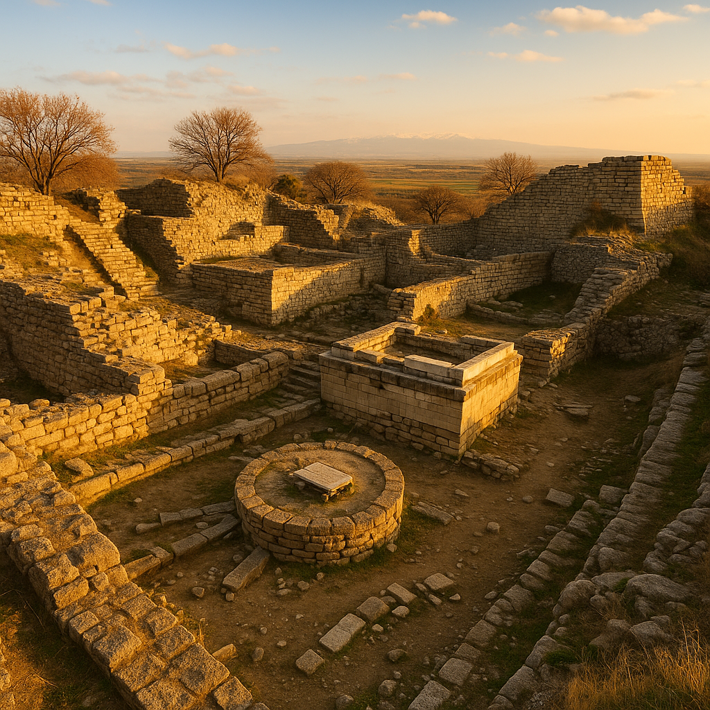
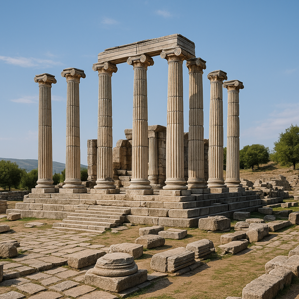
القلعة البيزنطية
القلعة البيزنطية في إنيز هي أبرز نصب في البلدة.
الميزات:
- حظيرة محصنة كبيرة تتوج الرأس الصخري
- جدران ضخمة بأبراج في نقاط استراتيجية
- قلعة داخلية (حصن) للدفاع كملاذ أخير
- تأمر القلعة المناظر على مصب النهر وساحل بحر إيجة والدلتا
- بوابات بمداخل منحنية لأغراض دفاعية
- صهاريج لتخزين المياه أثناء الحصار
تاريخ البناء:
- تتضمن القلعة بناء هلنستي وروماني سابق
- تعزيز كبير تحت يوستينيان الأول (القرن 6) — انظر أدناه
- المزيد من التعديلات خلال الحقب الصليبية والجنوية والعثمانية
- ظلت القلعة منشأة عسكرية عاملة طوال العصر العثماني
تحصينات يوستينيان
استثمر الإمبراطور يوستينيان الأول (527-565 م) بكثافة في تحصين أينوس كجزء من برنامج البناء الواسع عبر الإمبراطورية البيزنطية.
البرنامج:
- اعترف يوستينيان بأهمية أينوس الاستراتيجية — كانت تحرس مصب نهر هيبروس وساحل شمال بحر إيجة
- أمر بـإعادة بناء وتعزيز أسوار المدينة والقلعة
- يسجل بروكوبيوس، في المباني (De Aedificiis)، عمل تحصينات يوستينيان في تراقيا، رغم أن الوصف المحدد لأينوس موضع جدل
- استخدمت التحصينات اليوستينيانية تقنيات مميزة: جدران سميكة من قلب الحطام مع غطاء من الطوب والحجر، أبراج مستديرة ومربعة، وبوابات ضخمة
الأهمية:
- يهدف برنامج تحصين يوستينيان إلى حماية الإمبراطورية ضد الغارات البربرية (الآفار والسلاف والبلغار) التي هددت البلقان
- كانت أينوس، كميناء ونقطة عبور للنهر، حاسمة للتحكم في الوصول بين البلقان وبحر إيجة
- التحصينات اليوستينيانية من بين أفضل الأمثلة المحفوظة للعمارة العسكرية البيزنطية من القرن السادس في تراقيا
عاصمة مقاطعة رودوب
في إعادة التنظيم الإداري الروماني المتأخر، تمت ترقية أينوس إلى موقع عاصمة المقاطعة.
مقاطعة رودوب:
- أُنشئت خلال الإصلاحات الديوكليتيانية (أواخر القرن 3-أوائل القرن 4) عندما قُسمت المقاطعات الأكبر للإمبراطورية المبكرة
- غطت المقاطعة الجزء الجنوبي من تراقيا — من دلتا هيبروس إلى جبال رودوب
- سميت على اسم جبال رودوب التي شكلت حدودها الشمالية
- أصبحت أينوس (كأكبر ميناء وأكبر مدينة) العاصمة (ميتروبوليس)
ما يعنيه ذلك:
- استضافت أينوس حاكم المقاطعة وإدارته
- نُسق جمع الضرائب للمقاطعة من أينوس
- تم تعزيز البنية التحتية للمدينة لخدمة وظيفتها كعاصمة — المباني الحكومية والمحاكم والمساكن الرسمية
- جلبت مكانة عاصمة المقاطعة هيبة وسكانًا ونشاطًا اقتصاديًا متزايدًا
الأبرشية والمسيحية المبكرة
كانت أينوس مركزًا مهمًا للمسيحية المبكرة في تراقيا.
الأبرشية:
- الأبرشية مؤكدة في أينوس من القرن الرابع على أقل تقدير
- حضر أسقف أينوس مجامع الكنيسة الكبرى، بما في ذلك مجمع أفسس (431) ومجمع خلقيدونية (451)
- كانت الأبرشية تابعة لـمتروبوليت تراجانوبوليس (التي رُفعت لاحقًا)
- كان المجتمع المسيحي في أينوس كبيرًا — أهمية مكانة المدينة كعاصمة للمقاطعة عززت أهميتها الدينية
البازيليكا:
- تم تحديد العديد من البازيليكا المسيحية المبكرة في إنيز
- تشمل هذه البازيليكا الكبيرة ذات الثلاثة أجنحة بأرضيات فسيفسائية
- يعود تاريخ البازيليكا إلى القرنين 5-6 — العصر الذهبي لبناء المسيحية في الإمبراطورية البيزنطية
- بعض بقايا البازيليكا مرئية في وسط المدينة
الأهمية:
- تُظهر أبرشية أينوس التنصير المبكر والشامل لتراقيا
- يُظهر وجود الأساقفة في المجامع المسكونية الكبرى اندماج أينوس في التسلسل الهرمي الأوسع للكنيسة
- بقايا البازيليكا من بين أهم النصب المسيحية المبكرة في تراقيا التركية
الميناء والتجارة البحرية
كان ميناء أينوس أساس ازدهارها.
الميناء:
- يقع في المنطقة المحمية حيث التقى نهر هيبروس بحر إيجة
- وفر مصب النهر حماية طبيعية من عواصف بحر إيجة
- يمكن أن تسافر السفن صعودًا (إلى حد محدود) للوصول إلى الداخل التراقي
- خدم الميناء كل من السفن البحرية والقوارب النهرية
طرق التجارة:
- صعود النهر: الوصول إلى المنطقة الخلفية التراقية عبر هيبروس — الحبوب والمعادن والأخشاب والماشية
- بحر إيجة: الاتصال بالجزر اليونانية وغرب الأناضول والقسطنطينية وشرق البحر المتوسط
- البحر الأسود: عبر هيليسبونت (الدردنيل) والبروبونتيس (بحر مرمرة)
- برًا: الاتصال بفيا إغناتيا
السلع التجارية:
- الحبوب من السهول التراقية الخصبة
- الأسماك من النهر والدلتا
- النبيذ من كروم العنب المحلية
- الأخشاب والمعادن من جبال رودوب
- العبيد (كانت تراقيا مصدرًا رئيسيًا للمستعبدين في العصور القديمة)
- السلع الفاخرة العابرة بين الشرق والغرب
اتصال فيا إغناتيا
كانت أينوس متصلة بـفيا إغناتيا — الطريق السريع الروماني العظيم عبر البلقان.
فيا إغناتيا:
- بُنيت في القرن الثاني ق.م، امتدت فيا إغناتيا من ديراخيوم (دوريس، ألبانيا) على البحر الأدرياتيكي إلى بيزنطيون (القسطنطينية/إسطنبول) على البوسفور
- كانت الطريق السريع الشرق-غرب الأهم في البلقان الرومانية
- ربط طريق فرعي أينوس بالطريق السريع الرئيسي
الأهمية:
- دمج اتصال فيا إغناتيا أينوس في شبكة الطرق الرومانية
- استكملت التجارة البرية التجارة البحرية
- يمكن للقوات العسكرية الوصول إلى أينوس من المراكز الرئيسية في البلقان
- عززت شبكة الطرق دور أينوس كنقطة شحن بين الطرق البحرية والنهرية والبرية
أينوس في الحملات الصليبية والحقبة اللاتينية
جلبت الحملات الصليبية تغيرات دراماتيكية إلى أينوس.
الحملة الصليبية الرابعة (1204):
- عندما نهبت الحملة الصليبية الرابعة القسطنطينية وأسست الإمبراطورية اللاتينية، استولى الصليبيون على أينوس
- خُصصت المدينة لمختلف اللوردات اللاتينيين في تقسيم الإمبراطورية البيزنطية
- جعلت الأهمية الاستراتيجية للميناء جائزة قيمة
الحقبة الجنوية:
- أسست جمهورية جنوة مستعمرة تجارية في أينوس
- استخدم التجار الجنويون الميناء لشبكات تجارة البحر الأسود وبحر إيجة
- شُيدت الأبراج والمباني التجارية الجنوية
- استمر الوجود الجنوي حتى الفتح العثماني
التعافي البيزنطي:
- استعادت الإمبراطورية البيزنطية أينوس في القرن الرابع عشر
- ومع ذلك، كانت المدينة في تراجع — الميناء يتراكم فيه الطمي وانخفض عدد السكان
- دمر الموت الأسود (1347-1351) المدن التراقية بما في ذلك أينوس
إنيز العثمانية
غزت الإمبراطورية العثمانية إنيز عام 1456 خلال حملات السلطان محمد الثاني (الفاتح).
الفتح:
- محمد الثاني، طازج من فتح القسطنطينية (1453)، استوعب بشكل منهجي الممتلكات البيزنطية والجنوية المتبقية في تراقيا
- استسلمت إنيز دون حصار كبير
- زُودت القلعة بحامية من القوات العثمانية
الحقبة العثمانية:
- أصبحت إنيز حامية عثمانية وبلدة تجارية صغيرة
- تحول السكان من الأغلبية اليونانية المسيحية إلى مسلم-مسيحي مختلط
- شُيدت المساجد والحمامات والأسواق
- تراجع الميناء تدريجيًا مع تراكم الطمي في دلتا النهر، مما قلل من الأهمية التجارية لإنيز
- ومع ذلك، احتفظت البلدة بالأهمية العسكرية كمركز حدودي بالقرب من الحدود اليونانية
مسجد الفاتح والآثار العثمانية
أبرز نصب عثماني في إنيز هو مسجد الفاتح (Fatih Camii).
مسجد الفاتح:
- بُني في أواخر القرن الخامس عشر، على الأرجح من قبل أو تكريمًا للسلطان محمد الثاني (الفاتح — "الفاتح")
- مسجد متواضع لكن متناسب جيدًا نموذجي للعمارة الإقليمية العثمانية المبكرة
- قبة واحدة، بناء حجري، مئذنة
- قد يضم المسجد عناصر من كنيسة بيزنطية سابقة (ممارسة عثمانية شائعة في البلدات المفتوحة حديثًا)
آثار عثمانية أخرى:
- حمام عثماني — مدمر جزئيًا
- منازل ومباني تجارية من العصر العثماني في وسط البلدة
- نافورة مرممة (çeşme)
- تم الحفاظ على القلعة وتعديلها خلال الحقبة العثمانية
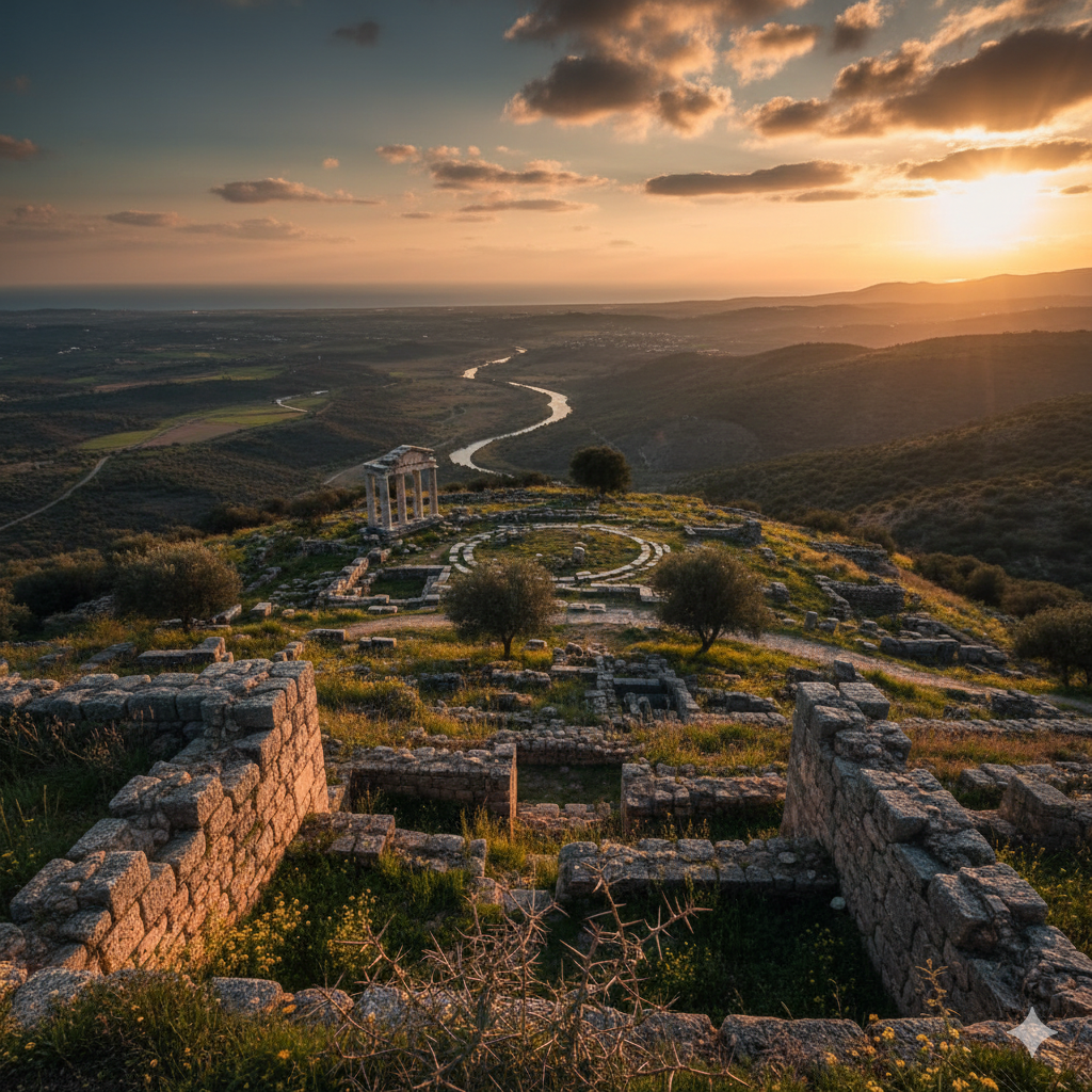
دلتا نهر ميريتش
دلتا ميريتش/إيفروس المحيطة بإنيز هي إحدى أهم المناطق الطبيعية في تركيا.
الدلتا:
- تشكلت من نهر ميريتش (هيبروس/إيفروس) عند تدفقه في بحر إيجة
- مجمع واسع من الأراضي الرطبة والبحيرات والمستنقعات والكثبان الرملية والمسطحات الملحية والمراعي
- مشتركة بين تركيا واليونان (النهر يشكل الحدود)
- معينة كـأرض رطبة ذات أهمية دولية بموجب اتفاقية رامسار
التنوع البيولوجي:
- أحد أهم موائل الطيور في أوروبا — أكثر من 300 نوع من الطيور مسجلة
- تشمل الأنواع الرئيسية النحام الوردي والبجع واللقالق البيضاء والنسور والعديد من الطيور المائية
- مهمة للطيور المهاجرة على مسار الطيران شرق إفريقيا-غرب آسيا
- تدعم الدلتا أيضًا مجتمعات متنوعة من الأسماك والبرمائيات والنباتات
للزوار:
- مراقبة الطيور هي جذب رئيسي — مواسم الهجرة في الربيع والخريف مجزية بشكل خاص
- جولات قارب الدلتا متاحة أحيانًا من إنيز
- مزيج من الأطلال القديمة والجمال الطبيعي يجعل إنيز وجهة فريدة من نوعها مزدوجة
البحث الأثري
كشف التحقيق الأثري في إنيز عن تاريخ الموقع الطويل.
البحث الرئيسي:
- وثقت المسوحات السطحية بقايا من الكالكوليتي إلى الحقب العثمانية
- كشف التنقيب المحدود داخل القلعة ووسط البلدة عن طبقات بيزنطية وأقدم
- تمت دراسة وتوثيق أسوار التحصينات من قبل العديد من فرق البحث
- حققت المسوحات تحت الماء في منطقة الميناء القديم
- تم التنقيب جزئيًا عن البازيليكا المسيحية المبكرة
التحديات:
- تتداخل بلدة إنيز الحديثة مع الكثير من الموقع القديم
- تقيد منطقة الحدود العسكرية الوصول إلى بعض المناطق
- التمويل المحدود قيد نطاق التنقيب
- ومع ذلك، حمى بُعد إنيز إياها من التطور الحديث على نطاق واسع
الإمكانات:
- تمتلك إنيز إمكانات أثرية كبيرة — منطقة الميناء، على وجه الخصوص، يمكن أن تقدم معلومات مهمة عن التجارة البحرية القديمة
- تستحق التحصينات متعددة الفترات دراسة معمارية أكثر تفصيلًا
- لا تزال مستويات الكالكوليتي والعصر البرونزي غير مستكشفة إلى حد كبير
كيفية زيارة إنيز
الوصول:
- من أدرنة: نحو 60 km جنوبًا (نحو ساعة)
- من إسطنبول: نحو 300 km (نحو 3.5-4 ساعات عبر الطريق السريع إلى كيشان، ثم الطرق المحلية)
- من كيشان: 45 km (نحو 40 دقيقة)
- من إبسالا (معبر حدودي): 40 km (نحو 35 دقيقة)
- لا توجد خدمة قطار؛ خدمة حافلات محدودة من كيشان وأدرنة
- يُنصح بسيارة مستأجرة للمرونة
الموقع:
- خصص 2-3 ساعات للبلدة والأطلال
- التوقفات الرئيسية: القلعة البيزنطية، الجدران الهلنستية/الرومانية، مسجد الفاتح، بقايا البازيليكا، إطلالات من القلعة على الدلتا
- القلعة هي النصب الرئيسي — يتطلب بعض التسلق
- المشي عبر البلدة القديمة لرؤية المباني من العصر العثماني
- استمر إلى الساحل والدلتا لمراقبة الطيور والوصول إلى الشاطئ
أفضل وقت للزيارة:
- الربيع (أبريل-مايو) مثالي — الزهور البرية، الطيور المهاجرة، درجات حرارة لطيفة
- الخريف (سبتمبر-أكتوبر) ممتاز أيضًا لمراقبة الطيور
- الصيف حار مع رياح قوية من بحر إيجة
- يمكن أن يكون الشتاء باردًا مع ثلوج عرضية
نصائح عملية:
- إنيز بلدة صغيرة وهادئة — أماكن إقامة محدودة (بضع نزل وفنادق بسيطة)
- مطاعم بسيطة تقدم الأسماك الطازجة والأطباق المحلية
- احضر معك المنظار لمراقبة الطيور في الدلتا
- الشواطئ بالقرب من إنيز غير مطورة في الغالب — احضر معك الإمدادات
- كن على دراية بمنطقة الحدود — قد يكون لبعض المناطق بالقرب من الحدود اليونانية قيود
- ادمج مع زيارات إلى أدرنة (مسجد سليمية) وشبه جزيرة غاليبولي
الأسئلة الشائعة
س: ما هو ارتباط أينوس بإينياس؟ ج: ربطت بعض التقاليد القديمة اسم المدينة بـإينياس، البطل الطروادي. في حين أن هذا الارتباط ميثولوجي على الأرجح وليس تاريخيًا، فقد وضع أينوس ضمن الجغرافيا الأسطورية الغنية لدورة حرب طروادة.
س: هل يمكن زيارة القلعة؟ ج: نعم. القلعة البيزنطية متاحة وتقدم إطلالات ممتازة على دلتا ميريتش وساحل بحر إيجة. يتطلب بعض التسلق.
س: هل هناك مراقبة للطيور في الدلتا؟ ج: بالتأكيد. دلتا ميريتش/إيفروس من بين أهم مواقع مراقبة الطيور في أوروبا، مع أكثر من 300 نوع مسجل. هجرات الربيع والخريف مذهلة.
س: لماذا تراجعت أينوس؟ ج: تراكم الطمي في الميناء تدريجيًا حيث ترسب نهر ميريتش الرواسب في الدلتا. هذا قلل من الأهمية التجارية لأينوس. ساهم الموت الأسود والحروب وعدم الاستقرار السياسي أيضًا.
س: هل إنيز قريبة من الحدود اليونانية؟ ج: نعم. يشكل نهر ميريتش/إيفروس الحدود التركية اليونانية، وإنيز قريبة جدًا. قد يكون لبعض المناطق بالقرب من الحدود قيود وصول.
س: ما هي مقاطعة رودوب؟ ج: مقاطعة رومانية متأخرة تغطي الجزء الجنوبي من تراقيا (تقريبًا المنطقة بين دلتا نهر هيبروس وجبال رودوب). خدمت أينوس كعاصمتها.
س: هل يمكنك السباحة في إنيز؟ ج: نعم. توجد شواطئ غير مطورة بالقرب من إنيز على طول ساحل بحر إيجة. المياه نظيفة لكن المرافق ضئيلة.
الأدلة العملاتية: عملة أينوس
سكّت أينوس إحدى أكثر العملات تميزًا وإنجازًا فنيًا في العالم اليوناني القديم. يوفر السجل العملاتي تسلسلًا زمنيًا مفصلًا للهوية المدنية والتجارة والتغيير السياسي يمتد لما يقرب من أربعة قرون.
| الحقبة | الفئة | الوجه الأمامي | الوجه الخلفي | الأسطورة |
|---|---|---|---|---|
| نحو 474-449 ق.م | تترادراخمة فضية، دراخمة، ديوبول | رأس هرمس جانبي | عصا، لاحقًا ماعز | AINI |
| نحو 449-400 ق.م | تترادراخمة فضية | رأس هرمس جانبي (أسلوب أرفع) | ماعز واقف | AINI |
| النصف الأول القرن 4 ق.م | تترادراخمة فضية | رأس هرمس أمامي (مواجه) | ماعز | AINION |
| النصف الثاني القرن 4 ق.م | تترادراخمة فضية | هرمس أمامي | تمثال هرمس بيربيرايوس الملتحي على عرش | AINION |
| القرن 3-1 ق.م | فئات برونزية | رأس هرمس | متنوع (عصا، ماعز، أمفورا) | AINION |
بدأت عملات أينوس في الربع الثاني من القرن الخامس ق.م. الوحدات الفضية الأساسية للفترة المبكرة هي التترادراخمات والدراخمات والديوبولات. يتميز الوجه الأمامي باستمرار برأس هرمس، الإله الراعي للتجارة والسفر، مما يعكس هوية المدينة كميناء تجاري. التحول من الصورة الجانبية إلى الصورة الأمامية (المواجهة) في النصف الأول من القرن 4 ق.م يجعل عملات أينوس من بين أقدم الأمثلة على هذا التنسيق العملاتي التقني الصعب، قبل عملات الرأس المواجه الشهيرة في سيراكوزا.
تغير نوع الوجه الخلفي بمرور الوقت: في البداية عصا (عصا هرمس)، ثم ماعز (ربما مرتبطة باقتصاد رعي محلي أو حيوان طقوسي)، وفي أواخر القرن 4 تصوير رائع لـهرمس بيربيرايوس — تمثال هرمس ملتحٍ ومتُربع يمثل تجلٍ تراقي محلي لهرمس.
التسلسل الزمني للتنقيب والنتائج الأثرية
أُجريت الحفريات الأثرية التركية السنوية في إنيز منذ 1973، استكملت بحملات أبحاث جيوآثارية دولية من 2011-2012 فصاعدًا.
| الفترة | الفريق / المؤسسة | المساهمات الرئيسية |
|---|---|---|
| 1973-حتى الآن | فرق أثرية تركية | تنقيب منهجي داخل القلعة والبلدة؛ توثيق الطبقات متعددة الفترات |
| 1988 | منشور تحليل العملات | نشر مخزون عملات ذهبية بيزنطية في Belleten |
| 2011-2012 فصاعدًا | فرق جيوآثار دولية | المسح الجيوفيزيائي للميناء؛ اكتشاف جدران المدينة الهلنستية المدفونة |
| الحملات الأخيرة | فرق المسح تحت الماء | التحقيق في منطقة الميناء القديم والهياكل المغمورة |
العمق الستراتيغرافي: أثبت العمل الأثري أن الصخر الأساسي الذي تراكمت عليه طبقات متعاقبة من الحضارة يقع 7.5 m تحت مستوى الأرض الحالي، مما يشير إلى رواسب أثرية عميقة بشكل غير عادي تمتد من الحقبة الكالكوليتية حتى العصر العثماني.
الاكتشاف الجيوفيزيائي: لأول مرة، تم إثبات وجود جدران مدينة هلنستية مدفونة تحيط بشبه الجزيرة المثلثية لأينوس بالوسائل الجيوفيزيائية خلال حملات 2011-2012. هذه الجدران، التي كانت تحيط ذات يوم بشبه الجزيرة قبل أن تغمر التغيرات الساحلية أو تدفن أجزاء منها، تم اكتشافها من خلال مسوحات المقاومة والمغناطيسية، كاشفة عن المحيط الحضري الأصلي للفترة الكلاسيكية الهلنستية.
مخزون العملات الذهبية البيزنطية
أحد أهم الاكتشافات العملاتية في إنيز هو مخزون من العملات الذهبية البيزنطية الموجودة خلال الحفريات والمنشورة في مجلة Belleten عام 1988.
| الإمبراطور | العهد | عدد العملات | نطاق الوزن |
|---|---|---|---|
| ألكسيوس الأول كومنينوس | 1081-1118 | 1 | 4.30-4.50 g |
| يوحنا الثاني كومنينوس | 1118-1143 | 9 | 4.30-4.50 g |
| إسحاق الثاني أنجيلوس | 1185-1195 | 1 | 4.30-4.50 g |
اكتُشفت العملات على عمق 1.20 m تحت سطح الأرض الحالي، مع الحفاظ على نقاوة قياسية تبلغ 22 قيراطًا بأوزان تتراوح بين 4.30 و4.50 g. يبلغ العدد الإجمالي لعملات التنقيب المسترجعة من أينوس عبر جميع الحملات 1120، باستثناء 1500 عملة برونزية صغيرة إضافية موجودة في رواسب منفصلة عام 2000. تجعل هذه التجميع الكبير للعملات أينوس أحد أكثر المواقع الأثرية إنتاجية عملاتيًا في تراقيا التركية.
يشير تركيز العملات الذهبية الكومنينية من القرن 12 إلى أن المخزون تم تجميعه خلال فترة النشاط التجاري البيزنطي الجنوي في الميناء، وربما تم دفنه خلال فترة تهديد عسكري مثل الاضطرابات المحيطة بالحملة الصليبية الرابعة (1204).
بازيليكا آيا صوفيا والآثار البيزنطية
داخل حرم القلعة، تشمل بقايا بازيليكا حكمة الله (آيا صوفيا)، التي تعود إلى القرن السادس الميلادي، حنية نصف دائرية مرتفعة وناثيكسًا محفوظًا بأروقة وأقواس. كنيسة صغيرة مكرسة لـالقديس غريغوريوس، بُنيت أيضًا في القرن السادس، مزخرفة بفسيفساء أرضية غنية تتميز بالأنماط الهندسية والنباتية المميزة للفن الكنسي اليوستينياني.
| النصب | التاريخ | الميزات |
|---|---|---|
| بازيليكا آيا صوفيا | القرن 6 م | حنية نصف دائرية؛ ناثيكس بأروقة وأقواس |
| كنيسة القديس غريغوريوس | القرن 6 م | فسيفساء أرضية؛ أنماط هندسية ونباتية |
| أسوار التحصينات (المرحلة اليوستينيانية) | 527-565 م | قلب من الحطام مع غطاء من الطوب والحجر؛ أبراج مستديرة ومربعة |
| تحصينات جانب البحيرة | مراحل متعددة | مراحل بناء موثقة؛ تكيفات دفاعية مع التغيير الساحلي |
يسجل بروكوبيوس في De Aedificiis أن يوستينيان الأول حوّل جدران المدينة المنخفضة إلى تحصين منيع، مما يعكس الأولوية الاستراتيجية للدفاع عن مصب نهر هيبروس ضد غارات الآفار والسلاف والبلغار التي هددت البلقان في القرن السادس.
المصادر
- Procopius, Buildings (De Aedificiis)
- Thucydides, History of the Peloponnesian War
- Barrington Atlas of the Greek and Roman World
- Türkiye Diyanet Vakfı İslam Ansiklopedisi, "Enez" maddesi
- Wikipedia, "Ainos (Thrace)"
- Ramsar Convention — Meriç Delta Wetland Information
- Republic of Türkiye Ministry of Culture and Tourism — Edirne cultural heritage
- Crow, James. "Fortifications and Urbanism in Late Antiquity: Thrace"
- Asdracha, Catherine. La région des Rhodopes aux XIIIe et XIVe siècles