Résumé rapide : Les magnifiques Murailles de Nicée, qui entourent encore la ville moderne d'İznik, constituent un monument à plusieurs strates témoignant de l'immense importance historique de la cité. Construites pour la première fois aux époques hellénistique et romaine, et fortement renforcées tout au long des périodes byzantine et ottomane, ces murailles protégèrent l'une des cités les plus importantes de la chrétienté.
Table des matières
- Aperçu
- Contexte historique
- Archéologie et plan urbain
- L'expérience du visiteur
- Une brève histoire du passé
- Notes pratiques de voyage
- FAQ
- Sources
Aperçu
Les magnifiques Murailles de Nicée, qui entourent encore la ville moderne d'İznik, constituent un monument à plusieurs strates témoignant de l'immense importance historique de la cité. Construites pour la première fois aux époques hellénistique et romaine, et fortement renforcées tout au long des périodes byzantine et ottomane, ces murailles protégèrent l'une des cités les plus importantes de la chrétienté.
Cette page est conçue pour de véritables visiteurs : non seulement ce qu'est ce lieu, mais aussi pourquoi il importe et comment en faire l'expérience de manière significative.
Contexte historique
Les magnifiques Murailles de Nicée, qui entourent encore la ville moderne d'İznik, constituent un monument à plusieurs strates témoignant de l'immense importance historique de la cité. Construites pour la première fois aux époques hellénistique et romaine, et fortement renforcées tout au long des périodes byzantine et ottomane, ces murailles protégèrent l'une des cités les plus importantes de la chrétienté. Nicée fut l'hôte des premier (325 apr. J.-C.) et septième (787 apr. J.-C.) conciles œcuméniques, des réunions qui façonnèrent l'avenir de la foi chrétienne.
Les premières grandes murailles défensives furent érigées à l'époque romaine, mais après avoir été endommagées par des tremblements de terre et une invasion gothique en 258 apr. J.-C., elles furent considérablement reconstruites et renforcées. Leur rôle le plus crucial survint pendant la période byzantine. Lorsque Constantinople tomba aux mains de la quatrième croisade en 1204, Nicée devint la capitale du gouvernement byzantin en exil, connu sous le nom d'Empire de Nicée. Durant cette période, une seconde muraille extérieure fut construite, créant un formidable système défensif à double épaisseur qui fit de la cité l'une des forteresses les plus sûres de l'empire.
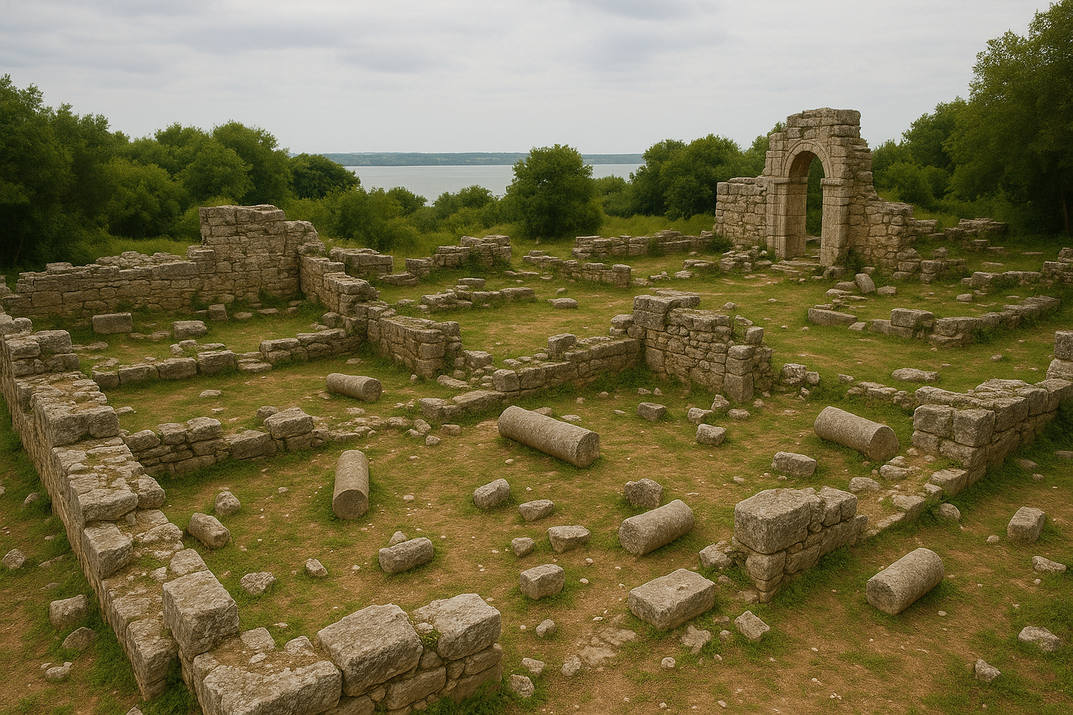
Les murailles d'İznik s'étendent sur près de 5 kilomètres, formant un circuit pentagonal autour de la cité. Elles constituent un exemple d'école d'architecture militaire romaine et byzantine.
- Construction stratifiée : Les murailles montrent clairement différentes phases de construction. Le noyau romain originel, fait de moellons et de mortier, est revêtu de blocs de pierre bien taillés. Les réparations et ajouts byzantins ultérieurs sont aisément identifiables grâce à l'usage caractéristique d'assises en « bandes de briques », qui apportaient à la fois flexibilité structurelle et touche décorative.
- Portes monumentales : La cité était accessible par quatre portes principales, chacune étant une structure complexe et fortement fortifiée. La Porte d'Istanbul au nord et la Porte de Lefke à l'est sont les mieux préservées. Elles sont ornées d'arcs de triomphe, de reliefs et d'inscriptions, et incorporent une grande quantité de spolia — pierres réutilisées provenant de bâtiments plus anciens, dont des colonnes et des sarcophages.
- Tours et défenses : Plus de 100 tours, à la fois carrées et semi-circulaires, ponctuent les murailles, offrant des points stratégiques pour la défense. Le système à double muraille était encore protégé par un large fossé, créant un obstacle véritablement intimidant pour tout assaillant.
Les murailles de Nicée ne protégeaient pas seulement une cité ; elles protégeaient une pierre angulaire de l'histoire chrétienne. C'est à l'intérieur de ces fortifications qu'eurent lieu deux des rassemblements les plus importants de l'histoire de l'Église :
- Le premier concile de Nicée (325 apr. J.-C.) : Convoqué par l'empereur Constantin le Grand, ce concile réunit des évêques venus de tout l'empire...
Au-delà des ruines visibles, la valeur historique de ce site provient de la continuité : pouvoirs changeants, fonctions urbaines changeantes, et manières changeantes dont les gens utilisèrent l'espace public au cours des siècles.
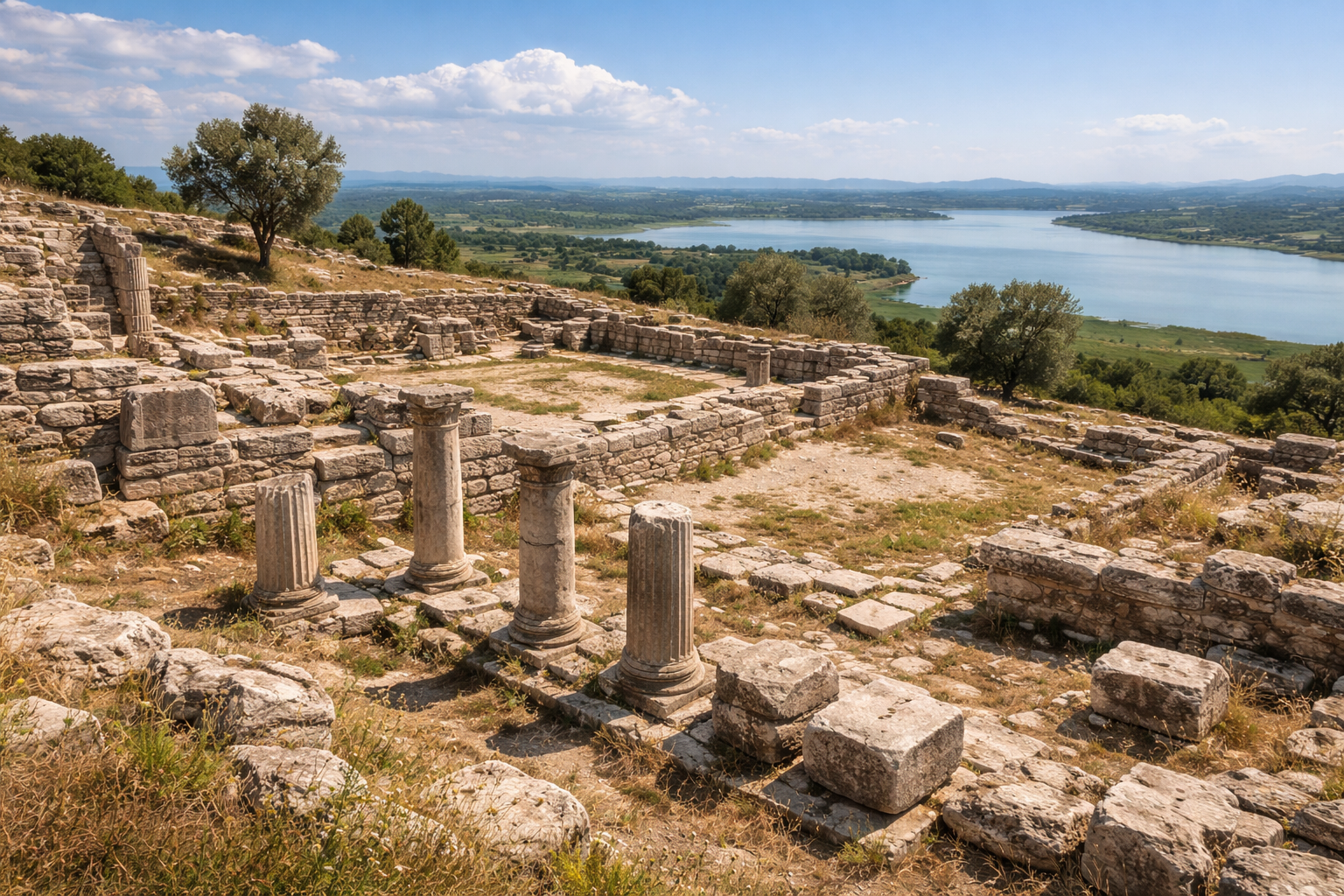
Archéologie et plan urbain
Lors de la lecture de ce site sur place, concentrez-vous sur trois strates :
- Strate de circulation : rues, portes, terrasses, port ou liaisons en pente
- Strate publique : théâtres, agoras, thermes, temples, espaces administratifs
- Strate d'infrastructure : systèmes hydrauliques, murailles, zones de stockage, architecture de service
Cette méthode aide visiteurs et chercheurs à comprendre la cité comme un système vivant plutôt que comme des monuments isolés.
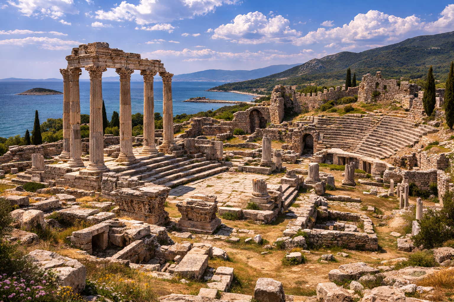
L'expérience du visiteur
Une visite de qualité comprend généralement :
- Un premier point d'orientation (point de vue, bord de l'acropole ou axe central)
- Un passage par la structure emblématique du site
- Une marche plus lente à travers les espaces de la vie quotidienne
- Un arrêt final reliant les ruines au paysage
Cette séquence crée un récit historique plus fort qu'un déplacement rapide « pour la photo uniquement ».
Une brève histoire du passé
Imaginez arriver ici dans l'Antiquité au lever du soleil : des ouvriers préparant la journée, des voyageurs entrant par les routes ou les voies portuaires, des marchands ouvrant des espaces de stockage, et une architecture publique façonnant déjà le mouvement et le rituel. Les pierres que vous voyez aujourd'hui ne sont pas des objets muets ; ce sont des fragments de ces rythmes quotidiens répétés.
Notes pratiques de voyage
- Préférez le printemps et l'automne pour le confort.
- En été, évitez si possible le pic de chaleur de la mi-journée.
- Portez des chaussures de marche stables pour les terrains accidentés.
- Gardez suffisamment de temps (au moins 1,5 à 3 heures) pour un itinéraire significatif.
- Vérifiez les conditions d'accès et de billetterie actuelles avant le départ.
FAQ
Pourquoi le Château d'İznik (Murailles de Nicée) – İznik, Bursa est-il important ?
Parce qu'il préserve de multiples strates historiques et aide à expliquer la continuité culturelle régionale en Türkiye.
Combien de temps devrais-je y passer ?
La plupart des visiteurs y passent 1,5 à 3 heures ; les visites approfondies peuvent prendre une demi-journée.
Le site convient-il aux voyageurs débutants en archéologie ?
Oui. Avec une planification de base, ce site convient aussi bien aux visiteurs débutants qu'expérimentés.
Dimensions des murailles et spécifications d'ingénierie
| Paramètre | Mesure |
|---|---|
| Longueur totale du circuit | ~4 970 m (muraille intérieure) ; ~3 100 m de circonférence (certaines sources varient selon la méthode de mesure) |
| Épaisseur de la muraille (base) | 5--7 m |
| Hauteur de la muraille | 10--13 m |
| Nombre de tours | 114 tours défensives (documentées) |
| Espacement des tours | Intervalles de ~40--50 m |
| Hauteur maximale des tours | Jusqu'à 15 m |
| Nombre de portes principales | 4 (Istanbul, Lefke, Yenisehir, Gol) |
| Nombre de portes secondaires | 12 portes-poternes plus petites |
| Forme du plan | Pentagonale |
| Fossé | Large fossé extérieur (partiellement comblé) |
| Matériaux de construction | Blocs de calcaire, assises de briques romaines, mortier de chaux, spolia réutilisés |
Phases de construction et chronologie
| Phase | Date | Événement / Travaux | Autorité |
|---|---|---|---|
| Phase I | Fin du Ier s. apr. J.-C. | Construction du circuit pentagonal initial des murailles | Dynastie flavienne (Vespasien / Titus) |
| Phase II | 123 apr. J.-C. | Dégâts du tremblement de terre ; reconstruction financée par l'empereur Hadrien ; redédicace de la Porte de Lefke | Empereur Hadrien |
| Phase III | 268 apr. J.-C. | Les Goths prennent et détruisent la cité ; murailles reconstruites sur le même tracé | Empereur Claude II |
| Phase IV | VIe s. apr. J.-C. | Programme majeur de restauration | Empereur Justinien Ier |
| Phase V | 1204--1261 | Nicée devient la capitale de l'Empire byzantin en exil ; ajout de la muraille extérieure (proteichisma), créant un système à double muraille | Empire de Nicée (dynastie des Laskaris) |
| Phase VI | XIIIe s. | Portes extérieures construites avec des colonnes spolia et des bastions semi-cylindriques flanquants | Théodore Ier / II Laskaris |
| Phase VII | Période ottomane | Réparations sélectives ; certaines tours adaptées aux défenses de l'ère de la poudre à canon | Sultans ottomans |
Les quatre portes monumentales
| Porte | Orientation | Caractéristiques clés |
|---|---|---|
| Istanbul Kapisi (Porte d'Istanbul) | Nord | Porte romaine à triple arche ; arc de triomphe à panneaux de relief ; spolia largement réutilisés, dont sarcophages et fûts de colonnes |
| Lefke Kapisi (Porte de Lefke) | Est | Porte la mieux préservée ; inscription dédicatoire à l'empereur Hadrien (reconstruction post-123 apr. J.-C.) ; forme à triple porte ajoutée à la période byzantine ; tours flanquantes |
| Yenisehir Kapisi (Porte de Yenisehir) | Sud | Noyau de l'époque romaine ; moins bien préservée que les portes nord et est ; partiellement masquée par une route moderne |
| Gol Kapisi (Porte du Lac) | Ouest | S'ouvre vers le lac d'Iznik ; accès stratégique au front d'eau ; l'approche la plus vulnérable, défendue par des grappes de tours supplémentaires |
Les murailles présentent une technique de construction en bandes distinctive : des assises alternées de blocs de calcaire taillés et de briques romaines (3--5 assises de briques par bande). Cette technique, caractéristique de l'architecture militaire romaine tardive et byzantine, offrait à la fois une flexibilité structurelle lors des tremblements de terre et une apparence polychrome visuellement frappante.
Spolia : éléments architecturaux réutilisés
Les murailles de Nicée comptent parmi les exemples les plus riches de réutilisation de spolia dans l'architecture défensive d'Anatolie. Les éléments incorporés dans les murailles et les portes comprennent :
- Colonnes en marbre provenant de temples et bâtiments publics d'époque romaine démolis
- Blocs de pierre inscrits portant des textes grecs et latins, placés face intérieure pour cacher leur fonction d'origine
- Panneaux de sarcophages intégrés dans les fondations des portes
- Chapiteaux corinthiens et ioniques encastrés dans la maçonnerie des tours
- Bases de statues honorifiques recyclées comme remblai structurel
Cette réutilisation s'accéléra après la destruction gothique de 268 apr. J.-C. et de nouveau lors de la construction de la double muraille au XIIIe siècle, lorsque les ingénieurs byzantins exploitèrent systématiquement les structures romaines antérieures comme carrière pour les matériaux de construction.
Les conciles œcuméniques et leur contexte archéologique
Les deux grands conciles œcuméniques tenus à Nicée ne laissèrent aucune structure construite à dessein qui ait survécu, mais leur signification historique définit le site :
| Concile | Date | Convoqué par | Résultat clé | Présence approximative |
|---|---|---|---|---|
| Premier concile de Nicée | 325 apr. J.-C. | Empereur Constantin Ier | Credo de Nicée établi ; arianisme condamné ; date de Pâques uniformisée | ~318 évêques |
| Septième concile œcuménique | 787 apr. J.-C. | Impératrice Irène | Restauration de la vénération des icônes ; iconoclasme condamné | ~350 évêques |
Le premier concile se réunit dans une salle au sein du complexe du palais impérial, que l'on croit avoir été située près du centre actuel d'Iznik. Aucun vestige architectural de cette salle n'a été identifié de manière concluante, bien que des fondations d'églises d'époque byzantine et des mosaïques de sol aient été fouillées à l'intérieur de la zone fortifiée.
Sources
- https://en.wikipedia.org/wiki/Walls_of_Nicaea
- https://www.thebyzantinelegacy.com/iznik
- https://www.travelatelier.com/iznik-nicea/
- https://www.toldinstone.com/iznik-nicea-city-walls/
- https://commons.wikimedia.org/w/index.php?search=İznik+Castle+–+İznik,+Bursa&title=Special:MediaSearch&type=image
- https://en.wikipedia.org/wiki/İznik_Castle_–_İznik,_Bursa
Analyse historique avancée
Stratification politique
Le Château d'İznik (Murailles de Nicée) – İznik, Bursa doit être interprété à travers les changements d'autorité politique, car chaque régime a modifié les priorités administratives, l'investissement urbain et l'architecture symbolique. Cela signifie que les vestiges visibles ne sont pas des pierres neutres : ils reflètent des décisions historiques concernant le contrôle, la légitimité et la stratégie territoriale à long terme.
Adaptation urbaine
Les cités ont évolué en fonction de la topographie, des ressources et des contraintes de mobilité. Sur des sites comme le Château d'İznik (Murailles de Nicée) – İznik, Bursa, l'adaptation peut être retracée dans les voies de circulation, les systèmes de murailles, la gestion de l'eau et la redistribution des espaces publics au fil du temps.
Continuité et réutilisation des matériaux
Une réalité archéologique fondamentale est la réutilisation : blocs, inscriptions et éléments architecturaux ont souvent migré à travers les périodes. La réutilisation n'est pas simplement pratique — c'est aussi un message culturel, par lequel les communautés ultérieures ont sélectivement préservé, transformé ou réinterprété le prestige antérieur.
Rituel et mémoire publique
Les espaces sacrés et civiques se chevauchent souvent dans les cités de longue durée. Les paysages rituels peuvent persister même lorsque les systèmes politiques changent, ce qui les rend essentiels pour étudier la continuité dans la mémoire collective.
Cadre d'interprétation détaillé pour le visiteur
Utilisez ce cadre en 8 étapes sur place :
- Établissez l'orientation avec la topographie et le contexte d'itinéraire.
- Identifiez le système structurel le mieux préservé (murailles, port, théâtre, temple, etc.).
- Distinguez la phase primaire des interventions ultérieures.
- Comparez les secteurs monumentaux et ceux de la vie quotidienne.
- Lisez les infrastructures hydrauliques et logistiques comme des systèmes de survie.
- Évaluez l'axe symbolique/rituel et la politique de visibilité.
- Suivez les preuves de réutilisation et de réparation.
- Concluez par la relation cité-paysage à un point de vue final.
Cette méthode améliore la qualité de l'interprétation tant pour les visiteurs généraux que pour les lecteurs avancés.
Planification pratique pour chercheurs et voyageurs
- Allouez au moins un cycle d'interprétation complet (2 à 4 heures).
- Si possible, associez la visite du site au contexte du musée local.
- Prenez des notes par phase, et non par ordre d'observation aléatoire.
- Séparez ce qui est directement visible de ce qui est inféré.
- Utilisez cartes et altitudes pour valider les hypothèses de mouvement.
Questions-réponses élargies du visiteur
Ce site est-il réservé aux spécialistes de l'archéologie ?
Non. Une planification structurée de l'itinéraire et un cadrage historique de base rendent le site compréhensible aux non-spécialistes.
Pourquoi différentes périodes se chevauchent-elles en un seul lieu ?
Parce que les cités sont des systèmes vivants. Elles sont reconstruites, réaffectées et politiquement recadrées plutôt que créées une seule fois.
Quelle est la manière la plus fiable d'éviter une interprétation superficielle ?
Suivre la chronologie, comparer les strates et inclure les infrastructures et le paysage dans votre lecture.
Faut-il éviter les visites hivernales ?
Pas nécessairement. L'hiver peut offrir une densité de foule plus faible et un meilleur rythme d'interprétation si les conditions météorologiques sont gérables.
Qu'est-ce qui distingue ce site des autres cités antiques ?
Sa combinaison spécifique de géographie, d'histoire politique, d'architecture et de continuité à travers de multiples transitions historiques.